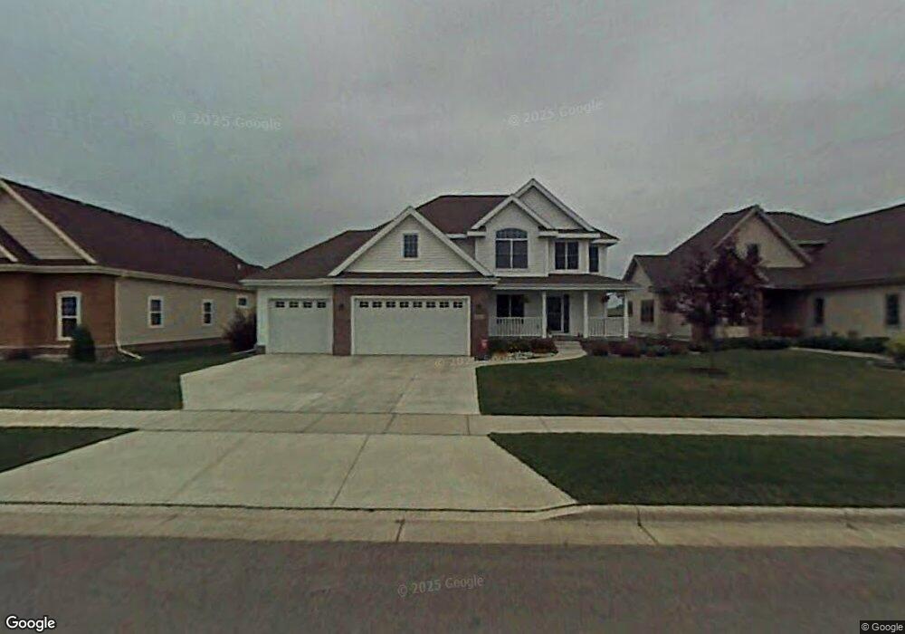
1233 Dartmouth Dr Waunakee, WI 53597
Estimated Value: $663,592 - $783,000
4
Beds
3
Baths
2,999
Sq Ft
$246/Sq Ft
Est. Value
About This Home
This home is located at 1233 Dartmouth Dr, Waunakee, WI 53597 and is currently estimated at $737,148, approximately $245 per square foot. 1233 Dartmouth Dr is a home located in Dane County with nearby schools including Arboretum Elementary School, Waunakee Intermediate School, and Waunakee Community Middle School.
Ownership History
Date
Name
Owned For
Owner Type
Purchase Details
Closed on
Aug 15, 2006
Sold by
Bullock Danniel J and Bullock Kathrine J
Bought by
Meyer Shawn D and Meyer Karol J
Current Estimated Value
Home Financials for this Owner
Home Financials are based on the most recent Mortgage that was taken out on this home.
Original Mortgage
$85,000
Interest Rate
6.51%
Mortgage Type
Stand Alone Second
Create a Home Valuation Report for This Property
The Home Valuation Report is an in-depth analysis detailing your home's value as well as a comparison with similar homes in the area
Home Values in the Area
Average Home Value in this Area
Purchase History
| Date | Buyer | Sale Price | Title Company |
|---|---|---|---|
| Meyer Shawn D | $425,000 | -- |
Source: Public Records
Mortgage History
| Date | Status | Borrower | Loan Amount |
|---|---|---|---|
| Closed | Meyer Shawn D | $85,000 | |
| Open | Meyer Shawn D | $340,000 |
Source: Public Records
Tax History Compared to Growth
Tax History
| Year | Tax Paid | Tax Assessment Tax Assessment Total Assessment is a certain percentage of the fair market value that is determined by local assessors to be the total taxable value of land and additions on the property. | Land | Improvement |
|---|---|---|---|---|
| 2024 | $8,428 | $515,000 | $109,500 | $405,500 |
| 2023 | $8,145 | $515,000 | $109,500 | $405,500 |
| 2021 | $8,321 | $425,500 | $103,500 | $322,000 |
| 2020 | $8,058 | $425,500 | $103,500 | $322,000 |
| 2019 | $8,026 | $425,500 | $103,500 | $322,000 |
| 2018 | $7,845 | $367,500 | $100,500 | $267,000 |
| 2017 | $7,789 | $367,500 | $100,500 | $267,000 |
| 2016 | $7,681 | $367,500 | $100,500 | $267,000 |
| 2015 | $7,547 | $367,500 | $100,500 | $267,000 |
| 2014 | $7,141 | $356,500 | $100,500 | $256,000 |
| 2013 | $7,783 | $356,500 | $100,500 | $256,000 |
Source: Public Records
Map
Nearby Homes
- 1306 Hanover Ct
- 1140 Reese Trail
- 1151 Reese Trail
- 1104 Reese Trail
- 1146 Irene Ct
- 1148 Irene Ct
- 1155 Irene Ct Unit 15
- 1153 Irene Ct Unit 14
- 1157 Irene Ct Unit 16
- 1151 Irene Ct Unit 13
- 1109 Stephenson Ln
- 1033 Quinn Dr
- 1110 Stephenson Ln
- 1122 Stephenson Ln
- 1028 Quinn Dr
- 5802 Woodland Dr
- 1016 Quinn Dr
- 5018 Apricot Blossom Ct
- 5006 Apricot Blossom Ct
- Lot 36 Cooper Hawk Dr
- 1231 Dartmouth Dr
- 1235 Dartmouth Dr
- 1237 Dartmouth Dr
- 1225 Dartmouth Dr
- 1239 Dartmouth Dr
- 1234 Dartmouth Dr
- 1232 Dartmouth Dr
- 1236 Dartmouth Dr
- 1223 Dartmouth Dr
- 1238 Dartmouth Dr
- 1241 Dartmouth Dr
- 1226 Dartmouth Dr
- 1221 Dartmouth Dr
- 1224 Dartmouth Dr
- 1240 Dartmouth Dr
- 1325 Gile Dr
- 1327 Gile Dr
- 1323 Gile Dr
- 1242 Dartmouth Dr
- 1215 Dartmouth Dr