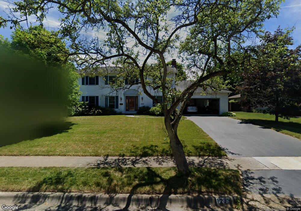
1233 Langston Dr Columbus, OH 43220
Estimated Value: $768,000 - $872,000
4
Beds
3
Baths
2,835
Sq Ft
$289/Sq Ft
Est. Value
About This Home
This home is located at 1233 Langston Dr, Columbus, OH 43220 and is currently estimated at $819,821, approximately $289 per square foot. 1233 Langston Dr is a home located in Franklin County with nearby schools including Greensview Elementary School, Hastings Middle School, and Upper Arlington High School.
Ownership History
Date
Name
Owned For
Owner Type
Purchase Details
Closed on
Apr 23, 1998
Sold by
Washbush Charles E and Washbush Jane C
Bought by
Mascari Louis J and Mascari Mary J
Current Estimated Value
Create a Home Valuation Report for This Property
The Home Valuation Report is an in-depth analysis detailing your home's value as well as a comparison with similar homes in the area
Home Values in the Area
Average Home Value in this Area
Purchase History
| Date | Buyer | Sale Price | Title Company |
|---|---|---|---|
| Mascari Louis J | $292,000 | Chicago Title |
Source: Public Records
Tax History Compared to Growth
Tax History
| Year | Tax Paid | Tax Assessment Tax Assessment Total Assessment is a certain percentage of the fair market value that is determined by local assessors to be the total taxable value of land and additions on the property. | Land | Improvement |
|---|---|---|---|---|
| 2024 | $12,780 | $220,750 | $91,000 | $129,750 |
| 2023 | $12,621 | $220,745 | $91,000 | $129,745 |
| 2022 | $10,591 | $151,560 | $52,470 | $99,090 |
| 2021 | $9,375 | $151,560 | $52,470 | $99,090 |
| 2020 | $9,292 | $151,560 | $52,470 | $99,090 |
| 2019 | $8,900 | $128,350 | $52,470 | $75,880 |
| 2018 | $8,573 | $128,350 | $52,470 | $75,880 |
| 2017 | $8,568 | $128,350 | $52,470 | $75,880 |
| 2016 | $8,304 | $125,590 | $43,090 | $82,500 |
| 2015 | $8,297 | $125,590 | $43,090 | $82,500 |
| 2014 | $8,306 | $125,590 | $43,090 | $82,500 |
| 2013 | $3,966 | $114,170 | $39,165 | $75,005 |
Source: Public Records
Map
Nearby Homes
- 4326 Kenny Rd
- 4271 Kenbury Place
- 4160 Ruxton Ln
- 4543 Ducrest Dr
- 1033 Folkestone Rd
- 1512 Lafayette Dr Unit B
- 1594 Lafayette Dr Unit 1594
- 1610 Lafayette Dr Unit 1610
- 4710 Charecote Ln Unit D
- 1046 Merrimar Cir N Unit B
- 1030 Galliton Ct Unit B
- 1109 Millcreek Ln
- 4020 Ritamarie Dr
- 713 Marburn Dr
- 1466 Weybridge Rd
- 4924 Reed Rd Unit B
- 4740 Merrifield Place Unit 25
- 3701 Reed Rd
- 1835 Willoway Cir N
- 1865 Willoway Cir N Unit 1865
- 1245 Langston Dr
- 1221 Langston Dr
- 1240 Carron Dr
- 1250 Carron Dr
- 1234 Carron Dr
- 1257 Langston Dr
- 1211 Langston Dr
- 1224 Langston Dr
- 1260 Carron Dr
- 1220 Carron Dr
- 1212 Langston Dr
- 1248 Langston Dr
- 1269 Langston Dr
- 1201 Langston Dr
- 1270 Carron Dr
- 1260 Langston Dr
- 1210 Carron Dr
- 1200 Langston Dr
- 1237 Darcann Dr
- 1225 Darcann Dr