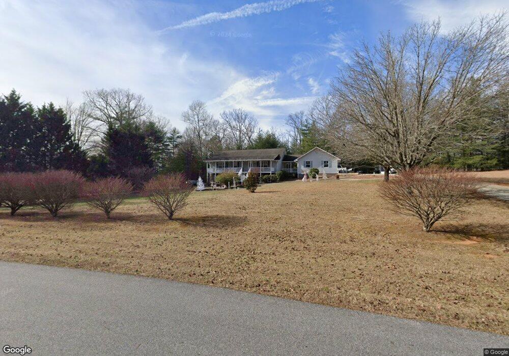
1233 Mauney Cir Blairsville, GA 30512
Ivylog NeighborhoodEstimated Value: $332,000 - $418,000
3
Beds
3
Baths
1,344
Sq Ft
$277/Sq Ft
Est. Value
About This Home
This home is located at 1233 Mauney Cir, Blairsville, GA 30512 and is currently estimated at $372,771, approximately $277 per square foot. 1233 Mauney Cir is a home with nearby schools including Union County Primary School, Union County Elementary School, and Union County Middle School.
Ownership History
Date
Name
Owned For
Owner Type
Purchase Details
Closed on
Mar 17, 2008
Sold by
Bridges Darrell
Bought by
Bridges Vicki P
Current Estimated Value
Purchase Details
Closed on
Sep 2, 1999
Bought by
Bridges Darrell and Bridges Vi
Create a Home Valuation Report for This Property
The Home Valuation Report is an in-depth analysis detailing your home's value as well as a comparison with similar homes in the area
Home Values in the Area
Average Home Value in this Area
Purchase History
| Date | Buyer | Sale Price | Title Company |
|---|---|---|---|
| Bridges Vicki P | -- | -- | |
| Bridges Darrell | -- | -- |
Source: Public Records
Tax History Compared to Growth
Tax History
| Year | Tax Paid | Tax Assessment Tax Assessment Total Assessment is a certain percentage of the fair market value that is determined by local assessors to be the total taxable value of land and additions on the property. | Land | Improvement |
|---|---|---|---|---|
| 2024 | $1,600 | $137,520 | $7,400 | $130,120 |
| 2023 | $1,788 | $136,272 | $7,400 | $128,872 |
| 2022 | $1,397 | $106,924 | $6,880 | $100,044 |
| 2021 | $1,337 | $86,852 | $6,880 | $79,972 |
| 2020 | $1,311 | $71,320 | $8,215 | $63,105 |
| 2019 | $1,240 | $71,320 | $8,215 | $63,105 |
| 2018 | $1,253 | $71,320 | $8,215 | $63,105 |
| 2017 | $1,218 | $71,320 | $8,215 | $63,105 |
| 2016 | $1,218 | $71,320 | $8,215 | $63,105 |
| 2015 | $1,229 | $71,320 | $8,215 | $63,105 |
| 2013 | -- | $71,320 | $8,215 | $63,104 |
Source: Public Records
Map
Nearby Homes
- Lot 1 Serenity Dr
- Lot 2 Serenity Ridge Ln
- Lot 1 Serenity Ridge Ln
- 600 Lakeside Dr
- 359 New Water Way
- 136 Anchorage Dr
- 290 Bayside Ln
- 993 Lakeside Dr
- Lot 46 Bayside Ln
- 101 Christian Ct
- 1243 Forest Dr
- LT 37 Hidden Harbor
- LT 44 Hidden Harbor
- 402 Eagle Dr
- 16 Antioch Church Rd
- 1048 Hawks Claw Rd Unit 4
- 1048 Hawks Claw Rd
- 1250 Owen Glen Dr
- 302 Brook Green Ct
- 332 Talon Trace