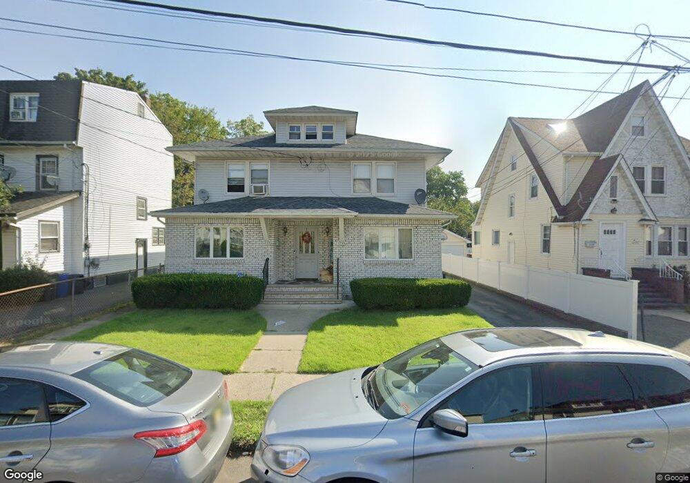
1233 Robert St Unit 5 Hillside, NJ 07205
Westminster NeighborhoodEstimated Value: $532,000 - $764,000
3
Beds
2
Baths
1,475
Sq Ft
$432/Sq Ft
Est. Value
About This Home
This home is located at 1233 Robert St Unit 5, Hillside, NJ 07205 and is currently estimated at $637,007, approximately $431 per square foot. 1233 Robert St Unit 5 is a home located in Union County with nearby schools including Abram P. Morris-Saybrook Elementary School, Hurden Looker School, and Ola Edwards Community School.
Ownership History
Date
Name
Owned For
Owner Type
Purchase Details
Closed on
Dec 23, 2021
Sold by
Ataide Candido F and Ataide Maria
Bought by
Mateo-Cartacio Miguel
Current Estimated Value
Home Financials for this Owner
Home Financials are based on the most recent Mortgage that was taken out on this home.
Original Mortgage
$515,490
Interest Rate
3.12%
Mortgage Type
FHA
Purchase Details
Closed on
Jul 7, 2005
Sold by
Ataide Candido F
Bought by
Ataide Candido F and Ataide Maria
Create a Home Valuation Report for This Property
The Home Valuation Report is an in-depth analysis detailing your home's value as well as a comparison with similar homes in the area
Home Values in the Area
Average Home Value in this Area
Purchase History
| Date | Buyer | Sale Price | Title Company |
|---|---|---|---|
| Mateo-Cartacio Miguel | $545,000 | Nu World Title | |
| Mateo-Cartacio Miguel | $545,000 | Nu World Title | |
| Ataide Candido F | -- | -- |
Source: Public Records
Mortgage History
| Date | Status | Borrower | Loan Amount |
|---|---|---|---|
| Previous Owner | Mateo-Cartacio Miguel | $515,490 |
Source: Public Records
Tax History Compared to Growth
Tax History
| Year | Tax Paid | Tax Assessment Tax Assessment Total Assessment is a certain percentage of the fair market value that is determined by local assessors to be the total taxable value of land and additions on the property. | Land | Improvement |
|---|---|---|---|---|
| 2025 | $13,098 | $158,700 | $71,300 | $87,400 |
| 2024 | $12,717 | $158,700 | $71,300 | $87,400 |
| 2023 | $12,717 | $158,700 | $71,300 | $87,400 |
| 2022 | $12,599 | $158,700 | $71,300 | $87,400 |
| 2021 | $12,517 | $158,700 | $71,300 | $87,400 |
| 2020 | $12,444 | $158,700 | $71,300 | $87,400 |
| 2019 | $12,202 | $158,700 | $71,300 | $87,400 |
| 2018 | $12,080 | $158,700 | $71,300 | $87,400 |
| 2017 | $12,007 | $158,700 | $71,300 | $87,400 |
| 2016 | $11,993 | $158,700 | $71,300 | $87,400 |
| 2015 | $11,887 | $158,700 | $71,300 | $87,400 |
| 2014 | -- | $158,700 | $71,300 | $87,400 |
Source: Public Records
Map
Nearby Homes
- 1141 Church St
- 124 Woodruff Place
- 1432 Lexington Place Unit 1434
- 1408 Lexington Place Unit 1410
- 1379 Garfield Place
- 1444 N Broad St
- 170 Windsor Way
- 1290 Baker St
- 1282 Baker St
- 1451 Bond St
- 420 Hollywood Ave
- 155 Silver Ave
- 1473 Center St
- 904 Cross Ave
- 1406 Maple Ave
- 383 Conant St
- 149 Baltimore Ave
- 71 Georgian Ct
- 1414 Boa Place Unit 2
- 111 Hanford St
- 1233 Robert St Unit 2
- 1237 Robert St
- 1229 Robert St
- 1241 Robert St
- 1225 Robert St
- 1243 Robert St
- 1238A N Broad St Unit 1238A
- 1223 Robert St
- 1236B N Broad St
- 1236A N Broad St
- 1230 Robert St
- 1232 Robert St
- 1247 Robert St
- 1236 Robert St
- 1224 Robert St
- 1220 Robert St
- 1226 Robert St Unit 1228
- 1221 Robert St
- 1238B N Broad St
- 1238 Robert St Unit 40
