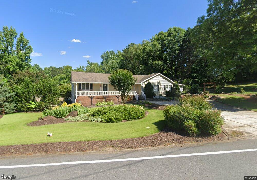
1233 W Wylie Bridge Rd Woodstock, GA 30188
Estimated Value: $349,204 - $412,000
3
Beds
2
Baths
2,172
Sq Ft
$177/Sq Ft
Est. Value
About This Home
This home is located at 1233 W Wylie Bridge Rd, Woodstock, GA 30188 and is currently estimated at $384,051, approximately $176 per square foot. 1233 W Wylie Bridge Rd is a home located in Cherokee County with nearby schools including Little River Elementary, Mill Creek Middle School, and River Ridge High School.
Ownership History
Date
Name
Owned For
Owner Type
Purchase Details
Closed on
Aug 15, 2005
Sold by
Serafin Christopher R
Bought by
Serafin Christopher R and Serafin Andrea
Current Estimated Value
Purchase Details
Closed on
Mar 18, 2005
Sold by
Serafin Christopher R
Bought by
Weaver Homes Inc
Home Financials for this Owner
Home Financials are based on the most recent Mortgage that was taken out on this home.
Original Mortgage
$163,920
Interest Rate
5.74%
Mortgage Type
Purchase Money Mortgage
Purchase Details
Closed on
Sep 17, 1993
Sold by
Cook William C
Bought by
Serafin Christopher R
Home Financials for this Owner
Home Financials are based on the most recent Mortgage that was taken out on this home.
Original Mortgage
$75,000
Interest Rate
7.01%
Mortgage Type
Purchase Money Mortgage
Create a Home Valuation Report for This Property
The Home Valuation Report is an in-depth analysis detailing your home's value as well as a comparison with similar homes in the area
Home Values in the Area
Average Home Value in this Area
Purchase History
| Date | Buyer | Sale Price | Title Company |
|---|---|---|---|
| Serafin Christopher R | -- | -- | |
| Weaver Homes Inc | $48,500 | -- | |
| Serafin Christopher R | $75,000 | -- |
Source: Public Records
Mortgage History
| Date | Status | Borrower | Loan Amount |
|---|---|---|---|
| Previous Owner | Weaver Homes Inc | $163,920 | |
| Previous Owner | Serafin Christopher R | $75,000 |
Source: Public Records
Tax History Compared to Growth
Tax History
| Year | Tax Paid | Tax Assessment Tax Assessment Total Assessment is a certain percentage of the fair market value that is determined by local assessors to be the total taxable value of land and additions on the property. | Land | Improvement |
|---|---|---|---|---|
| 2025 | $3,537 | $134,680 | $39,760 | $94,920 |
| 2024 | $3,077 | $118,400 | $25,640 | $92,760 |
| 2023 | $2,322 | $120,640 | $25,640 | $95,000 |
| 2022 | $2,029 | $84,920 | $25,640 | $59,280 |
| 2021 | $1,955 | $74,480 | $25,640 | $48,840 |
| 2020 | $1,892 | $71,720 | $26,920 | $44,800 |
| 2019 | $1,871 | $68,960 | $25,640 | $43,320 |
| 2018 | $1,851 | $67,600 | $25,640 | $41,960 |
| 2017 | $1,889 | $171,400 | $25,640 | $42,920 |
| 2016 | $1,756 | $156,600 | $21,960 | $40,680 |
| 2015 | $1,160 | $104,400 | $18,840 | $22,920 |
| 2014 | $1,073 | $96,800 | $16,200 | $22,520 |
Source: Public Records
Map
Nearby Homes
- 201 Colony Springs Dr
- 1231 W Wylie Bridge Rd
- 203 Colony Springs Dr Unit 1
- 1224 W Wylie Bridge Rd Unit 2
- 1226 W Wylie Bridge Rd Unit 2
- 205 Colony Springs Dr
- 1220 W Wylie Bridge Rd
- 202 Colony Springs Dr
- 1228 W Wylie Bridge Ridge 0
- 0 W Wylie Bridge Rd Unit 7291323
- 1228 W Wylie Bridge Rd
- 204 Colony Springs Dr
- 207 Colony Springs Dr
- W Wylie Bridge Ridge 0
- W W Wylie Bridge Rd
- 1218 W Wylie Bridge Rd Unit 2
- 194 Colemans Bluff Dr Unit 2
- 194 Colemans Bluff Dr Unit 107
- 192 Colemans Bluff Dr
- 206 Colony Springs Dr