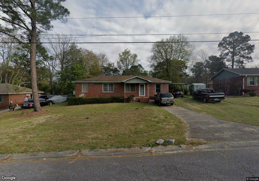
1233 Westmount Rd Macon, GA 31204
Estimated Value: $70,000 - $77,000
3
Beds
1
Bath
1,326
Sq Ft
$56/Sq Ft
Est. Value
About This Home
This home is located at 1233 Westmount Rd, Macon, GA 31204 and is currently estimated at $74,701, approximately $56 per square foot. 1233 Westmount Rd is a home located in Bibb County with nearby schools including John Robert Lewis Elementary School, Weaver Middle School, and Westside High School.
Ownership History
Date
Name
Owned For
Owner Type
Purchase Details
Closed on
May 17, 2023
Sold by
Moses Lester
Bought by
Waller Charles D
Current Estimated Value
Home Financials for this Owner
Home Financials are based on the most recent Mortgage that was taken out on this home.
Original Mortgage
$45,000
Interest Rate
6.28%
Mortgage Type
New Conventional
Purchase Details
Closed on
Nov 21, 2011
Sold by
Moses Barbara
Bought by
Moses Lester
Create a Home Valuation Report for This Property
The Home Valuation Report is an in-depth analysis detailing your home's value as well as a comparison with similar homes in the area
Home Values in the Area
Average Home Value in this Area
Purchase History
| Date | Buyer | Sale Price | Title Company |
|---|---|---|---|
| Waller Charles D | $55,000 | None Listed On Document | |
| Moses Lester | -- | -- |
Source: Public Records
Mortgage History
| Date | Status | Borrower | Loan Amount |
|---|---|---|---|
| Closed | Waller Charles D | $45,000 |
Source: Public Records
Tax History Compared to Growth
Tax History
| Year | Tax Paid | Tax Assessment Tax Assessment Total Assessment is a certain percentage of the fair market value that is determined by local assessors to be the total taxable value of land and additions on the property. | Land | Improvement |
|---|---|---|---|---|
| 2025 | $622 | $25,294 | $2,802 | $22,492 |
| 2024 | $559 | $22,932 | $3,009 | $19,923 |
| 2023 | $32 | $31,942 | $2,075 | $29,867 |
| 2022 | $321 | $24,891 | $3,555 | $21,336 |
| 2021 | $419 | $24,891 | $3,555 | $21,336 |
| 2020 | $428 | $24,891 | $3,555 | $21,336 |
| 2019 | $431 | $24,891 | $3,555 | $21,336 |
| 2018 | $839 | $24,891 | $3,555 | $21,336 |
| 2017 | $402 | $24,891 | $3,555 | $21,336 |
| 2016 | $420 | $24,891 | $3,555 | $21,336 |
| 2015 | $575 | $24,225 | $3,555 | $20,670 |
| 2014 | $753 | $24,225 | $3,555 | $20,670 |
Source: Public Records
Map
Nearby Homes
- 1042 Washington St
- 3846 Log Cabin Dr
- 1202 James St
- 3584 Log Cabin Dr
- 3565 Log Cabin Dr
- 3220 Hollingsworth Rd
- 3533 Greenbriar Rd
- 3908 Log Cabin Dr
- 3515 Greenbriar Rd
- 4450 Bluebird Terrace
- 4281 Robinson Ct
- 3782 Robinson Rd
- 3941 Log Cabin Dr
- 3515 Log Cabin Dr
- 1184 Edna Place
- 3491 Bond St W
- 3483 Napier Ave
- 1225 Westmount Rd
- 1241 Westmount Rd
- 3764 Log Cabin Dr
- 1215 Westmount Rd
- 3758 Log Cabin Dr
- 1251 Westmount Rd
- 1105 Hartridge Dr
- 1240 Westmount Rd
- 3778 Log Cabin Dr
- 3754 Log Cabin Dr
- 1248 Westmount Rd
- 3748 Log Cabin Dr
- 1261 Westmount Rd
- 1117 Hartridge Dr
- 1104 Hartridge Dr
- 3782 Log Cabin Dr
- 1205 Sherbrooke Dr
- 1252 Westmount Rd
- 1252 W Mount Rd
- 1201 Sherbrooke Dr