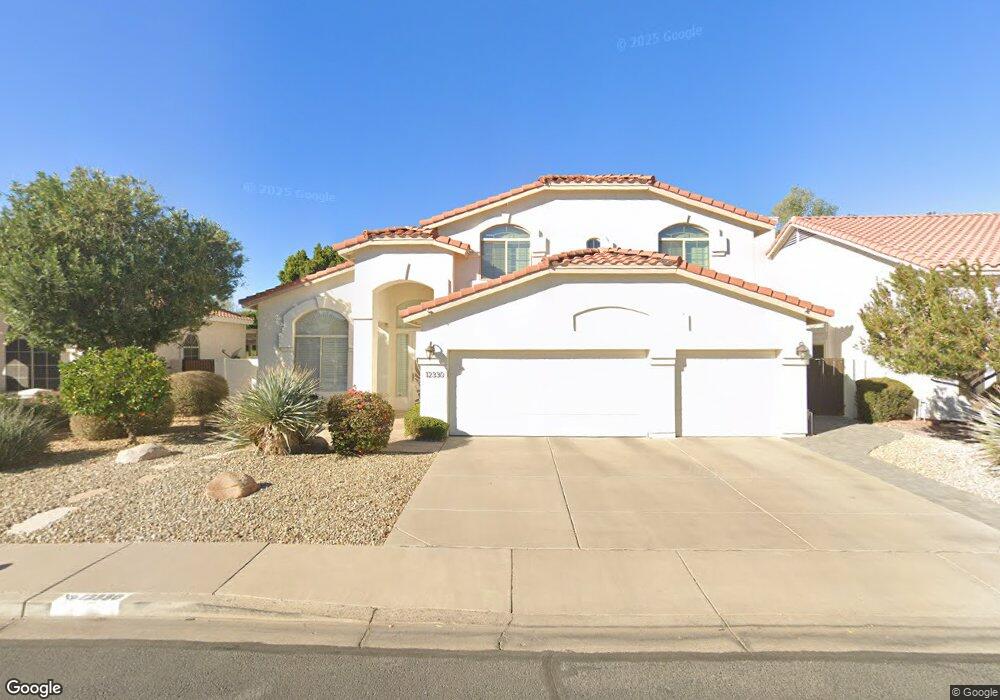
12330 N 57th Dr Glendale, AZ 85304
Estimated Value: $556,700 - $659,000
4
Beds
3
Baths
2,942
Sq Ft
$208/Sq Ft
Est. Value
About This Home
This home is located at 12330 N 57th Dr, Glendale, AZ 85304 and is currently estimated at $611,175, approximately $207 per square foot. 12330 N 57th Dr is a home located in Maricopa County with nearby schools including Marshall Ranch Elementary School and Ironwood High School.
Ownership History
Date
Name
Owned For
Owner Type
Purchase Details
Closed on
Apr 30, 2012
Sold by
Rinderknecht Linda
Bought by
Rinderknecht Linda and Linda Rinderknecht Revocable Trust
Current Estimated Value
Purchase Details
Closed on
Mar 15, 2011
Sold by
Graef Geroge J and Graef Rita M
Bought by
Rinderknecht Linda
Home Financials for this Owner
Home Financials are based on the most recent Mortgage that was taken out on this home.
Original Mortgage
$150,000
Outstanding Balance
$103,259
Interest Rate
4.83%
Mortgage Type
New Conventional
Estimated Equity
$507,916
Purchase Details
Closed on
Oct 6, 1997
Sold by
Maracay Homes Arizona I Llc
Bought by
Graef George J and Graef Rita M
Home Financials for this Owner
Home Financials are based on the most recent Mortgage that was taken out on this home.
Original Mortgage
$185,800
Interest Rate
7.36%
Mortgage Type
New Conventional
Create a Home Valuation Report for This Property
The Home Valuation Report is an in-depth analysis detailing your home's value as well as a comparison with similar homes in the area
Home Values in the Area
Average Home Value in this Area
Purchase History
| Date | Buyer | Sale Price | Title Company |
|---|---|---|---|
| Rinderknecht Linda | -- | None Available | |
| Rinderknecht Linda | $200,000 | Chicago Title | |
| Graef George J | $201,572 | Security Title Agency |
Source: Public Records
Mortgage History
| Date | Status | Borrower | Loan Amount |
|---|---|---|---|
| Open | Rinderknecht Linda | $150,000 | |
| Previous Owner | Graef George J | $185,800 |
Source: Public Records
Tax History Compared to Growth
Tax History
| Year | Tax Paid | Tax Assessment Tax Assessment Total Assessment is a certain percentage of the fair market value that is determined by local assessors to be the total taxable value of land and additions on the property. | Land | Improvement |
|---|---|---|---|---|
| 2025 | $2,787 | $29,782 | -- | -- |
| 2024 | $2,764 | $28,364 | -- | -- |
| 2023 | $2,764 | $44,420 | $8,880 | $35,540 |
| 2022 | $2,736 | $32,930 | $6,580 | $26,350 |
| 2021 | $2,873 | $31,370 | $6,270 | $25,100 |
| 2020 | $2,905 | $29,660 | $5,930 | $23,730 |
| 2019 | $2,828 | $30,230 | $6,040 | $24,190 |
| 2018 | $2,767 | $28,780 | $5,750 | $23,030 |
| 2017 | $2,775 | $25,660 | $5,130 | $20,530 |
| 2016 | $2,752 | $24,900 | $4,980 | $19,920 |
| 2015 | $2,573 | $25,400 | $5,080 | $20,320 |
Source: Public Records
Map
Nearby Homes
- 5812 W Columbine Dr
- 5534 W Riviera Dr
- 11814 N 56th Dr
- 12407 N 54th Ave
- 6018 W Riviera Dr
- 5318 W Shaw Butte Dr
- 5315 W Shaw Butte Dr
- 6128 W Columbine Dr
- 5410 W Altadena Ave
- 12031 N 53rd Ave
- 6101 W Sunnyside Dr
- 6213 W Corrine Dr
- 5545 W Joan de Arc Ave
- 5607 W Cholla St
- 5757 W Eugie Ave Unit 1040
- 5757 W Eugie Ave Unit 2100
- 5527 W Garden Dr
- 11227 N 59th Dr
- 5613 W Yucca St
- 5174 W Laurel Ave
- 12410 N 57th Dr
- 12324 N 57th Dr
- 12329 N 58th Ave
- 5803 W Charter Oak Rd
- 12416 N 57th Dr
- 5788 W Wethersfield Dr
- 5794 W Wethersfield Dr
- 12335 N 58th Ave
- 12321 N 57th Dr
- 12411 N 57th Dr
- 5800 W Wethersfield Dr
- 12422 N 57th Dr
- 5809 W Charter Oak Rd
- 12315 N 57th Dr
- 12417 N 57th Dr
- 12341 N 58th Ave
- 5763 W Bloomfield Rd
- 5806 W Wethersfield Dr
- 5810 W Charter Oak Rd
- 12423 N 57th Dr