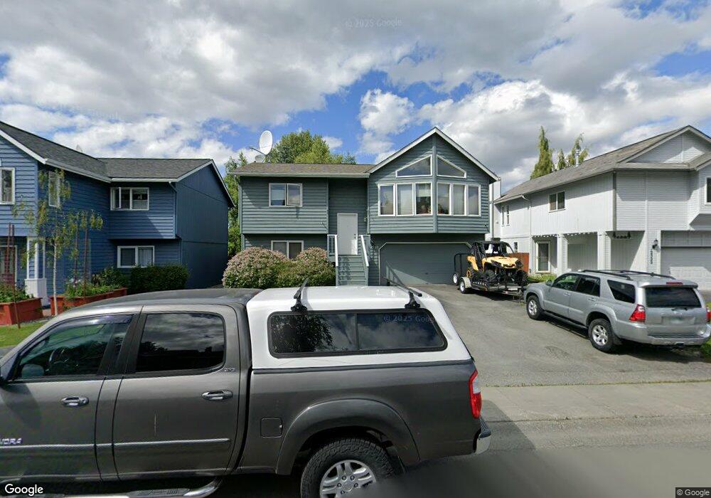
12332 Woodward Dr Anchorage, AK 99516
Huffman-O'Malley NeighborhoodEstimated Value: $267,000 - $500,000
4
Beds
2
Baths
1,668
Sq Ft
$250/Sq Ft
Est. Value
About This Home
This home is located at 12332 Woodward Dr, Anchorage, AK 99516 and is currently estimated at $417,161, approximately $250 per square foot. 12332 Woodward Dr is a home located in Anchorage Municipality with nearby schools including Bowman Elementary School, Hanshew Middle School, and Service High School.
Ownership History
Date
Name
Owned For
Owner Type
Purchase Details
Closed on
Aug 11, 2004
Sold by
Boado Marie Ann and Boado Joel D
Bought by
Boado Joel D and Boado Marie Ann
Current Estimated Value
Home Financials for this Owner
Home Financials are based on the most recent Mortgage that was taken out on this home.
Original Mortgage
$195,000
Interest Rate
5.95%
Mortgage Type
New Conventional
Purchase Details
Closed on
Oct 26, 1999
Sold by
Otto Jerry H and Otto Amanda J
Bought by
Boado Marie-Ann and Boado Joel D
Home Financials for this Owner
Home Financials are based on the most recent Mortgage that was taken out on this home.
Original Mortgage
$165,815
Interest Rate
7.82%
Mortgage Type
FHA
Purchase Details
Closed on
Oct 21, 1994
Sold by
Phh Homequity
Bought by
Otto Jerry H and Otto Amanda J
Home Financials for this Owner
Home Financials are based on the most recent Mortgage that was taken out on this home.
Original Mortgage
$124,650
Interest Rate
8.54%
Mortgage Type
New Conventional
Purchase Details
Closed on
Apr 30, 1991
Sold by
Spinell Homes Inc
Bought by
Hansen Bruce E
Home Financials for this Owner
Home Financials are based on the most recent Mortgage that was taken out on this home.
Original Mortgage
$125,847
Interest Rate
9.66%
Mortgage Type
FHA
Create a Home Valuation Report for This Property
The Home Valuation Report is an in-depth analysis detailing your home's value as well as a comparison with similar homes in the area
Home Values in the Area
Average Home Value in this Area
Purchase History
| Date | Buyer | Sale Price | Title Company |
|---|---|---|---|
| Boado Joel D | -- | Stewart | |
| Boado Marie-Ann | -- | -- | |
| Boado Marie-Ann | -- | -- | |
| Otto Jerry H | -- | -- | |
| Hansen Bruce E | -- | -- |
Source: Public Records
Mortgage History
| Date | Status | Borrower | Loan Amount |
|---|---|---|---|
| Closed | Boado Joel D | $195,000 | |
| Closed | Boado Marie-Ann | $165,815 | |
| Previous Owner | Otto Jerry H | $124,650 | |
| Previous Owner | Hansen Bruce E | $125,847 |
Source: Public Records
Tax History Compared to Growth
Tax History
| Year | Tax Paid | Tax Assessment Tax Assessment Total Assessment is a certain percentage of the fair market value that is determined by local assessors to be the total taxable value of land and additions on the property. | Land | Improvement |
|---|---|---|---|---|
| 2025 | $5,166 | $407,800 | $114,800 | $293,000 |
| 2024 | $5,166 | $395,000 | $114,800 | $280,200 |
| 2023 | $6,301 | $370,000 | $114,800 | $255,200 |
| 2022 | $4,969 | $345,100 | $114,800 | $230,300 |
| 2021 | $5,831 | $323,600 | $114,800 | $208,800 |
| 2020 | $4,512 | $315,700 | $114,800 | $200,900 |
| 2019 | $4,268 | $310,900 | $114,800 | $196,100 |
| 2018 | $4,254 | $309,400 | $114,800 | $194,600 |
| 2017 | $4,609 | $314,300 | $114,800 | $199,500 |
| 2016 | $4,078 | $316,700 | $114,800 | $201,900 |
| 2015 | $4,078 | $309,500 | $114,800 | $194,700 |
| 2014 | $4,078 | $304,800 | $119,900 | $184,900 |
Source: Public Records
Map
Nearby Homes
- 2521 Winterchase Cir
- 2048 Meander Dr
- 12283 Timberwood Cir
- 1677 Circlewood Dr
- 2020 Steeple Dr
- 12241 Gander St
- 3025 Huffman Rd
- 2701 Kempton Hills Dr
- 2735 Meadow Wood Cir
- 13105 Stephenson St
- 000 Wagner St
- 12101 Wagner St
- 11335 Tulin Park Loop
- 11359 Tulin Park Loop
- 12496 Silver Fox Ln Unit 6
- 13322 Diggins Dr
- 3040 Chesapeake Cir
- 2640 E 112th Ave
- 11483 Moonrise Ridge Place Unit 10
- 11418 Moonrise Ridge Place Unit 19
- 12322 Woodward Dr
- 12342 Woodward Dr
- 12312 Woodward Dr
- 12352 Woodward Dr
- 12337 Silver Spruce Cir
- 12302 Woodward Dr
- 12345 Silver Spruce Cir
- 12323 Silver Spruce Cir
- 12351 Silver Spruce Cir
- 12333 Woodward Dr
- 12323 Woodward Dr
- 12301 Silver Spruce Cir
- 12252 Woodward Dr
- 12313 Woodward Dr
- 12353 Woodward Dr
- 12295 Silver Spruce Cir
- 12303 Woodward Dr
- 000 Silver Spruce Cir
- 12242 Woodward Dr
- 12289 Silver Spruce Cir