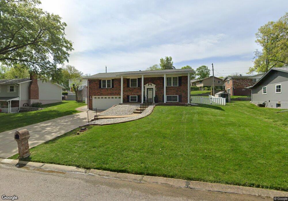
12338 Cape Cod Dr Saint Louis, MO 63146
Estimated Value: $290,952 - $382,000
3
Beds
3
Baths
1,350
Sq Ft
$249/Sq Ft
Est. Value
About This Home
This home is located at 12338 Cape Cod Dr, Saint Louis, MO 63146 and is currently estimated at $335,988, approximately $248 per square foot. 12338 Cape Cod Dr is a home located in St. Louis County with nearby schools including Ross Elementary School, Parkway Northeast Middle School, and Parkway North High School.
Ownership History
Date
Name
Owned For
Owner Type
Purchase Details
Closed on
Nov 30, 2021
Sold by
Clemons Dorothy A
Bought by
Dorothy Ann Clemons Revocable Living Trust
Current Estimated Value
Purchase Details
Closed on
Jul 31, 2000
Sold by
Sanchez Susan M and Sanchez Paul J
Bought by
Clemons Dorothy A
Home Financials for this Owner
Home Financials are based on the most recent Mortgage that was taken out on this home.
Original Mortgage
$128,300
Interest Rate
8.15%
Create a Home Valuation Report for This Property
The Home Valuation Report is an in-depth analysis detailing your home's value as well as a comparison with similar homes in the area
Home Values in the Area
Average Home Value in this Area
Purchase History
| Date | Buyer | Sale Price | Title Company |
|---|---|---|---|
| Dorothy Ann Clemons Revocable Living Trust | -- | Hammond And Shinners Pc | |
| Clemons Dorothy A | $142,600 | -- |
Source: Public Records
Mortgage History
| Date | Status | Borrower | Loan Amount |
|---|---|---|---|
| Previous Owner | Clemons Dorothy A | $128,300 |
Source: Public Records
Tax History
| Year | Tax Paid | Tax Assessment Tax Assessment Total Assessment is a certain percentage of the fair market value that is determined by local assessors to be the total taxable value of land and additions on the property. | Land | Improvement |
|---|---|---|---|---|
| 2025 | $3,105 | $59,130 | $17,440 | $41,690 |
| 2024 | $3,105 | $47,350 | $13,070 | $34,280 |
| 2023 | $3,065 | $47,350 | $13,070 | $34,280 |
| 2022 | $2,976 | $41,910 | $13,070 | $28,840 |
| 2021 | $2,955 | $41,910 | $13,070 | $28,840 |
| 2020 | $2,870 | $38,870 | $15,770 | $23,100 |
| 2019 | $2,825 | $38,870 | $15,770 | $23,100 |
| 2018 | $2,802 | $35,600 | $11,340 | $24,260 |
| 2016 | $2,578 | $31,350 | $8,720 | $22,630 |
Source: Public Records
Map
Nearby Homes
- 12266 Ravelle Dr
- 1201 Ross Ave
- 12509 Larkwood Dr
- 1018 Tempo Dr
- 1056 King Carey Dr
- 12381 Merrick Dr
- 12363 Merrick Dr
- 1503 Papillon Dr
- 1639 Prestonpark Ln
- 842 N New Ballas Ct Unit 103
- 842 N New Ballas Ct Unit 102
- 950 E Rue de La Banque St Unit L6
- 950 E Rue de La Banque Unit 317
- 12205 Blackheath Ct
- 630 Emerson Rd Unit 104
- 840 Angleterre Dr
- 12812 Portulaca Dr Unit I
- 11727 Summerhaven Dr
- 442 Royalwood Dr
- 12818 Portulaca Dr Unit K
- 12346 Cape Cod Dr
- 1259 Hyannis Dr
- 1246 Cheverly Ct
- 12337 Cape Cod Dr
- 1238 Cheverly Ct
- 1251 Hyannis Dr
- 1301 Hyannis Dr
- 12351 Cape Cod Dr
- 1255 Cheverly Ct
- 1228 Cheverly Ct
- 12320 Cape Cod Dr
- 1243 Hyannis Dr
- 1258 Hyannis Dr
- 1247 Cheverly Ct
- 12401 Cape Cod Dr
- 1250 Hyannis Dr
- 1300 Hyannis Dr
- 11 Sunview Ln
- 12408 Cape Cod Dr
- 1315 Hyannis Dr
Your Personal Tour Guide
Ask me questions while you tour the home.