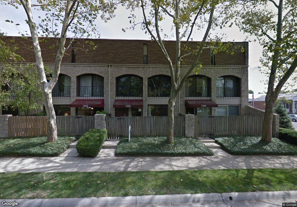
1234 Ashland Ave Unit 1234 Columbus, OH 43212
Estimated Value: $227,000 - $294,000
2
Beds
2
Baths
1,288
Sq Ft
$205/Sq Ft
Est. Value
About This Home
This home is located at 1234 Ashland Ave Unit 1234, Columbus, OH 43212 and is currently estimated at $263,804, approximately $204 per square foot. 1234 Ashland Ave Unit 1234 is a home located in Franklin County with nearby schools including Robert Louis Stevenson Elementary School, Larson Middle School, and Grandview Heights High School.
Ownership History
Date
Name
Owned For
Owner Type
Purchase Details
Closed on
Sep 29, 2000
Sold by
Gill Leslie A
Bought by
Hickey Kenneth F and Hickey Mary B
Current Estimated Value
Home Financials for this Owner
Home Financials are based on the most recent Mortgage that was taken out on this home.
Original Mortgage
$55,000
Interest Rate
7.9%
Purchase Details
Closed on
Aug 5, 1997
Sold by
Rpa Development Corp
Bought by
Gill Leslie A
Home Financials for this Owner
Home Financials are based on the most recent Mortgage that was taken out on this home.
Original Mortgage
$33,400
Interest Rate
7.68%
Purchase Details
Closed on
May 19, 1997
Sold by
Miller Richard H and State Street Bank & Trust Comp
Bought by
Rpa Development Corp and Pdp Inc
Create a Home Valuation Report for This Property
The Home Valuation Report is an in-depth analysis detailing your home's value as well as a comparison with similar homes in the area
Home Values in the Area
Average Home Value in this Area
Purchase History
| Date | Buyer | Sale Price | Title Company |
|---|---|---|---|
| Hickey Kenneth F | $95,000 | Title First Agency Inc | |
| Gill Leslie A | $68,400 | Charter Title Agency | |
| Rpa Development Corp | $50,000 | Charter Title Agency |
Source: Public Records
Mortgage History
| Date | Status | Borrower | Loan Amount |
|---|---|---|---|
| Closed | Hickey Kenneth F | $55,000 | |
| Closed | Gill Leslie A | $33,400 |
Source: Public Records
Tax History Compared to Growth
Tax History
| Year | Tax Paid | Tax Assessment Tax Assessment Total Assessment is a certain percentage of the fair market value that is determined by local assessors to be the total taxable value of land and additions on the property. | Land | Improvement |
|---|---|---|---|---|
| 2024 | $3,691 | $73,080 | $10,850 | $62,230 |
| 2023 | $3,265 | $73,080 | $10,850 | $62,230 |
| 2022 | $3,520 | $67,420 | $9,210 | $58,210 |
| 2021 | $3,296 | $67,420 | $9,210 | $58,210 |
| 2020 | $3,282 | $67,420 | $9,210 | $58,210 |
| 2019 | $2,854 | $53,900 | $7,350 | $46,550 |
| 2018 | $2,650 | $53,900 | $7,350 | $46,550 |
| 2017 | $2,661 | $53,900 | $7,350 | $46,550 |
| 2016 | $2,458 | $44,450 | $7,350 | $37,100 |
| 2015 | $2,458 | $44,450 | $7,350 | $37,100 |
| 2014 | $2,465 | $44,450 | $7,350 | $37,100 |
| 2013 | $1,191 | $44,450 | $7,350 | $37,100 |
Source: Public Records
Map
Nearby Homes
- 1263 Oakland Ave
- 1317 Broadview Ave
- 1384 Glenn Ave
- 1475 W 3rd Ave Unit 204
- 1000 Urlin Ave Unit 1607
- 1000 Urlin Ave Unit 511
- 1000 Urlin Ave Unit 917
- 1000 Urlin Ave Unit 516
- 1000 Urlin Ave Unit 1007
- 1000 Urlin Ave Unit 2002
- 1000 Urlin Ave Unit 1407
- 1000 Urlin Ave Unit 520
- 1000 Urlin Ave Unit 605
- 1000 Urlin Ave Unit 2222
- 1313 Lincoln Rd
- 1457 Broadview Ave Unit 459
- 1399 W 1st Ave
- 1956 Bluff Ave
- 1378 Morning Ave
- 1561 Glenn Ave
- 1240 Ashland Ave Unit 1240
- 1226 Ashland Ave Unit 1226
- 1204 Ashland Ave Unit 1204
- 1248 Ashland Ave
- 1230 Ashland Ave Unit 1230
- 1246 Ashland Ave
- 1232 Ashland Ave
- 1244 Ashland Ave
- 1228 Ashland Ave
- 1212 Ashland Ave Unit 1212
- 1208 Ashland Ave
- 1210 Ashland Ave Unit 1210
- 1214 Ashland Ave Unit 1214
- 1216 Ashland Ave
- 1206 Ashland Ave Unit 1206
- 1220 Ashland Ave
- 1254 Ashland Ave
- 1222 Ashland Ave Unit 1222
- 1252 Ashland Ave
- 1236 Ashland Ave