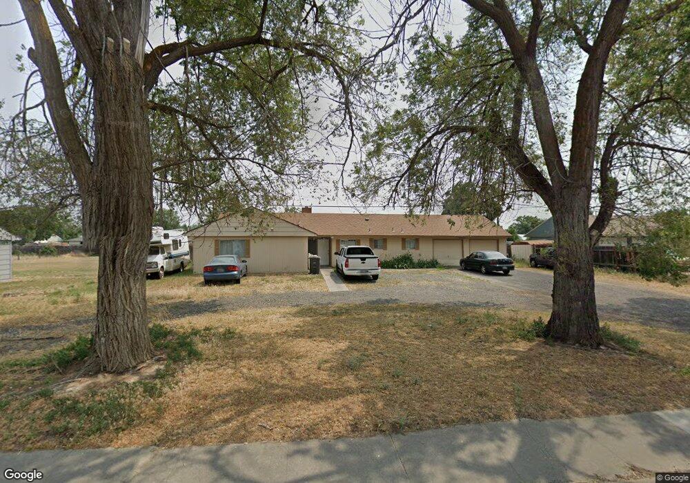
1234 Pershing Rd Moses Lake, WA 98837
Estimated Value: $239,000 - $276,000
4
Beds
2
Baths
1,546
Sq Ft
$167/Sq Ft
Est. Value
About This Home
This home is located at 1234 Pershing Rd, Moses Lake, WA 98837 and is currently estimated at $257,487, approximately $166 per square foot. 1234 Pershing Rd is a home located in Grant County with nearby schools including North Elementary School, Endeavor Middle School, and Moses Lake High School.
Ownership History
Date
Name
Owned For
Owner Type
Purchase Details
Closed on
Feb 9, 2024
Sold by
Rodriguez Mario A
Bought by
Rodriguez Oscar Cesar and Rodriguez Deloy
Current Estimated Value
Purchase Details
Closed on
Sep 11, 2014
Sold by
Masset Urban V
Bought by
Rodriguez Mario A
Home Financials for this Owner
Home Financials are based on the most recent Mortgage that was taken out on this home.
Original Mortgage
$85,025
Interest Rate
4.09%
Mortgage Type
New Conventional
Purchase Details
Closed on
Jan 24, 2009
Sold by
The Secretary Of Housing & Urban Develop
Bought by
Masset Urban V
Purchase Details
Closed on
Sep 5, 2008
Sold by
Wells Fargo Bank Na
Bought by
Hud
Purchase Details
Closed on
Jul 3, 2008
Sold by
Pattan Laura L and Pattan Lloyd L
Bought by
Wells Fargo Bank Na
Create a Home Valuation Report for This Property
The Home Valuation Report is an in-depth analysis detailing your home's value as well as a comparison with similar homes in the area
Home Values in the Area
Average Home Value in this Area
Purchase History
| Date | Buyer | Sale Price | Title Company |
|---|---|---|---|
| Rodriguez Oscar Cesar | -- | None Listed On Document | |
| Rodriguez Mario A | $89,500 | Stewart Title | |
| Masset Urban V | -- | Grant County Title | |
| Hud | -- | Frontier Title | |
| Wells Fargo Bank Na | $129,453 | Frontier Title |
Source: Public Records
Mortgage History
| Date | Status | Borrower | Loan Amount |
|---|---|---|---|
| Previous Owner | Rodriguez Mario A | $85,025 |
Source: Public Records
Tax History
| Year | Tax Paid | Tax Assessment Tax Assessment Total Assessment is a certain percentage of the fair market value that is determined by local assessors to be the total taxable value of land and additions on the property. | Land | Improvement |
|---|---|---|---|---|
| 2025 | $1,584 | $155,463 | -- | -- |
| 2024 | $2,294 | $200,905 | $34,500 | $166,405 |
| 2023 | $2,253 | $175,030 | $34,500 | $140,530 |
| 2022 | $2,118 | $175,030 | $34,500 | $140,530 |
| 2021 | $1,833 | $175,030 | $34,500 | $140,530 |
| 2020 | $1,885 | $146,035 | $34,500 | $111,535 |
| 2019 | $1,406 | $101,005 | $20,000 | $81,005 |
| 2018 | $1,578 | $97,165 | $20,000 | $77,165 |
| 2017 | $1,410 | $97,165 | $20,000 | $77,165 |
| 2016 | $1,299 | $87,605 | $20,000 | $67,605 |
| 2013 | -- | $81,460 | $20,000 | $61,460 |
Source: Public Records
Map
Nearby Homes
- 1314 Pershing Rd
- 1316 Pershing Rd
- 1215 Lowry St
- 137 Schilling Dr
- 9035 Forrestal Ln
- 9021 Mcconnell Dr Unit A
- 9023 Mcconnell Dr Unit A
- 9008 Bong Loop Unit B
- 9016 Bong Loop Unit A
- 206 208 Beale Ave
- 537 Fairchild Loop
- 0 Nna I Rd NE Unit NWM2484402
- 533 Fairchild Loop
- 4898 Shorecrest Dr NE
- 8521 Jean Rd NE
- 4815 Airway Dr NE Unit 128
- 4815 Airway Dr NE Unit 177
- 4815 Airway Dr NE Unit 72
- 4815 Airway Dr NE Unit 81
- 7342 Redmond Rd NE
- 1228 Pershing Rd
- 1236 Pershing Rd
- 1224 Pershing Rd
- 1222 Pershing Rd
- 1222 -1224 Pershing Rd
- 1222 1224 Pershing Rd
- 1222 1224 Pershing Rd
- 1223 Doolittle Dr
- 1227 Doolittle Dr
- 1233 Pershing Rd Unit 1235
- 1233 Pershing Rd
- 1233 1235 Pershing Dr
- 1233 1235 Pershing
- 1231 Pershing Rd
- 1225 Pershing Rd
- 1220 Pershing Rd
- 1240 Pershing Rd
- 1219 Pershing Rd
- 1219 Doolittle Dr
- 1217 Doolittle Dr
Your Personal Tour Guide
Ask me questions while you tour the home.