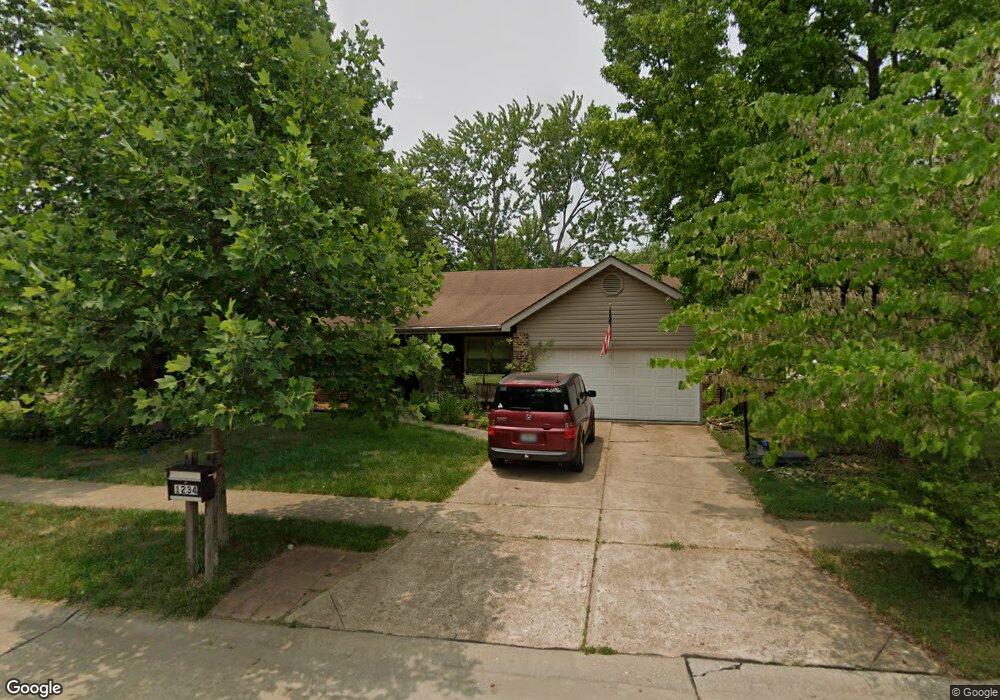
1234 Summit Meadows Dr Fenton, MO 63026
Estimated Value: $297,068 - $309,000
3
Beds
2
Baths
1,295
Sq Ft
$235/Sq Ft
Est. Value
About This Home
This home is located at 1234 Summit Meadows Dr, Fenton, MO 63026 and is currently estimated at $303,767, approximately $234 per square foot. 1234 Summit Meadows Dr is a home located in St. Louis County with nearby schools including Bowles Elementary School, Rockwood South Middle School, and Rockwood Summit Senior High School.
Ownership History
Date
Name
Owned For
Owner Type
Purchase Details
Closed on
Dec 12, 2000
Sold by
Powell Richard L and Powell Kim Denise
Bought by
Standlee John H and Standlee Leandra G
Current Estimated Value
Home Financials for this Owner
Home Financials are based on the most recent Mortgage that was taken out on this home.
Original Mortgage
$110,700
Outstanding Balance
$40,853
Interest Rate
7.72%
Estimated Equity
$262,914
Create a Home Valuation Report for This Property
The Home Valuation Report is an in-depth analysis detailing your home's value as well as a comparison with similar homes in the area
Home Values in the Area
Average Home Value in this Area
Purchase History
| Date | Buyer | Sale Price | Title Company |
|---|---|---|---|
| Standlee John H | $138,400 | -- | |
| Standlee John H | $138,400 | -- |
Source: Public Records
Mortgage History
| Date | Status | Borrower | Loan Amount |
|---|---|---|---|
| Open | Standlee John H | $110,700 | |
| Closed | Standlee John H | $110,700 |
Source: Public Records
Tax History Compared to Growth
Tax History
| Year | Tax Paid | Tax Assessment Tax Assessment Total Assessment is a certain percentage of the fair market value that is determined by local assessors to be the total taxable value of land and additions on the property. | Land | Improvement |
|---|---|---|---|---|
| 2025 | $3,379 | $47,590 | $23,690 | $23,900 |
| 2024 | $3,379 | $45,240 | $18,600 | $26,640 |
| 2023 | $3,376 | $45,240 | $18,600 | $26,640 |
| 2022 | $3,259 | $40,700 | $18,600 | $22,100 |
| 2021 | $3,234 | $40,700 | $18,600 | $22,100 |
| 2020 | $3,204 | $38,760 | $15,690 | $23,070 |
| 2019 | $3,213 | $38,760 | $15,690 | $23,070 |
| 2018 | $2,942 | $34,030 | $11,820 | $22,210 |
| 2017 | $2,919 | $34,030 | $11,820 | $22,210 |
| 2016 | $2,640 | $31,050 | $9,920 | $21,130 |
| 2015 | $2,585 | $31,050 | $9,920 | $21,130 |
| 2014 | $2,769 | $32,440 | $8,630 | $23,810 |
Source: Public Records
Map
Nearby Homes
- 1248 Green Knoll Dr
- 260 Trueman Heritage Pkwy
- 818 Mary Lee Ct
- The Westhampton Plan at Bowles Crossing
- The Rockport Plan at Bowles Crossing
- The Richmond Plan at Bowles Crossing
- The Liberty Plan at Bowles Crossing
- The Brookfield Plan at Bowles Crossing
- The Arlington Plan at Bowles Crossing
- 678 Greensleeves Dr
- 683 Greenholme Ct
- 811 Mary Lee Ct
- The Westhampton Plan at Hawkins Point
- The Rockport Plan at Hawkins Point
- The Brookfield Plan at Hawkins Point
- The Liberty Plan at Hawkins Point
- The Arlington Plan at Hawkins Point
- 1009 Remington Oaks Ct
- 800 Mary Lee Ct
- 82 May Valley Ln
- 1230 Summit Meadows Dr
- 1240 Summit Meadows Dr
- 1226 Summit Meadows Dr
- 546 Green Forest Dr
- 542 Green Forest Dr
- 550 Green Forest Dr
- 538 Green Forest Dr
- 1235 Summit Meadows Dr
- 1222 Summit Meadows Dr
- 554 Green Forest Dr
- 1239 Summit Meadows Dr
- 1243 Summit Meadows Dr
- 558 Green Forest Dr
- 1218 Summit Meadows Dr
- 1247 Summit Meadows Dr
- 1219 Summit Meadows Dr
- 543 Green Forest Dr
- 539 Green Forest Dr
- 547 Green Forest Dr
- 530 Green Forest Dr