Estimated Value: $723,000 - $789,625
3
Beds
2
Baths
1,836
Sq Ft
$408/Sq Ft
Est. Value
About This Home
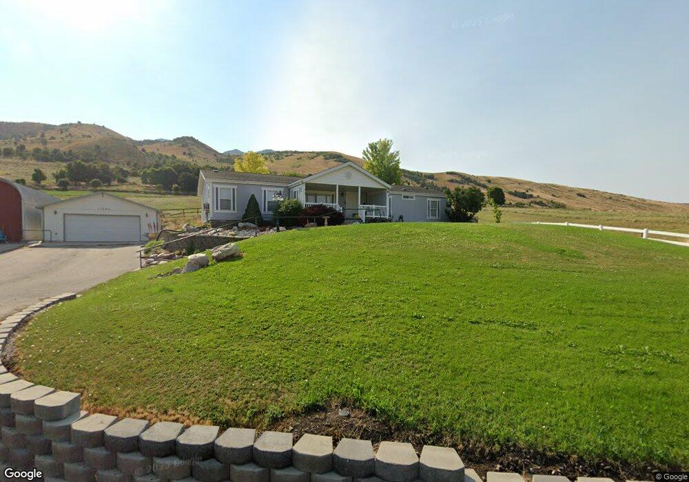
This home is located at 12340 N 2400 E, Cove, UT 84320 and is currently estimated at $749,906, approximately $408 per square foot. 12340 N 2400 E is a home located in Cache County with nearby schools including Lewiston School, White Pine Middle School, and North Cache Middle School.
Ownership History
Date
Name
Owned For
Owner Type
Purchase Details
Closed on
Jun 12, 2020
Sold by
Adams Marcia
Bought by
Marcia Adams and Marcia Adams Trust
Current Estimated Value
Purchase Details
Closed on
Sep 6, 2012
Sold by
Elliott Steven B and Elliott Kathryne M
Bought by
Adams Marcia
Home Financials for this Owner
Home Financials are based on the most recent Mortgage that was taken out on this home.
Original Mortgage
$102,500
Outstanding Balance
$70,351
Interest Rate
3.55%
Mortgage Type
New Conventional
Estimated Equity
$679,555
Create a Home Valuation Report for This Property
The Home Valuation Report is an in-depth analysis detailing your home's value as well as a comparison with similar homes in the area
Purchase History
| Date | Buyer | Sale Price | Title Company |
|---|---|---|---|
| Marcia Adams | -- | None Available | |
| Adams Marcia | -- | Accommodation | |
| Adams Marcia | -- | Pinnacle Title Ins Agency |
Source: Public Records
Mortgage History
| Date | Status | Borrower | Loan Amount |
|---|---|---|---|
| Open | Adams Marcia | $102,500 | |
| Closed | Adams Marcia | $102,500 |
Source: Public Records
Tax History
| Year | Tax Paid | Tax Assessment Tax Assessment Total Assessment is a certain percentage of the fair market value that is determined by local assessors to be the total taxable value of land and additions on the property. | Land | Improvement |
|---|---|---|---|---|
| 2025 | $3,093 | $494,995 | $0 | $0 |
| 2024 | $2,063 | $304,940 | $0 | $0 |
| 2023 | $2,185 | $302,425 | $0 | $0 |
| 2022 | $2,154 | $285,145 | $0 | $0 |
| 2021 | $2,278 | $401,485 | $158,000 | $243,485 |
| 2020 | $1,218 | $216,755 | $69,800 | $146,955 |
| 2019 | $1,288 | $216,754 | $69,800 | $146,954 |
| 2018 | $1,221 | $198,390 | $69,800 | $128,590 |
| 2017 | $1,210 | $112,425 | $0 | $0 |
| 2016 | $1,225 | $112,425 | $0 | $0 |
| 2015 | $1,001 | $93,300 | $0 | $0 |
| 2014 | $971 | $93,300 | $0 | $0 |
| 2013 | -- | $93,300 | $0 | $0 |
Source: Public Records
Map
Nearby Homes
- 2307 Maple Leaf Dr
- 13485 N 2200 E
- 684 N Cherry Creek Pkwy E
- 684 N Cherry Creek Pkwy E Unit 26
- 1009 E High Creek Rd
- 673 Cherry Creek Pkwy Unit 24
- 299 Chokecherry Cir
- 349 Sunburst Ln
- Lincoln Plan at The Knolls
- Willow Plan at The Knolls
- Crimson Plan at The Knolls
- Abigail Plan at The Knolls
- Camden Plan at The Knolls
- Huntington Plan at The Knolls
- Cedar Ridge Plan at The Knolls
- Oakridge Plan at The Knolls
- Jefferson Plan at The Knolls
- Chamberlain Plan at The Knolls
- Fairway Plan at The Knolls
- Hamilton Plan at The Knolls
- 12421 N 2400 E
- 12432 N 2400 E
- 12430 N 2400 E
- 12303 N 2000 E
- 12160 N 2000 E
- 12235 N 2000 E
- 1980 E High Creek Rd
- 12110 N 2000 E
- 12704 N High Creek Rd
- 2307 Maple Leaf Dr Unit 5
- 1952 E High Creek Rd
- 2050 Maple Leaf Dr
- 2050 Maple Leaf Dr Unit 3
- 12720 N High Creek Rd
- 12755 N High Creek Rd
- 12043 N 2000 E
- 12886 N 2400 E
- 12020 N 2000 E
- 12758 N High Creek Rd
- 11953 N 2000 E
Your Personal Tour Guide
Ask me questions while you tour the home.