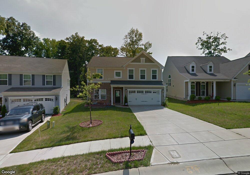
12341 Lookout Point Dr Charlotte, NC 28269
Prosperity Church Road NeighborhoodEstimated Value: $451,263 - $486,000
4
Beds
3
Baths
3,260
Sq Ft
$144/Sq Ft
Est. Value
About This Home
This home is located at 12341 Lookout Point Dr, Charlotte, NC 28269 and is currently estimated at $468,566, approximately $143 per square foot. 12341 Lookout Point Dr is a home located in Mecklenburg County with nearby schools including Croft Community Elementary, Ridge Road Middle School, and Mallard Creek High School.
Ownership History
Date
Name
Owned For
Owner Type
Purchase Details
Closed on
Sep 4, 2012
Sold by
Nvr Inc Corp
Bought by
Moncada Jason and Velandia Claudia
Current Estimated Value
Home Financials for this Owner
Home Financials are based on the most recent Mortgage that was taken out on this home.
Original Mortgage
$189,121
Interest Rate
3.6%
Mortgage Type
New Conventional
Create a Home Valuation Report for This Property
The Home Valuation Report is an in-depth analysis detailing your home's value as well as a comparison with similar homes in the area
Home Values in the Area
Average Home Value in this Area
Purchase History
| Date | Buyer | Sale Price | Title Company |
|---|---|---|---|
| Moncada Jason | $199,500 | None Available |
Source: Public Records
Mortgage History
| Date | Status | Borrower | Loan Amount |
|---|---|---|---|
| Previous Owner | Moncada Jason | $189,121 |
Source: Public Records
Tax History Compared to Growth
Tax History
| Year | Tax Paid | Tax Assessment Tax Assessment Total Assessment is a certain percentage of the fair market value that is determined by local assessors to be the total taxable value of land and additions on the property. | Land | Improvement |
|---|---|---|---|---|
| 2025 | $3,126 | $392,600 | $90,000 | $302,600 |
| 2024 | $3,126 | $392,600 | $90,000 | $302,600 |
| 2023 | $3,019 | $392,600 | $90,000 | $302,600 |
| 2022 | $2,383 | $233,900 | $40,000 | $193,900 |
| 2021 | $2,372 | $233,900 | $40,000 | $193,900 |
| 2020 | $2,364 | $233,900 | $40,000 | $193,900 |
| 2019 | $2,349 | $233,900 | $40,000 | $193,900 |
| 2018 | $2,354 | $173,800 | $33,300 | $140,500 |
| 2017 | $2,313 | $173,800 | $33,300 | $140,500 |
| 2016 | $2,303 | $173,800 | $33,300 | $140,500 |
| 2015 | $2,292 | $173,800 | $33,300 | $140,500 |
| 2014 | $2,294 | $0 | $0 | $0 |
Source: Public Records
Map
Nearby Homes
- 7718 Wiltshire Ridge Rd
- 4321 Silvermere Way
- 4045 Amber Leigh Way Dr
- 3111 Ewert Cut Ln
- 10024 Avon Farm Ln
- 4306 Wynborough Ln
- 11931 Old Timber Rd
- 11850 Old Timber Rd
- 12315 Heritage Hills Ln
- 9701 Kent Village Dr
- 9614 Runswyck Ct
- 9608 Runswyck Ct
- 7106 Kinsmore Ln
- 7114 Kinsmore Ln
- 5106 Stone Park Dr
- 8619 Delamere Ln
- 12529 Old Timber Rd
- 12125 Brownestone View Dr
- 12016 Gemstone Ct
- 10101 White Cascade Dr
- 12345 Lookout Point Dr
- 12337 Lookout Point Dr
- 12337 Lookout Point Dr Unit 55
- 12349 Lookout Point Dr
- 12333 Lookout Point Dr
- 12333 Lookout Point Dr Unit 54
- 12328 Lookout Point Dr
- 12329 Lookout Point Dr
- 4007 Amber Leigh Way Dr
- 12325 Lookout Point Dr
- 12320 Lookout Point Dr
- 60 Amber Leigh Way Dr
- 12403 Lookout Point Dr
- 12321 Lookout Point Dr
- 12316 Lookout Point Dr Unit 43
- 12316 Lookout Point Dr
- 12407 Lookout Point Dr
- 7802 Suttonview Dr
- 7702 Wiltshire Ridge Rd
- 12317 Lookout Point Dr