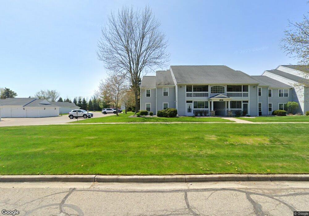
12344 Saint Andrews Way Unit 76 Fenton, MI 48430
Estimated Value: $166,000 - $199,000
2
Beds
2
Baths
1,338
Sq Ft
$140/Sq Ft
Est. Value
About This Home
This home is located at 12344 Saint Andrews Way Unit 76, Fenton, MI 48430 and is currently estimated at $187,128, approximately $139 per square foot. 12344 Saint Andrews Way Unit 76 is a home located in Genesee County with nearby schools including West Shore Elementary School, Torrey Hill Intermediate School, and Lake Fenton Middle School.
Ownership History
Date
Name
Owned For
Owner Type
Purchase Details
Closed on
Apr 23, 2012
Sold by
Johnson Margaret D
Bought by
Johnson Margaret D and Vearl P Johnson & Margaret D Johnson Tru
Current Estimated Value
Purchase Details
Closed on
Aug 2, 2010
Sold by
The Anthony J Peters & Lorene A Peters D
Bought by
Johnson Margaret D
Purchase Details
Closed on
May 14, 2001
Sold by
Peters Anthony J and Peters Lorene A
Bought by
Peters Anthony J and Peters Lorene A
Create a Home Valuation Report for This Property
The Home Valuation Report is an in-depth analysis detailing your home's value as well as a comparison with similar homes in the area
Home Values in the Area
Average Home Value in this Area
Purchase History
| Date | Buyer | Sale Price | Title Company |
|---|---|---|---|
| Johnson Margaret D | -- | None Available | |
| Johnson Margaret D | $50,000 | None Available | |
| Peters Anthony J | -- | -- |
Source: Public Records
Tax History Compared to Growth
Tax History
| Year | Tax Paid | Tax Assessment Tax Assessment Total Assessment is a certain percentage of the fair market value that is determined by local assessors to be the total taxable value of land and additions on the property. | Land | Improvement |
|---|---|---|---|---|
| 2025 | $1,260 | $93,600 | $0 | $0 |
| 2024 | $444 | $87,000 | $0 | $0 |
| 2023 | $424 | $78,700 | $0 | $0 |
| 2022 | $1,202 | $76,000 | $0 | $0 |
| 2021 | $1,185 | $59,300 | $0 | $0 |
| 2020 | $388 | $55,200 | $0 | $0 |
| 2019 | $381 | $50,800 | $0 | $0 |
| 2018 | $1,113 | $45,700 | $0 | $0 |
| 2017 | $1,073 | $42,900 | $0 | $0 |
| 2016 | $1,060 | $37,700 | $0 | $0 |
| 2015 | $1,036 | $34,600 | $0 | $0 |
| 2014 | $350 | $30,800 | $0 | $0 |
| 2012 | -- | $33,500 | $33,500 | $0 |
Source: Public Records
Map
Nearby Homes
- 12333 Saint Andrews Way Unit 86
- 12364 Saint Andrews Way Unit 66
- 13167 Harbor Landings Dr
- 13163 Harbor Landings Dr Unit 112
- 3129 Harbor Pointe Cir
- 3130 Harbor Pointe Cir Unit 64
- 3127 Harbor Pointe Cir
- 13111 Harbor Landings Dr Unit 46
- 2410 Torrey Grove Ct Unit 12
- 12147 Torrey Rd
- 2414 Cranewood Dr
- 12356 Jennings Rd
- VL Crane Crane Rd
- 24 S Hill Dr
- 2361 Golden Shore Dr
- 2234 Toledo St
- 2369 Golden Shores Dr
- 3302 Rolston Rd
- 2509 Golden Shores Dr
- 2497 Golden Shores Dr
- 12348 Saint Andrews Way Unit 80
- 12342 Saint Andrews Way Unit 75
- 12346 Saint Andrews Way
- 12354 Saint Andrews Way
- 12358 Saint Andrews Way
- 12356 Saint Andrews Way Unit 77
- 12316 Saint Andrews Way Unit Bldg-Unit
- 12316 Saint Andrews Way Unit 103
- 12318 Saint Andrews Way Unit Bldg-Unit
- 12318 Saint Andrews Way Unit 104
- 12323 Saint Andrews Way
- 12323 Saint Andrews Way Unit 82
- 12313 Saint Andrews Way Unit 90
- 12312 Saint Andrews Way Unit 101
- 12337 Saint Andrews Way Unit 88
- 12314 Saint Andrews Way Unit 102
- 12311 Saint Andrews Way Unit 89
- 12327 Saint Andrews Way Unit 9, 84
- 12327 Saint Andrews Way Unit 84
- 12327 Saint Andrews Way Unit 9