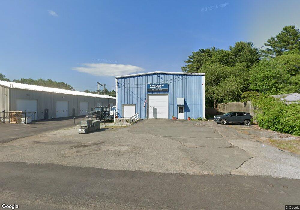
1235 Auburn St Whitman, MA 02382
Estimated Value: $537,257
--
Bed
3
Baths
4,200
Sq Ft
$128/Sq Ft
Est. Value
About This Home
This home is located at 1235 Auburn St, Whitman, MA 02382 and is currently estimated at $537,257, approximately $127 per square foot. 1235 Auburn St is a home located in Plymouth County with nearby schools including Trinity Catholic Academy, Brockton Area Seventh-Day Adventist Academy, and Cardinal Spellman High School.
Ownership History
Date
Name
Owned For
Owner Type
Purchase Details
Closed on
May 31, 2019
Sold by
Kennedy Brian J
Bought by
1235 Auburn Street Llc
Current Estimated Value
Purchase Details
Closed on
Sep 29, 2004
Sold by
Plymouth Cnty Communic
Bought by
Deems Donald A and Kennedy Brian J
Purchase Details
Closed on
Feb 15, 1996
Sold by
Carchet Rt and Field
Bought by
Plymouth County Comm
Home Financials for this Owner
Home Financials are based on the most recent Mortgage that was taken out on this home.
Original Mortgage
$25,000
Interest Rate
7.02%
Mortgage Type
Commercial
Purchase Details
Closed on
Feb 6, 1995
Sold by
Berger Harold and Berger Concetta S
Bought by
Cherry Rt and Andrews George R
Purchase Details
Closed on
Apr 20, 1989
Sold by
Mejia Diana M
Bought by
Carchet Rt
Create a Home Valuation Report for This Property
The Home Valuation Report is an in-depth analysis detailing your home's value as well as a comparison with similar homes in the area
Home Values in the Area
Average Home Value in this Area
Purchase History
| Date | Buyer | Sale Price | Title Company |
|---|---|---|---|
| 1235 Auburn Street Llc | -- | -- | |
| Deems Donald A | -- | -- | |
| Deems Donald A | $390,000 | -- | |
| Deems Donald A | $390,000 | -- | |
| Plymouth County Comm | $175,000 | -- | |
| Plymouth County Comm | $175,000 | -- | |
| Cherry Rt | $35,000 | -- | |
| Cherry Rt | $35,000 | -- | |
| Carchet Rt | $200,000 | -- | |
| Carchet Rt | $200,000 | -- |
Source: Public Records
Mortgage History
| Date | Status | Borrower | Loan Amount |
|---|---|---|---|
| Previous Owner | Carchet Rt | $25,000 | |
| Previous Owner | Carchet Rt | $128,000 |
Source: Public Records
Tax History Compared to Growth
Tax History
| Year | Tax Paid | Tax Assessment Tax Assessment Total Assessment is a certain percentage of the fair market value that is determined by local assessors to be the total taxable value of land and additions on the property. | Land | Improvement |
|---|---|---|---|---|
| 2025 | $4,059 | $309,400 | $163,600 | $145,800 |
| 2024 | $3,709 | $291,100 | $144,300 | $146,800 |
| 2023 | $3,869 | $285,100 | $144,300 | $140,800 |
| 2022 | $3,759 | $258,200 | $130,900 | $127,300 |
| 2021 | $3,751 | $242,000 | $125,100 | $116,900 |
| 2020 | $3,582 | $226,000 | $115,500 | $110,500 |
| 2019 | $3,467 | $225,400 | $115,500 | $109,900 |
| 2018 | $3,389 | $225,600 | $115,500 | $110,100 |
| 2017 | $3,398 | $225,300 | $115,500 | $109,800 |
| 2016 | $3,430 | $220,000 | $115,500 | $104,500 |
| 2015 | $3,434 | $220,000 | $115,500 | $104,500 |
Source: Public Records
Map
Nearby Homes
- 1121 Auburn St
- 26 Alger St
- 99 Alger St
- 877 Auburnville Way Unit D4
- 32 Joyce Terrace
- 104 Crestfield Dr
- 93 Porter St
- 262 Homeland Dr
- 307 Homeland Dr
- 967 Centre St
- 728 Auburn St Unit F6
- 4 Locust Hill Ln
- 485 Temple St
- 16 Davis St
- 618 Auburn St
- 78 Linda St
- 59 Sterling Rd
- 91 Clapp St
- 63 Rice St
- 300 High St
- 1225 Auburn St
- 1199 Auburn St
- 1152 Auburn St
- 1135 Auburn St
- 1179 Auburn St
- 1140 Auburn St
- 1129 Auburn St
- 1132 Auburn St
- 220 Sportsmans Trail
- 210 Sportsmans Trail
- 1276 Auburn St
- 200 Sportsmans Trail
- 1120 Auburn St
- 1300 Auburn St
- 190 Sportsmans Trail
- 230 Sportsmans Trail
- 180 Sportsmans Trail
- 233 Sportsmans Trail
- 1100 Auburn St
- 168 Alger St