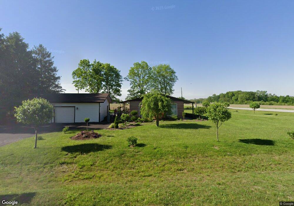
1235 Bobby Rd Marion, IN 46953
Estimated Value: $173,000 - $190,760
3
Beds
2
Baths
1,575
Sq Ft
$115/Sq Ft
Est. Value
About This Home
This home is located at 1235 Bobby Rd, Marion, IN 46953 and is currently estimated at $181,690, approximately $115 per square foot. 1235 Bobby Rd is a home located in Grant County with nearby schools including Westview Elementary School, Northview Elementary School, and R.J. Baskett Middle School.
Ownership History
Date
Name
Owned For
Owner Type
Purchase Details
Closed on
Sep 18, 2006
Sold by
Jpmorgan Chase Bank
Bought by
Collins James D and Ritter Russell D
Current Estimated Value
Home Financials for this Owner
Home Financials are based on the most recent Mortgage that was taken out on this home.
Original Mortgage
$79,900
Outstanding Balance
$47,747
Interest Rate
6.58%
Mortgage Type
New Conventional
Estimated Equity
$133,943
Purchase Details
Closed on
Jul 26, 2006
Sold by
Dunn Perry and Dunn Lorie A
Bought by
Jpmorgan Chase Bank
Home Financials for this Owner
Home Financials are based on the most recent Mortgage that was taken out on this home.
Original Mortgage
$79,900
Outstanding Balance
$47,747
Interest Rate
6.58%
Mortgage Type
New Conventional
Estimated Equity
$133,943
Create a Home Valuation Report for This Property
The Home Valuation Report is an in-depth analysis detailing your home's value as well as a comparison with similar homes in the area
Home Values in the Area
Average Home Value in this Area
Purchase History
| Date | Buyer | Sale Price | Title Company |
|---|---|---|---|
| Collins James D | -- | None Available | |
| Jpmorgan Chase Bank | $76,500 | None Available |
Source: Public Records
Mortgage History
| Date | Status | Borrower | Loan Amount |
|---|---|---|---|
| Open | Collins James D | $79,900 |
Source: Public Records
Tax History Compared to Growth
Tax History
| Year | Tax Paid | Tax Assessment Tax Assessment Total Assessment is a certain percentage of the fair market value that is determined by local assessors to be the total taxable value of land and additions on the property. | Land | Improvement |
|---|---|---|---|---|
| 2024 | $1,272 | $159,400 | $23,500 | $135,900 |
| 2023 | $1,097 | $144,800 | $23,500 | $121,300 |
| 2022 | $976 | $126,500 | $20,800 | $105,700 |
| 2021 | $934 | $121,100 | $20,800 | $100,300 |
| 2020 | $849 | $117,700 | $19,900 | $97,800 |
| 2019 | $785 | $113,300 | $19,900 | $93,400 |
| 2018 | $657 | $106,100 | $19,900 | $86,200 |
| 2017 | $559 | $101,100 | $19,900 | $81,200 |
| 2016 | $486 | $97,000 | $19,900 | $77,100 |
| 2014 | $469 | $99,400 | $19,900 | $79,500 |
| 2013 | $469 | $99,500 | $19,900 | $79,600 |
Source: Public Records
Map
Nearby Homes
- 6970 S Maple Dr
- 1508 W Glendale Dr
- 5416 S Baldwin Ave
- 712 W 9th St
- 514 W 7th St
- 1765 E Old Kokomo Rd
- 206 S Main St
- 5440 S Adams St
- 517 S Main St
- 4317 Wildoner Dr
- 906 E 49th St
- 4312 Thompson Dr
- 4305 Wildoner Dr
- 611 S Water St
- 4118 S Landess St
- 903 S Water St
- 401 W 39th St
- 3907 Joshua Dr
- 3808 S Carey St
- 3809 S Landess St
- 1203 Bobby Rd
- 1230 Bobby Rd
- 1201 Bobby Rd
- 7070 S Clark Dr
- 7061 S Western Ave
- 7060 S Clark Dr
- 7050 S Western Ave
- 7071 S Clark Dr
- 7045 S Western Ave
- 7040 S Western Ave
- 7030 S Clark Dr
- 7061 S Clark Dr
- 1135 Bobby Rd
- 7035 S Western Ave
- 7041 S Clark Dr
- 7022 S Western Ave
- 7024 S Clark Dr
- 7025 S Western Ave
- 7021 S Clark Dr
- 1235 W Goff Dr