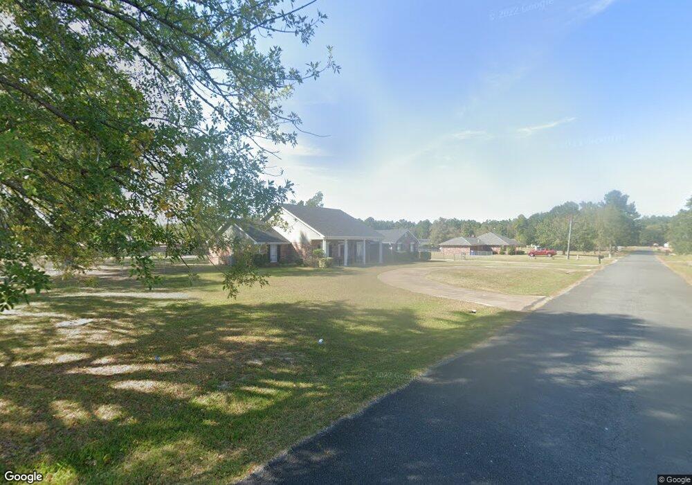
1235 Christina Dr Deridder, LA 70634
Estimated Value: $297,180 - $325,000
4
Beds
2
Baths
3,849
Sq Ft
$81/Sq Ft
Est. Value
About This Home
This home is located at 1235 Christina Dr, Deridder, LA 70634 and is currently estimated at $313,295, approximately $81 per square foot. 1235 Christina Dr is a home located in Beauregard Parish with nearby schools including K.R. Hanchey Elementary School, Pine Wood Elementary School, and Carver Elementary School.
Ownership History
Date
Name
Owned For
Owner Type
Purchase Details
Closed on
Jul 13, 2016
Sold by
Nihart Franklin Jesse and Nihart Anna Belle Ash
Bought by
Bennet Johnny James and Bennet Carol Lynell
Current Estimated Value
Purchase Details
Closed on
Mar 20, 2008
Sold by
Waraksa Thomas James and Waraksa Carolyn Flo Hawn
Bought by
Nihart Franklin Jesse and Nihart Anna Belle Ash
Home Financials for this Owner
Home Financials are based on the most recent Mortgage that was taken out on this home.
Original Mortgage
$114,000
Interest Rate
6.11%
Create a Home Valuation Report for This Property
The Home Valuation Report is an in-depth analysis detailing your home's value as well as a comparison with similar homes in the area
Home Values in the Area
Average Home Value in this Area
Purchase History
| Date | Buyer | Sale Price | Title Company |
|---|---|---|---|
| Bennet Johnny James | $247,500 | None Available | |
| Nihart Franklin Jesse | $234,000 | -- |
Source: Public Records
Mortgage History
| Date | Status | Borrower | Loan Amount |
|---|---|---|---|
| Previous Owner | Nihart Franklin Jesse | $114,000 |
Source: Public Records
Tax History Compared to Growth
Tax History
| Year | Tax Paid | Tax Assessment Tax Assessment Total Assessment is a certain percentage of the fair market value that is determined by local assessors to be the total taxable value of land and additions on the property. | Land | Improvement |
|---|---|---|---|---|
| 2024 | $2,337 | $22,770 | $1,400 | $21,370 |
| 2023 | $2,392 | $22,770 | $1,400 | $21,370 |
| 2022 | $2,391 | $22,770 | $1,400 | $21,370 |
| 2021 | $2,391 | $22,770 | $1,400 | $21,370 |
| 2020 | $2,390 | $22,770 | $1,400 | $21,370 |
| 2019 | $2,394 | $22,770 | $1,400 | $21,370 |
| 2018 | $2,394 | $22,770 | $1,400 | $21,370 |
| 2017 | $2,394 | $22,770 | $1,400 | $21,370 |
| 2016 | $2,394 | $22,770 | $1,400 | $21,370 |
| 2015 | $1,451 | $21,060 | $1,400 | $19,660 |
| 2014 | $1,451 | $21,060 | $1,400 | $19,660 |
Source: Public Records
Map
Nearby Homes
- 1615 Ernest Dr
- 0 Glendale Rd
- 1598 Glendale Rd
- 1938 Glendale Rd
- 629 Auburn Dr
- 1207 Seminole St
- 710 N Frusha Dr
- 1526 Peggy Ln
- 0 N Texas St
- 905 Cherokee St
- 0 Tbd N Texas St
- 809 N Texas St
- 1125 Willow St
- 113 Barbara St
- 0 N Frusha Dr
- 721 N Texas St
- 0 Planer Mill Rd
- 0 Bilbo Street (Tract 1)
- 0 Bilbo Street (Tract 2)
- 0 W Dr Tbd
- 1234 Christina Dr
- 1251 Christina Dr
- 1252 Christina Dr
- 1206 Christina Dr
- 1230 Maybelle Dr
- 1250 Maybelle Dr
- 1645 Ernest Dr
- 1270 Christina Dr
- 1632 Amalynn Dr
- 1213 Allison Dr
- 1665 Ernest Dr
- 1235 Allison Dr
- 1175 Allison Dr
- 1611 Amalynn Dr
- 1611 Amalynn Dr Unit Dr
- 1136 Christina Dr
- 1245 Allison Dr
- 1284 Christina Dr
- 0 Allison Dr 1157 Unit 1157
- 1631 Amalynn Dr