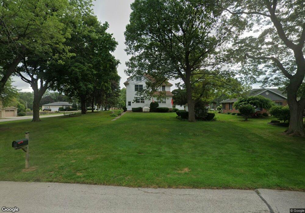
1235 Laurel Ln Schaumburg, IL 60193
South Schaumburg NeighborhoodEstimated Value: $500,089 - $620,000
6
Beds
1
Bath
2,344
Sq Ft
$239/Sq Ft
Est. Value
About This Home
This home is located at 1235 Laurel Ln, Schaumburg, IL 60193 and is currently estimated at $560,522, approximately $239 per square foot. 1235 Laurel Ln is a home located in Cook County with nearby schools including Frederick Nerge Elementary School, Margaret Mead Junior High School, and J B Conant High School.
Ownership History
Date
Name
Owned For
Owner Type
Purchase Details
Closed on
May 28, 2010
Sold by
Mensching Lois J
Bought by
Johnson Danielle L
Current Estimated Value
Home Financials for this Owner
Home Financials are based on the most recent Mortgage that was taken out on this home.
Original Mortgage
$273,781
Outstanding Balance
$185,991
Interest Rate
5.25%
Mortgage Type
FHA
Estimated Equity
$374,531
Create a Home Valuation Report for This Property
The Home Valuation Report is an in-depth analysis detailing your home's value as well as a comparison with similar homes in the area
Home Values in the Area
Average Home Value in this Area
Purchase History
| Date | Buyer | Sale Price | Title Company |
|---|---|---|---|
| Johnson Danielle L | $290,000 | Cti |
Source: Public Records
Mortgage History
| Date | Status | Borrower | Loan Amount |
|---|---|---|---|
| Open | Johnson Danielle L | $273,781 |
Source: Public Records
Tax History Compared to Growth
Tax History
| Year | Tax Paid | Tax Assessment Tax Assessment Total Assessment is a certain percentage of the fair market value that is determined by local assessors to be the total taxable value of land and additions on the property. | Land | Improvement |
|---|---|---|---|---|
| 2024 | $10,556 | $36,122 | $8,602 | $27,520 |
| 2023 | $10,208 | $41,000 | $8,602 | $32,398 |
| 2022 | $10,208 | $41,000 | $8,602 | $32,398 |
| 2021 | $7,811 | $29,100 | $24,192 | $4,908 |
| 2020 | $7,744 | $29,100 | $24,192 | $4,908 |
| 2019 | $7,748 | $32,334 | $24,192 | $8,142 |
| 2018 | $8,742 | $32,565 | $20,428 | $12,137 |
| 2017 | $8,622 | $32,565 | $20,428 | $12,137 |
| 2016 | $8,306 | $32,565 | $20,428 | $12,137 |
| 2015 | $7,968 | $29,258 | $17,203 | $12,055 |
| 2014 | $7,897 | $29,258 | $17,203 | $12,055 |
| 2013 | $7,677 | $29,258 | $17,203 | $12,055 |
Source: Public Records
Map
Nearby Homes
- 1205 Laurel Ln
- 124 E Monterey Ave
- 286 Nantucket Harbor Unit 601
- 1323 S Roselle Rd
- 1420 Indian Hill Dr
- 13 W Monterey Ave
- 1078 Newport Harbor Unit 6101
- 421 E Wise Rd
- 125 Manchester Ct Unit 32A
- 1100 Boston Harbor Unit 7004
- 1623 Indian Hill Dr
- 211 Steeple Bush Ln Unit 10343
- 205 Steeple Bush Ln Unit 10444
- 1531 Marion St
- 1630 Myrtle Park St
- 1630 Myrtle Park St
- 1630 Myrtle Park St
- 620 S Point Dr
- 120 Pratt Blvd
- 1342 Lunt Ct Unit 56
- 1295 Laurel Ln
- 133 E Niagara Ave
- 122 E Niagara Ave
- 1307 Laurel Ln
- 130 E Niagara Ave
- 201 E Niagara Ave
- 1234 Laurel Ln
- 1300 Laurel Ln
- 1228 Laurel Ln
- 1308 Laurel Ln
- 132 E Monterey Ave
- 1222 Laurel Ln
- 1217 Laurel Ln
- 1226 Greenview Ct
- 124 E Monterey Ave
- 124 E Monterey Ave
- 211 E Niagara Ave
- 200 E Monterey Ave
- 1216 Laurel Ln
- 206 E Monterey Ave