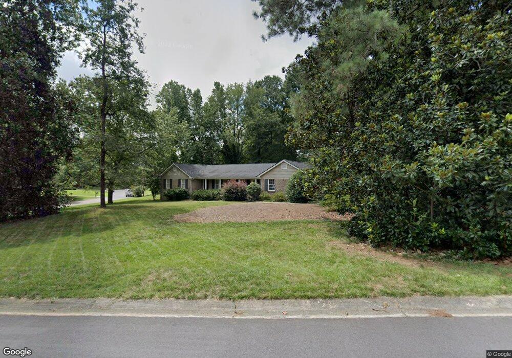
1235 Mill Glen Dr Unit 1 Atlanta, GA 30338
Estimated Value: $604,000 - $674,000
3
Beds
3
Baths
2,511
Sq Ft
$255/Sq Ft
Est. Value
About This Home
This home is located at 1235 Mill Glen Dr Unit 1, Atlanta, GA 30338 and is currently estimated at $639,402, approximately $254 per square foot. 1235 Mill Glen Dr Unit 1 is a home located in DeKalb County with nearby schools including Austin Elementary School, Peachtree Middle School, and Dunwoody High School.
Ownership History
Date
Name
Owned For
Owner Type
Purchase Details
Closed on
Nov 30, 1993
Sold by
Hastings Malcolm R Kathryn
Bought by
Garrett Randall S Ashley
Current Estimated Value
Home Financials for this Owner
Home Financials are based on the most recent Mortgage that was taken out on this home.
Original Mortgage
$124,000
Interest Rate
6.75%
Create a Home Valuation Report for This Property
The Home Valuation Report is an in-depth analysis detailing your home's value as well as a comparison with similar homes in the area
Home Values in the Area
Average Home Value in this Area
Purchase History
| Date | Buyer | Sale Price | Title Company |
|---|---|---|---|
| Garrett Randall S Ashley | $155,000 | -- |
Source: Public Records
Mortgage History
| Date | Status | Borrower | Loan Amount |
|---|---|---|---|
| Closed | Garrett Randall S Ashley | $124,000 |
Source: Public Records
Tax History Compared to Growth
Tax History
| Year | Tax Paid | Tax Assessment Tax Assessment Total Assessment is a certain percentage of the fair market value that is determined by local assessors to be the total taxable value of land and additions on the property. | Land | Improvement |
|---|---|---|---|---|
| 2025 | $5,024 | $182,000 | $80,000 | $102,000 |
| 2024 | $5,119 | $182,000 | $80,000 | $102,000 |
| 2023 | $5,119 | $182,000 | $80,000 | $102,000 |
| 2022 | $5,500 | $198,240 | $80,000 | $118,240 |
| 2021 | $5,007 | $179,920 | $80,000 | $99,920 |
| 2020 | $4,319 | $145,760 | $70,400 | $75,360 |
| 2019 | $4,237 | $145,760 | $70,400 | $75,360 |
| 2018 | $4,003 | $145,760 | $70,400 | $75,360 |
| 2017 | $4,280 | $152,040 | $70,400 | $81,640 |
| 2016 | $3,975 | $145,440 | $70,400 | $75,040 |
| 2014 | $3,609 | $109,920 | $70,040 | $39,880 |
Source: Public Records
Map
Nearby Homes
- 5625 Roberts Dr
- 5697 Whitehall Walk
- 1120 Whitehall Pointe
- 1136 Coronation Dr
- 5662 Queensborough Dr
- 980 Fenimore Cir
- 1495 Spalding Dr
- 1293 Witham Dr
- 1605 Saint Tropez Way
- 5717 Braddock Ct
- 8205 Innsbruck Dr
- 812 Stratford Ct
- 525 Spender Trace
- 5816 Chamblee Dunwoody Rd
- 4006 Wingate Way
- 7632 Auden Trail
- 7967 Magnolia Square
- 5379 Harris Cir
- 3020 Wingate Way
- 5648 Mill Glen Ct
- 1223 Mill Glen Dr Unit 1
- 5649 Roberts Dr
- 5651 Mill Glen Ct
- 5641 Mill Glen Ct
- 1230 Mill Glen Dr Unit 1
- 1238 Mill Glen Dr
- 1248 Mill Glen Dr
- 5638 Mill Glen Ct
- 1220 Mill Glen Dr
- 5633 Mill Glen Ct
- 5628 Mill Glen Ct
- 1265 Mill Glen Dr
- 1258 Mill Glen Dr
- 5633 Roberts Dr
- 5625 Mill Glen Ct
- 1233 Manor Oaks Ct
- 1281 Mill Glen Dr
- 1223 Manor Oaks Ct
- 1268 Mill Glen Dr