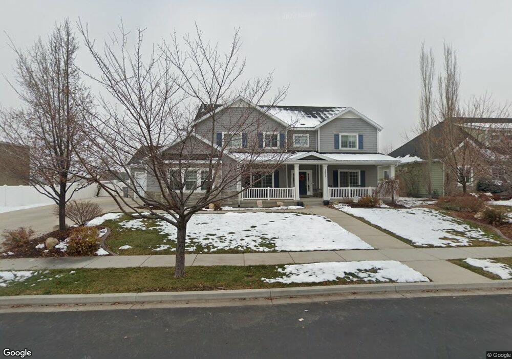
1235 N 1050 E American Fork, UT 84003
Estimated Value: $1,083,000 - $1,332,102
6
Beds
6
Baths
5,560
Sq Ft
$222/Sq Ft
Est. Value
About This Home
This home is located at 1235 N 1050 E, American Fork, UT 84003 and is currently estimated at $1,233,276, approximately $221 per square foot. 1235 N 1050 E is a home located in Utah County with nearby schools including Deerfield Elementary School, Mountain Ridge Junior High School, and American Fork High School.
Ownership History
Date
Name
Owned For
Owner Type
Purchase Details
Closed on
Sep 23, 2013
Sold by
Stone Ridge Financial Llc
Bought by
Griffin Michael and Griffin Jennifer
Current Estimated Value
Purchase Details
Closed on
Mar 29, 2013
Sold by
Pemberton Properties Llc
Bought by
Stone Ridge Financial Llc
Create a Home Valuation Report for This Property
The Home Valuation Report is an in-depth analysis detailing your home's value as well as a comparison with similar homes in the area
Home Values in the Area
Average Home Value in this Area
Purchase History
| Date | Buyer | Sale Price | Title Company |
|---|---|---|---|
| Griffin Michael | -- | Select Title Insurance Agen | |
| Stone Ridge Financial Llc | -- | Select Title Insurance Agenc |
Source: Public Records
Tax History
| Year | Tax Paid | Tax Assessment Tax Assessment Total Assessment is a certain percentage of the fair market value that is determined by local assessors to be the total taxable value of land and additions on the property. | Land | Improvement |
|---|---|---|---|---|
| 2025 | $5,472 | $686,455 | -- | -- |
| 2024 | $5,472 | $607,970 | $0 | $0 |
| 2023 | $5,436 | $640,310 | $0 | $0 |
| 2022 | $5,446 | $633,105 | $0 | $0 |
| 2021 | $4,760 | $864,300 | $178,200 | $686,100 |
| 2020 | $4,647 | $818,400 | $165,000 | $653,400 |
| 2019 | $4,430 | $806,900 | $153,500 | $653,400 |
| 2018 | $4,100 | $714,000 | $145,800 | $568,200 |
| 2017 | $3,891 | $365,750 | $0 | $0 |
| 2016 | $3,995 | $348,865 | $0 | $0 |
| 2015 | $4,295 | $355,960 | $0 | $0 |
| 2014 | $4,329 | $353,870 | $0 | $0 |
Source: Public Records
Map
Nearby Homes
- 1089 N 950 E
- 1125 N 1270 E
- 1077 N 950 E
- 1058 N 930 E Unit 64
- 1045 N 930 E Unit 58
- 9587 N 4500 W
- 9617 N 4500 W
- 4675 W Ferguson Way
- 4552 W Windsor Cir
- 9752 N Dorchester Dr
- 4531 W Cambridge Dr
- 4979 W Willowbank Dr
- 4968 W Evergreen Ln
- 5061 W Evergreen Ln
- 1121 E 580 N
- 5034 W Green Ash Ln
- 5042 W Green Ash Ln
- 4998 W Green Ash Ln
- 4992 W Green Ash Ln
- 5056 W Green Ash Ln
- 1235 N 1050 E Unit 3
- 1253 N 1050 E
- 1217 N 1050 E
- 1217 N 1050 E Unit 2
- 1238 N 1050 E
- 1271 N 1050 E
- 1191 N 1050 E Unit 1
- 1222 N 1050 E
- 1258 N 1050 E
- 1196 N 1050 E
- 1276 N 1050 E
- 1179 N 1050 E
- 1239 N 1100 E
- 1217 N 1100 E
- 1251 N 1100 E
- 1195 N 1100 E
- 1035 E 1280 N
- 1096 E 1280 N
- 1047 E 1280 N
- 1167 N 1050 E
Your Personal Tour Guide
Ask me questions while you tour the home.