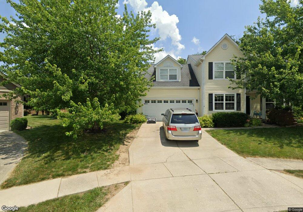
1235 Prestwick Cir Greenwood, IN 46143
Estimated Value: $365,000 - $393,244
4
Beds
3
Baths
3,256
Sq Ft
$116/Sq Ft
Est. Value
About This Home
This home is located at 1235 Prestwick Cir, Greenwood, IN 46143 and is currently estimated at $377,811, approximately $116 per square foot. 1235 Prestwick Cir is a home located in Johnson County with nearby schools including Sugar Grove Elementary School, Center Grove Middle School North, and Center Grove High School.
Ownership History
Date
Name
Owned For
Owner Type
Purchase Details
Closed on
Oct 26, 2007
Sold by
Wright Leigh Yvette
Bought by
Mueller Christopher M and Mueller Sandra J
Current Estimated Value
Home Financials for this Owner
Home Financials are based on the most recent Mortgage that was taken out on this home.
Original Mortgage
$48,725
Interest Rate
6.44%
Mortgage Type
Stand Alone Second
Create a Home Valuation Report for This Property
The Home Valuation Report is an in-depth analysis detailing your home's value as well as a comparison with similar homes in the area
Home Values in the Area
Average Home Value in this Area
Purchase History
| Date | Buyer | Sale Price | Title Company |
|---|---|---|---|
| Mueller Christopher M | -- | Chicago Title Insurance Co |
Source: Public Records
Mortgage History
| Date | Status | Borrower | Loan Amount |
|---|---|---|---|
| Closed | Mueller Christopher M | $48,725 | |
| Open | Mueller Christopher M | $146,175 |
Source: Public Records
Tax History Compared to Growth
Tax History
| Year | Tax Paid | Tax Assessment Tax Assessment Total Assessment is a certain percentage of the fair market value that is determined by local assessors to be the total taxable value of land and additions on the property. | Land | Improvement |
|---|---|---|---|---|
| 2025 | $3,252 | $405,800 | $53,500 | $352,300 |
| 2024 | $3,252 | $325,200 | $53,500 | $271,700 |
| 2023 | $3,176 | $316,900 | $53,500 | $263,400 |
| 2022 | $2,794 | $279,900 | $48,100 | $231,800 |
| 2021 | $2,521 | $252,600 | $38,200 | $214,400 |
| 2020 | $2,366 | $237,100 | $38,200 | $198,900 |
| 2019 | $2,177 | $218,200 | $34,800 | $183,400 |
| 2018 | $2,022 | $215,100 | $34,800 | $180,300 |
| 2017 | $1,887 | $188,200 | $34,800 | $153,400 |
| 2016 | $1,882 | $192,800 | $45,900 | $146,900 |
| 2014 | $1,844 | $185,800 | $45,900 | $139,900 |
| 2013 | $1,844 | $187,100 | $45,900 | $141,200 |
Source: Public Records
Map
Nearby Homes
- 771 Burr Oak Dr
- 1216 Thornmeadow Cir
- 859 Sheffield Dr
- 1179 Barrington Dr
- 1119 Lazio Ct
- 599 Yorktown Rd
- 1117 Sarah Ct
- 1127 Kay Dr
- 497 S Hendricks Dr
- 543 Schooley Dr
- 564 Parkhurst Ct
- 662 Leah Way
- 691 Hunting Creek Dr
- 1132 Veranda Ct
- 1393 Padana Dr
- Emmett Plan at Brighton Knoll - Designer Collection
- Winston Plan at Brighton Knoll - Designer Collection
- Wyatt Plan at Brighton Knoll - Designer Collection
- Charles Plan at Brighton Knoll - Designer Collection
- Blair Plan at Brighton Knoll - Designer Collection
- 1243 Prestwick Cir
- 1242 Prestwick Cir
- 870 Breaside Ln
- 884 Breaside Ln
- 856 Breaside Ln
- 898 Breaside Ln
- 1249 Prestwick Cir
- 1240 Black Oak Dr
- 847 Prestwick Way
- 842 Breaside Ln
- 759 Burr Oak Dr
- 765 Burr Oak Dr
- 751 Burr Oak Dr
- 1234 Black Oak Cir
- 1263 Prestwick Cir
- 1252 Black Oak Dr
- 1235 Black Oak Cir
- 843 Breaside Ln
- 920 Breaside Ln
- 1226 Black Oak Cir