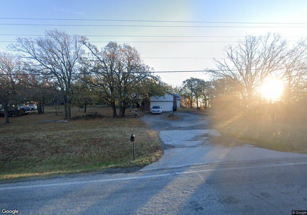
1235 S 263rd West Ave Sand Springs, OK 74063
Estimated Value: $271,000 - $305,000
3
Beds
3
Baths
1,929
Sq Ft
$153/Sq Ft
Est. Value
About This Home
This home is located at 1235 S 263rd West Ave, Sand Springs, OK 74063 and is currently estimated at $295,351, approximately $153 per square foot. 1235 S 263rd West Ave is a home located in Tulsa County with nearby schools including Keystone Elementary School.
Ownership History
Date
Name
Owned For
Owner Type
Purchase Details
Closed on
Aug 14, 2024
Sold by
Ronald L Stong L and Ronald Rhonda G
Bought by
Childs Rodger S and Childs Julie D
Current Estimated Value
Home Financials for this Owner
Home Financials are based on the most recent Mortgage that was taken out on this home.
Original Mortgage
$163,000
Outstanding Balance
$161,163
Interest Rate
6.89%
Mortgage Type
New Conventional
Estimated Equity
$134,188
Purchase Details
Closed on
May 26, 2024
Sold by
Stong Ronald L and Stong Rhonda G
Bought by
Ronald L Stong And Rhonda G Stong Revocable T and Stong
Purchase Details
Closed on
Jul 14, 2023
Sold by
Halley Michael E and Halley Mary Jane
Bought by
Stong Ronald and Stong Rhonda
Purchase Details
Closed on
Sep 1, 1989
Purchase Details
Closed on
Jan 1, 1984
Create a Home Valuation Report for This Property
The Home Valuation Report is an in-depth analysis detailing your home's value as well as a comparison with similar homes in the area
Home Values in the Area
Average Home Value in this Area
Purchase History
| Date | Buyer | Sale Price | Title Company |
|---|---|---|---|
| Childs Rodger S | $245,000 | Apex Title | |
| Ronald L Stong And Rhonda G Stong Revocable T | -- | None Listed On Document | |
| Stong Ronald | $235,000 | Firstitle & Abstract Services | |
| -- | $57,000 | -- | |
| -- | $6,500 | -- |
Source: Public Records
Mortgage History
| Date | Status | Borrower | Loan Amount |
|---|---|---|---|
| Open | Childs Rodger S | $163,000 |
Source: Public Records
Tax History Compared to Growth
Tax History
| Year | Tax Paid | Tax Assessment Tax Assessment Total Assessment is a certain percentage of the fair market value that is determined by local assessors to be the total taxable value of land and additions on the property. | Land | Improvement |
|---|---|---|---|---|
| 2024 | $1,069 | $25,850 | $2,897 | $22,953 |
| 2023 | $1,069 | $12,612 | $2,678 | $9,934 |
| 2022 | $1,057 | $11,244 | $2,388 | $8,856 |
| 2021 | $1,031 | $10,888 | $2,312 | $8,576 |
| 2020 | $896 | $10,542 | $2,239 | $8,303 |
| 2019 | $924 | $10,205 | $2,167 | $8,038 |
| 2018 | $899 | $9,879 | $2,098 | $7,781 |
| 2017 | $898 | $10,879 | $2,310 | $8,569 |
| 2016 | $901 | $10,879 | $2,310 | $8,569 |
| 2015 | $900 | $10,879 | $2,310 | $8,569 |
| 2014 | $830 | $10,879 | $2,310 | $8,569 |
Source: Public Records
Map
Nearby Homes
- 1605 S 263rd West Ave
- 1424 S 262nd West Ave
- 1474 S 271st West Ave
- 27540 W 8th St S
- 792 S 276th Ave W
- 610 N 256th West Ave
- 1 S Ave
- 1 S 265th West Ave
- 0000 S 289th West Ave
- 001 Rocky Hill Dr
- 2 Diamond Head Dr
- 42 Diamond Head Dr
- 0 W 41st St S
- 6 Eagle Ridge Rd
- 8 Eagle Ridge Rd
- 7 Eagle Ridge Rd
- 1009 S 220th Ave W
- 21902 W 13th St S
- 911 S 221st West Ave
- 4234 S 261st West Ave
- 1235 S 263rd Ave W
- 26309 W 13th St S
- 26305 W 13th St S
- 1226 S 262nd West Ave
- 1221 S 263rd West Ave
- 1220 S 262nd West Ave
- 1246 S 263rd West Ave
- 1235 S 262nd West Ave
- 1235 S 262nd West Ave
- 1310 S 262nd West Ave
- 1310 S 263rd West Ave
- 1228 S 263rd West Ave
- 1231 S 262nd West Ave
- 26228 W 13th St S
- 1317 S 263rd West Ave
- 1316 S 262nd West Ave
- 1316 S 263rd West Ave
- 1311 S 262nd Ave W
- 1311 S 262nd West Ave