Estimated Value: $2,189,000 - $4,514,034
Studio
--
Bath
40,320
Sq Ft
$83/Sq Ft
Est. Value
About This Home
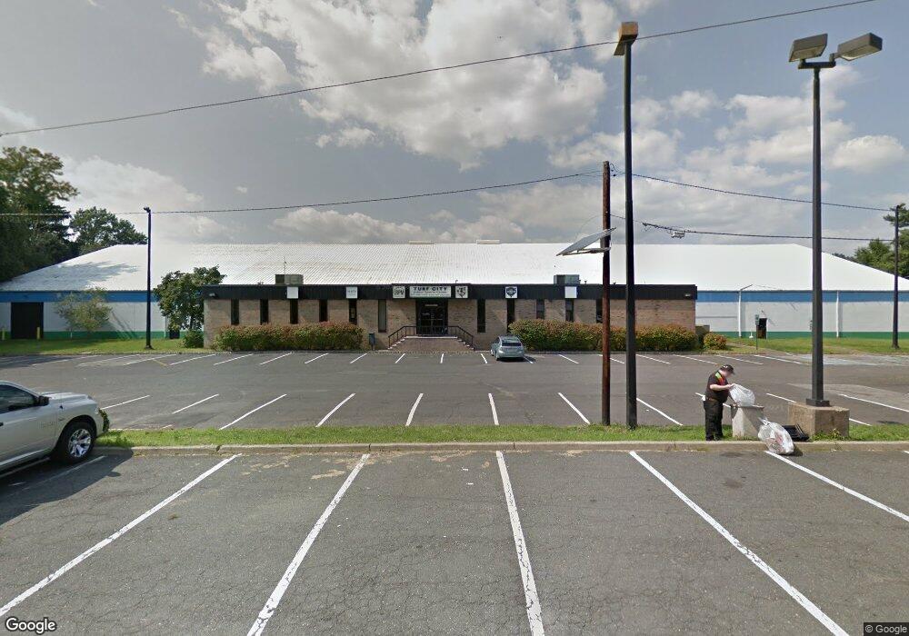
This home is located at 1235 State Route 23, Wayne, NJ 07470 and is currently estimated at $3,351,517, approximately $83 per square foot. 1235 State Route 23 is a home located in Passaic County with nearby schools including Ryerson Elementary School, George Washington Middle School, and Wayne Valley High School.
Ownership History
Date
Name
Owned For
Owner Type
Purchase Details
Closed on
Apr 3, 2002
Sold by
Seaton Assoc
Bought by
Indoor Sprots Center
Current Estimated Value
Home Financials for this Owner
Home Financials are based on the most recent Mortgage that was taken out on this home.
Original Mortgage
$1,800,000
Outstanding Balance
$728,376
Interest Rate
7.05%
Estimated Equity
$2,623,141
Create a Home Valuation Report for This Property
The Home Valuation Report is an in-depth analysis detailing your home's value as well as a comparison with similar homes in the area
Home Values in the Area
Average Home Value in this Area
Purchase History
| Date | Buyer | Sale Price | Title Company |
|---|---|---|---|
| Indoor Sprots Center | $1,800,000 | -- |
Source: Public Records
Mortgage History
| Date | Status | Borrower | Loan Amount |
|---|---|---|---|
| Open | Indoor Sprots Center | $1,800,000 |
Source: Public Records
Tax History
| Year | Tax Paid | Tax Assessment Tax Assessment Total Assessment is a certain percentage of the fair market value that is determined by local assessors to be the total taxable value of land and additions on the property. | Land | Improvement |
|---|---|---|---|---|
| 2025 | $106,338 | $1,788,400 | $530,000 | $1,258,400 |
| 2024 | $102,261 | $1,788,400 | $530,000 | $1,258,400 |
| 2022 | $101,116 | $1,788,400 | $530,000 | $1,258,400 |
| 2021 | $101,009 | $1,788,400 | $530,000 | $1,258,400 |
| 2020 | $100,562 | $1,788,400 | $530,000 | $1,258,400 |
| 2019 | $98,612 | $1,788,400 | $530,000 | $1,258,400 |
| 2018 | $97,736 | $1,788,400 | $530,000 | $1,258,400 |
| 2017 | $96,842 | $1,788,400 | $530,000 | $1,258,400 |
| 2016 | $95,483 | $1,788,400 | $530,000 | $1,258,400 |
| 2015 | $94,338 | $1,788,400 | $530,000 | $1,258,400 |
| 2014 | $91,673 | $1,788,400 | $530,000 | $1,258,400 |
Source: Public Records
Map
Nearby Homes
- 25-27 Newark Pompton Turnpike
- 193 Newark Pompton Turnpike
- 201 Newark Pompton Turnpike
- 108 Packanack Lake Rd
- 109 Monmouth Ave
- 27 Archung Rd
- 10 Winonah Ave
- 16 Gressinger Rd
- 31 Brookside Rd
- 2 Brookside Rd
- 310 Boulevard Dr
- 450 Boonton Turnpike
- 53 Laurel Dr
- 208 Fayette Ave
- 35 Beechwood Dr
- 221 Boulevard Dr
- 63 Chestnut Dr
- 62 Pine Brook Rd
- 9 Scalza Ln
- 30 S Valley Rd
- 1235 State Route 23
- 1235 State Route 23 Unit 1235
- 1235 New Jersey 23 Unit 1235
- 1241 State Route 23
- 1267 State Route 23
- 1275 New Jersey 23
- 1275 New Jersey 23 Unit 1
- 1275 New Jersey 23 Unit 2
- 20 Old Newark Pompton Turnpike
- 44 Newark Pompton Turnpike
- 44 Newark Pompton Turnpike
- 14 Old Newark Pompton Turnpike Unit 2
- 14 Old Newark Pompton Turnpike
- 1217 State Route 23
- 1293 New Jersey 23
- 10 Old Newark Pompton Turnpike
- 10 Newark Pompton Turnpike
- 6 Newark Pompton Turnpike
- 6 Old Newark Pompton Turnpike
- 25 Old Newark Pompton Turnpike Unit 27
Your Personal Tour Guide
Ask me questions while you tour the home.