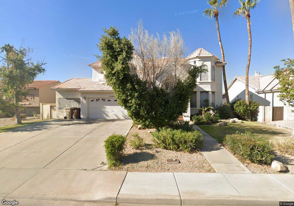
12350 N 72nd Dr Peoria, AZ 85381
Estimated Value: $578,026 - $691,000
--
Bed
5
Baths
2,353
Sq Ft
$273/Sq Ft
Est. Value
About This Home
This home is located at 12350 N 72nd Dr, Peoria, AZ 85381 and is currently estimated at $642,507, approximately $273 per square foot. 12350 N 72nd Dr is a home located in Maricopa County with nearby schools including Oakwood Elementary School, Cactus High School, and Legacy Traditional School - Glendale.
Ownership History
Date
Name
Owned For
Owner Type
Purchase Details
Closed on
Mar 4, 1996
Sold by
Smith Michael A and Smith Michael Allan
Bought by
Pokuta Bruce J and Pokuta Merrie M
Current Estimated Value
Home Financials for this Owner
Home Financials are based on the most recent Mortgage that was taken out on this home.
Original Mortgage
$138,000
Interest Rate
7.82%
Mortgage Type
New Conventional
Purchase Details
Closed on
Feb 9, 1996
Sold by
Smith Karen Sue and Smith Michael Allan
Bought by
Smith Karen Sue and Smith Michael Allan
Home Financials for this Owner
Home Financials are based on the most recent Mortgage that was taken out on this home.
Original Mortgage
$138,000
Interest Rate
7.82%
Mortgage Type
New Conventional
Create a Home Valuation Report for This Property
The Home Valuation Report is an in-depth analysis detailing your home's value as well as a comparison with similar homes in the area
Home Values in the Area
Average Home Value in this Area
Purchase History
| Date | Buyer | Sale Price | Title Company |
|---|---|---|---|
| Pokuta Bruce J | $183,000 | First American Title | |
| Smith Karen Sue | -- | -- |
Source: Public Records
Mortgage History
| Date | Status | Borrower | Loan Amount |
|---|---|---|---|
| Previous Owner | Pokuta Bruce J | $138,000 |
Source: Public Records
Tax History Compared to Growth
Tax History
| Year | Tax Paid | Tax Assessment Tax Assessment Total Assessment is a certain percentage of the fair market value that is determined by local assessors to be the total taxable value of land and additions on the property. | Land | Improvement |
|---|---|---|---|---|
| 2025 | $2,401 | $31,720 | -- | -- |
| 2024 | $2,432 | $30,210 | -- | -- |
| 2023 | $2,432 | $45,080 | $9,010 | $36,070 |
| 2022 | $2,381 | $34,420 | $6,880 | $27,540 |
| 2021 | $2,549 | $30,760 | $6,150 | $24,610 |
| 2020 | $2,574 | $32,070 | $6,410 | $25,660 |
| 2019 | $2,490 | $30,080 | $6,010 | $24,070 |
| 2018 | $2,408 | $29,480 | $5,890 | $23,590 |
| 2017 | $2,409 | $26,680 | $5,330 | $21,350 |
| 2016 | $2,385 | $26,530 | $5,300 | $21,230 |
| 2015 | $2,225 | $24,550 | $4,910 | $19,640 |
Source: Public Records
Map
Nearby Homes
- 7214 W Columbine Dr
- 7220 W Larkspur Dr
- 7233 W Corrine Dr
- 7126 W Columbine Dr
- 7418 W Corrine Dr
- 12709 N 72nd Ave
- 7266 W Cherry Hills Dr
- 7157 W Cherry Hills Dr
- 7301 W Sweetwater Ave
- 7113 W Sunnyside Dr
- 7126 W Jenan Dr
- 7225 W Canterbury Dr
- 7191 W Surrey Ave
- 7638 W Shaw Butte Dr
- 7243 W Sierra St
- 11640 N 74th Dr
- 6938 W Jenan Dr
- 6914 W Sunnyside Dr Unit 3
- 13051 N 75th Dr
- 7326 W Pershing Ave
- 12360 N 72nd Dr
- 7262 W Charter Oak Rd
- 7261 W Bloomfield Rd
- 12330 N 72nd Dr
- 12349 N 72nd Dr
- 12359 N 72nd Dr
- 12339 N 72nd Dr
- 7268 W Charter Oak Rd
- 7267 W Bloomfield Rd
- 7261 W Charter Oak Rd
- 12450 N 72nd Dr
- 12329 N 72nd Dr
- 12320 N 72nd Dr
- 7262 W Bloomfield Rd
- 7221 W Bloomfield Rd
- 7274 W Charter Oak Rd
- 7273 W Bloomfield Rd
- 7226 W Bloomfield Rd
- 7267 W Charter Oak Rd
- 7268 W Bloomfield Rd