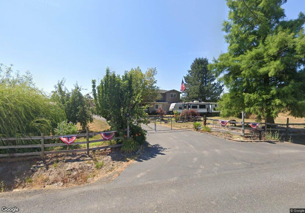
12350 S Barnards Rd Molalla, OR 97038
Estimated Value: $769,000 - $937,918
4
Beds
2
Baths
2,056
Sq Ft
$408/Sq Ft
Est. Value
About This Home
This home is located at 12350 S Barnards Rd, Molalla, OR 97038 and is currently estimated at $838,480, approximately $407 per square foot. 12350 S Barnards Rd is a home located in Clackamas County with nearby schools including Oregon Outreach - Molalla Pride.
Ownership History
Date
Name
Owned For
Owner Type
Purchase Details
Closed on
Mar 15, 2013
Sold by
Koberstein Tracy T and Koberstein Michelle M
Bought by
Duval Alan M and Duval Sara A
Current Estimated Value
Home Financials for this Owner
Home Financials are based on the most recent Mortgage that was taken out on this home.
Original Mortgage
$244,347
Interest Rate
3.5%
Mortgage Type
FHA
Purchase Details
Closed on
Aug 1, 2001
Sold by
Lilly Lauren C and Lilly Linda L
Bought by
Koberstein Tracy T and Koberstein Michelle M
Home Financials for this Owner
Home Financials are based on the most recent Mortgage that was taken out on this home.
Original Mortgage
$210,000
Interest Rate
7.09%
Create a Home Valuation Report for This Property
The Home Valuation Report is an in-depth analysis detailing your home's value as well as a comparison with similar homes in the area
Home Values in the Area
Average Home Value in this Area
Purchase History
| Date | Buyer | Sale Price | Title Company |
|---|---|---|---|
| Duval Alan M | $215,000 | First American | |
| Koberstein Tracy T | $330,000 | Chicago Title Insurance Co |
Source: Public Records
Mortgage History
| Date | Status | Borrower | Loan Amount |
|---|---|---|---|
| Previous Owner | Duval Alan M | $244,347 | |
| Previous Owner | Koberstein Tracy T | $210,000 |
Source: Public Records
Tax History Compared to Growth
Tax History
| Year | Tax Paid | Tax Assessment Tax Assessment Total Assessment is a certain percentage of the fair market value that is determined by local assessors to be the total taxable value of land and additions on the property. | Land | Improvement |
|---|---|---|---|---|
| 2025 | $3,478 | $257,064 | -- | -- |
| 2024 | $3,368 | $249,703 | -- | -- |
| 2023 | $3,368 | $242,558 | $0 | $0 |
| 2022 | $2,816 | $235,622 | $0 | $0 |
| 2021 | $2,689 | $228,891 | $0 | $0 |
| 2020 | $2,616 | $222,344 | $0 | $0 |
| 2019 | $2,237 | $190,081 | $0 | $0 |
| 2018 | $2,177 | $184,669 | $0 | $0 |
| 2017 | $2,056 | $179,402 | $0 | $0 |
| 2016 | $1,703 | $153,750 | $0 | $0 |
| 2015 | $1,656 | $149,392 | $0 | $0 |
| 2014 | $1,603 | $145,167 | $0 | $0 |
Source: Public Records
Map
Nearby Homes
- 30683 S Highway 213
- 29891 S Highway 213
- 12403 S Eby Rd
- 701 Oriental Ct
- 714 Saint James Place
- 33953 Oregon 213
- 947 Meadowlark Place
- 863 June Dr
- 31430 Oregon 213
- 31514 S Bear Meadow Ct
- 30593 S Elisha Rd
- 1522 W Main St
- 843 Julie Ln
- 1406 W Main St
- 340 Doug Fir Ln
- 1014 S View Dr
- 569 June Dr
- 900 Bear Creek Dr
- 902 S View Dr
- 850 N Valley Dr
- 12434 S Barnards Rd
- 12340 S Barnards Rd
- 12204 S Barnards Rd
- 12235 S Barnards Rd
- 12578 S Barnards Rd
- 12119 S Barnards Rd
- 30090 S Cramer Rd
- 12662 S Barnards Rd
- 30000 S Cramer Rd
- 12003 S Barnards Rd
- 12738 S Barnards Rd
- 12775 S Barnards Rd
- 30077 S Cramer Rd
- 30277 S Cramer Rd
- 30102 S Shandell Rd
- 30102 S Shandell Rd
- 29801 S Cramer Rd
- 12838 S Barnards Rd
- 11912 S Barnards Rd
- 29786 S Cramer Rd