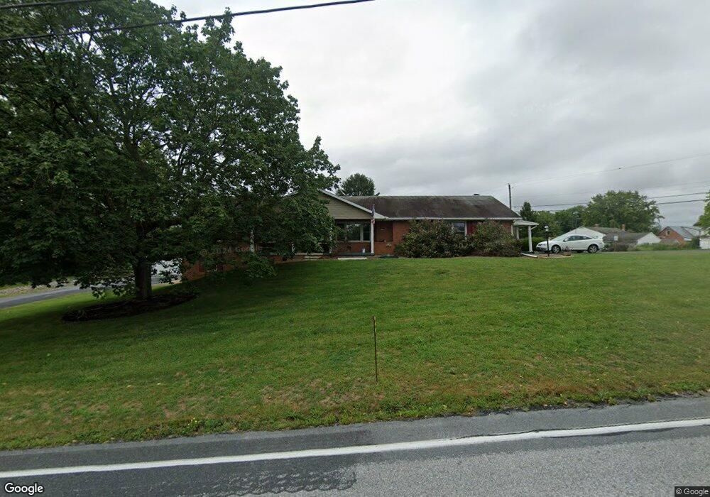
12351 Williamsport Pike Greencastle, PA 17225
Estimated Value: $415,000 - $462,501
4
Beds
3
Baths
3,065
Sq Ft
$141/Sq Ft
Est. Value
About This Home
This home is located at 12351 Williamsport Pike, Greencastle, PA 17225 and is currently estimated at $431,375, approximately $140 per square foot. 12351 Williamsport Pike is a home located in Franklin County with nearby schools including Greencastle-Antrim Primary School, Greencastle-Antrim Elementary School, and Greencastle-Antrim Middle School.
Ownership History
Date
Name
Owned For
Owner Type
Purchase Details
Closed on
Jan 27, 2025
Sold by
Johnson Carrie L and Tressler Dwayne I
Bought by
Tressler Dwayne I
Current Estimated Value
Home Financials for this Owner
Home Financials are based on the most recent Mortgage that was taken out on this home.
Original Mortgage
$165,000
Outstanding Balance
$164,020
Interest Rate
6.91%
Mortgage Type
New Conventional
Estimated Equity
$267,355
Purchase Details
Closed on
Sep 1, 2010
Sold by
Mauk Arthur P and Mauk Nancy L
Bought by
Tressler Dwayne I and Tressler Carrie L
Home Financials for this Owner
Home Financials are based on the most recent Mortgage that was taken out on this home.
Original Mortgage
$227,000
Interest Rate
4.37%
Mortgage Type
New Conventional
Create a Home Valuation Report for This Property
The Home Valuation Report is an in-depth analysis detailing your home's value as well as a comparison with similar homes in the area
Home Values in the Area
Average Home Value in this Area
Purchase History
| Date | Buyer | Sale Price | Title Company |
|---|---|---|---|
| Tressler Dwayne I | -- | None Listed On Document | |
| Tressler Dwayne I | $239,000 | None Available |
Source: Public Records
Mortgage History
| Date | Status | Borrower | Loan Amount |
|---|---|---|---|
| Open | Tressler Dwayne I | $165,000 | |
| Previous Owner | Tressler Dwayne I | $227,000 |
Source: Public Records
Tax History Compared to Growth
Tax History
| Year | Tax Paid | Tax Assessment Tax Assessment Total Assessment is a certain percentage of the fair market value that is determined by local assessors to be the total taxable value of land and additions on the property. | Land | Improvement |
|---|---|---|---|---|
| 2025 | $5,168 | $30,890 | $2,700 | $28,190 |
| 2024 | $4,688 | $30,890 | $2,700 | $28,190 |
| 2023 | $4,633 | $30,890 | $2,700 | $28,190 |
| 2022 | $4,633 | $30,890 | $2,700 | $28,190 |
| 2021 | $4,543 | $30,890 | $2,700 | $28,190 |
| 2020 | $4,208 | $29,380 | $2,700 | $26,680 |
| 2019 | $4,113 | $29,380 | $2,700 | $26,680 |
| 2018 | $4,069 | $29,380 | $2,700 | $26,680 |
| 2017 | $3,966 | $29,380 | $2,700 | $26,680 |
| 2016 | $842 | $29,380 | $2,700 | $26,680 |
| 2015 | $784 | $29,380 | $2,700 | $26,680 |
| 2014 | $784 | $29,380 | $2,700 | $26,680 |
Source: Public Records
Map
Nearby Homes
- 12689 Williamsport Pike
- 10135 Jasper Dr
- 12976 Daybreak Ln
- 11765 Melrose Ave
- 20 Helens Dr
- 763 Joy Dr
- 707 Shook Ct W
- 10937 Grant Shook Rd
- 10925 Grant Shook Rd
- 281 Toms Ln
- 1223 E Pebblebrook Dr
- 11498 Nicole Dr
- 642 Milnor Rd
- 2428 Pikeside Dr
- 0 Molly Pitcher Hwy Unit PAFL178468
- 0 Molly Pitcher Hwy Unit PAFL2030380
- 270 Paradise View Dr
- 480 S Carlisle St
- 375 Carolle St
- 460 Paradise View Dr
- 1510 Farm Ln
- 12385 Williamsport Pike
- 12290 Malissa Dr
- 12303 Williamsport Pike
- 1524 Farm Ln
- 12270 Malissa Dr
- 12334 Williamsport Pike
- 12281 Williamsport Pike
- 12331 Malissa Dr
- 1548 Farm Ln
- 12299 Malissa Dr
- 12264 Malissa Dr
- 12356 Williamsport Pike
- 12263 Williamsport Pike
- 12392 Williamsport Pike
- 12267 Malissa Dr
- 1632 Farm Ln
- 12250 Malissa Dr
- 12251 Malissa Dr
- 1674 Farm Ln