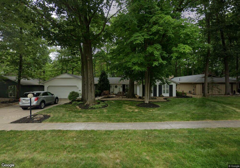
12355 The Bluff Strongsville, OH 44136
Estimated Value: $386,000 - $430,000
4
Beds
3
Baths
2,316
Sq Ft
$176/Sq Ft
Est. Value
About This Home
This home is located at 12355 The Bluff, Strongsville, OH 44136 and is currently estimated at $408,362, approximately $176 per square foot. 12355 The Bluff is a home located in Cuyahoga County with nearby schools including Strongsville High School, Sts Joseph & John Interparochial School, and Royal Redeemer Lutheran School.
Ownership History
Date
Name
Owned For
Owner Type
Purchase Details
Closed on
Jan 24, 2023
Sold by
Urbancic Cyril and Urbancic Joanne C
Bought by
Cyril Urnabcic Jr And Joanne C Urbancic Joint
Current Estimated Value
Purchase Details
Closed on
Oct 8, 1980
Sold by
Urbancic Cyril and Urbancic Joanne D
Bought by
Urbancic Cyril
Purchase Details
Closed on
Jan 1, 1975
Bought by
Urbancic Cyril and Urbancic Joanne D
Create a Home Valuation Report for This Property
The Home Valuation Report is an in-depth analysis detailing your home's value as well as a comparison with similar homes in the area
Home Values in the Area
Average Home Value in this Area
Purchase History
| Date | Buyer | Sale Price | Title Company |
|---|---|---|---|
| Cyril Urnabcic Jr And Joanne C Urbancic Joint | -- | -- | |
| Urbancic Cyril | -- | -- | |
| Urbancic Cyril | -- | -- |
Source: Public Records
Tax History Compared to Growth
Tax History
| Year | Tax Paid | Tax Assessment Tax Assessment Total Assessment is a certain percentage of the fair market value that is determined by local assessors to be the total taxable value of land and additions on the property. | Land | Improvement |
|---|---|---|---|---|
| 2024 | $4,638 | $108,570 | $22,505 | $86,065 |
| 2023 | $4,802 | $85,860 | $23,170 | $62,690 |
| 2022 | $4,793 | $85,860 | $23,170 | $62,690 |
| 2021 | $4,755 | $85,860 | $23,170 | $62,690 |
| 2020 | $4,297 | $70,390 | $19,010 | $51,380 |
| 2019 | $4,171 | $201,100 | $54,300 | $146,800 |
| 2018 | $3,803 | $70,390 | $19,010 | $51,380 |
| 2017 | $3,891 | $67,410 | $15,820 | $51,590 |
| 2016 | $3,860 | $67,410 | $15,820 | $51,590 |
| 2015 | $3,784 | $67,410 | $15,820 | $51,590 |
| 2014 | $3,784 | $65,460 | $15,370 | $50,090 |
Source: Public Records
Map
Nearby Homes
- 12101 The Bluffs
- 17809 Cliffside Dr Unit 4926
- 11650 River Moss Rd
- 18248 Meadow Ln
- 18336 Falling Water Rd
- 17281 Akita Ct Unit 4506
- 17289 Akita Ct Unit 4508
- 13513 Suncrest Ct
- 16519 Albion Rd
- 11499 Pearl Rd Unit A106
- 11479 Pearl Rd Unit A101
- 10369 Council Bluff
- 10471 Royal Oak Dr Unit 38-A
- 11432 Pearl Rd
- 10560 Stapleton Dr
- 15485 Albion Rd
- 9945 Twelve Oaks Cir
- 19240 Briarwood Ln
- 13099 Olympus Way
- 13066 Olympus Way
- 12395 The Bluff
- 12315 The Bluff
- 12315 The Bluffs
- 12265 The Bluff
- 12437 The Bluff
- 12243 Bluffside Place Unit 4709
- 12243 Bluffside Place
- 12203 Bluffside Place
- 12380 The Bluff
- 12336 The Bluff
- 12418 The Bluff
- 12221 The Bluff
- 12477 The Bluff
- 12454 The Bluff
- 12477 The Bluffs
- 12306 The Bluff
- 12201 Bluffside Place
- 12264 The Bluff
- 12492 The Bluff
- 12519 The Bluff