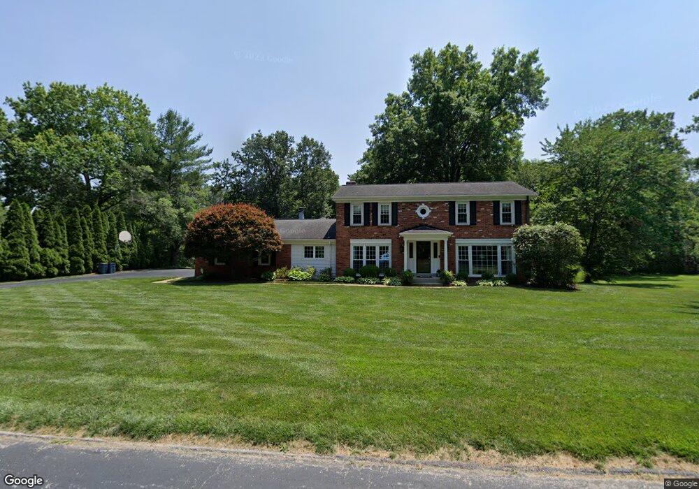
12358 Coppersmith Ct Saint Louis, MO 63131
Estimated Value: $794,707 - $1,027,000
4
Beds
3
Baths
3,147
Sq Ft
$299/Sq Ft
Est. Value
About This Home
This home is located at 12358 Coppersmith Ct, Saint Louis, MO 63131 and is currently estimated at $939,427, approximately $298 per square foot. 12358 Coppersmith Ct is a home located in St. Louis County with nearby schools including Mason Ridge Elementary School, Parkway West Middle School, and Parkway West High School.
Ownership History
Date
Name
Owned For
Owner Type
Purchase Details
Closed on
Apr 21, 2008
Sold by
Sullivan A Michael and Sullivan Joanne C
Bought by
Sullivan A Michael and Sullivan Rosemary B
Current Estimated Value
Purchase Details
Closed on
Sep 3, 2003
Sold by
Burns Edward and Burns Patricia
Bought by
Sullivan A Michael and Sullivan Joanne C
Create a Home Valuation Report for This Property
The Home Valuation Report is an in-depth analysis detailing your home's value as well as a comparison with similar homes in the area
Home Values in the Area
Average Home Value in this Area
Purchase History
| Date | Buyer | Sale Price | Title Company |
|---|---|---|---|
| Sullivan A Michael | $450,000 | None Available | |
| Sullivan A Michael | $435,000 | -- |
Source: Public Records
Tax History Compared to Growth
Tax History
| Year | Tax Paid | Tax Assessment Tax Assessment Total Assessment is a certain percentage of the fair market value that is determined by local assessors to be the total taxable value of land and additions on the property. | Land | Improvement |
|---|---|---|---|---|
| 2025 | $7,046 | $154,620 | $94,920 | $59,700 |
| 2024 | $7,046 | $119,820 | $75,910 | $43,910 |
| 2023 | $6,671 | $119,820 | $75,910 | $43,910 |
| 2022 | $6,850 | $111,840 | $66,390 | $45,450 |
| 2021 | $6,793 | $111,840 | $66,390 | $45,450 |
| 2020 | $6,849 | $107,810 | $66,390 | $41,420 |
| 2019 | $6,679 | $107,810 | $66,390 | $41,420 |
| 2018 | $7,444 | $111,080 | $66,390 | $44,690 |
| 2017 | $7,343 | $111,080 | $66,390 | $44,690 |
| 2016 | $6,402 | $92,070 | $56,960 | $35,110 |
| 2015 | $6,888 | $92,070 | $56,960 | $35,110 |
| 2014 | $6,449 | $93,440 | $53,200 | $40,240 |
Source: Public Records
Map
Nearby Homes
- 0 Unknown Unit 22071090
- 2056 N Ballas Rd
- 2062 N Ballas Rd
- TBB
- TBB Ballas Ridge Westchester IV
- TBB Ballas Ridge Hawthorne II
- TBB Ballas Ridge Roclare II
- TBB
- The Hawthorne Plan at Ballas Ridge
- The Roclare II Plan at Ballas Ridge
- The Westchester IV Plan at Ballas Ridge
- The Nottingham II Plan at Ballas Ridge
- The Hawthorne II Plan at Ballas Ridge
- 2409 N Ballas Rd
- 5 W Point Ln
- 152 Frontenac Forest
- 12439 Springdale Ln Unit TBB
- 9 Kirken Knoll Dr
- 11758 Westham Dr
- 11712 Westham Dr
- 12346 Coppersmith Ct
- 12370 Coppersmith Ct
- 2230 N Ballas Rd
- 12343 Ballas Woods Ct
- 2228 N Ballas Rd
- 12334 Coppersmith Ct
- 12386 Coppersmith Ct
- 12212 Wheatleigh Rd
- 12331 Ballas Woods Ct
- 2140 N Ballas Rd
- 12200 Wheatleigh Grove Rd
- 12355 Ballas Woods Ct
- 12074 Carberry Place
- 12322 Coppersmith Ct
- 12373 Ballas Woods Ct
- 12319 Ballas Woods Ct
- 2225 Clifton Forge Dr
- 12066 Carberry Place
- 12100 Carberry Place
- 12211 Wheatleigh Rd