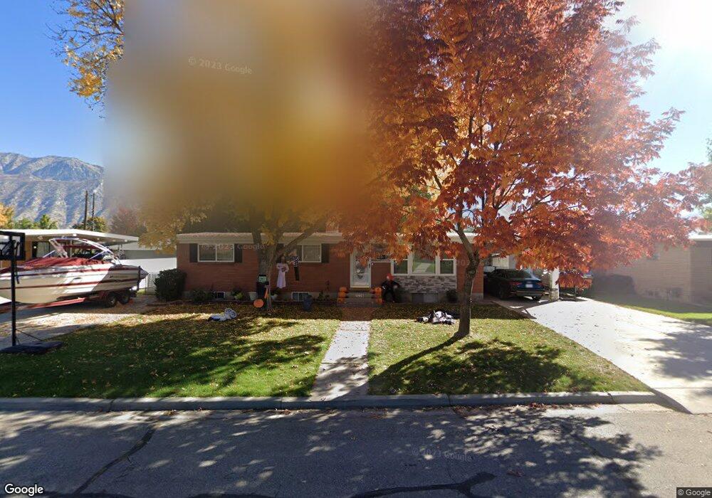
1236 N 1160 W Provo, UT 84604
Grandview South NeighborhoodEstimated Value: $486,298 - $538,000
6
Beds
3
Baths
1,200
Sq Ft
$425/Sq Ft
Est. Value
About This Home
This home is located at 1236 N 1160 W, Provo, UT 84604 and is currently estimated at $509,575, approximately $424 per square foot. 1236 N 1160 W is a home located in Utah County with nearby schools including Westridge Elementary School, Dixon Middle School, and Provo High School.
Ownership History
Date
Name
Owned For
Owner Type
Purchase Details
Closed on
Feb 15, 2008
Sold by
Walrath Joanne and Cheney Keri S
Bought by
Cheney William and Cheney Keri S
Current Estimated Value
Home Financials for this Owner
Home Financials are based on the most recent Mortgage that was taken out on this home.
Original Mortgage
$156,000
Interest Rate
5.85%
Mortgage Type
New Conventional
Purchase Details
Closed on
Jun 21, 2004
Sold by
Walrath Joanne
Bought by
Walrath Joanne and Cheney Keri S
Purchase Details
Closed on
Nov 13, 2001
Sold by
Walrath Joanne and Walrath Charles P
Bought by
Walrath Joanne
Home Financials for this Owner
Home Financials are based on the most recent Mortgage that was taken out on this home.
Original Mortgage
$69,000
Interest Rate
6.62%
Create a Home Valuation Report for This Property
The Home Valuation Report is an in-depth analysis detailing your home's value as well as a comparison with similar homes in the area
Home Values in the Area
Average Home Value in this Area
Purchase History
| Date | Buyer | Sale Price | Title Company |
|---|---|---|---|
| Cheney William | -- | Atlas Title Salt Lake | |
| Walrath Joanne | -- | -- | |
| Walrath Joanne | -- | Backman Stewart Title Servic | |
| Walrath Charles P | -- | Backman Stewart Title Servic |
Source: Public Records
Mortgage History
| Date | Status | Borrower | Loan Amount |
|---|---|---|---|
| Closed | Cheney William | $156,000 | |
| Closed | Walrath Charles P | $69,000 |
Source: Public Records
Tax History Compared to Growth
Tax History
| Year | Tax Paid | Tax Assessment Tax Assessment Total Assessment is a certain percentage of the fair market value that is determined by local assessors to be the total taxable value of land and additions on the property. | Land | Improvement |
|---|---|---|---|---|
| 2025 | $2,385 | $253,495 | $168,400 | $292,500 |
| 2024 | $2,385 | $234,795 | $0 | $0 |
| 2023 | $2,430 | $235,840 | $0 | $0 |
| 2022 | $2,324 | $227,425 | $0 | $0 |
| 2021 | $1,773 | $302,500 | $106,900 | $195,600 |
| 2020 | $1,709 | $273,400 | $97,200 | $176,200 |
| 2019 | $1,599 | $266,100 | $97,200 | $168,900 |
| 2018 | $1,405 | $237,100 | $90,200 | $146,900 |
| 2017 | $1,267 | $117,480 | $0 | $0 |
| 2016 | $1,266 | $109,450 | $0 | $0 |
| 2015 | $1,253 | $109,450 | $0 | $0 |
| 2014 | $1,113 | $101,310 | $0 | $0 |
Source: Public Records
Map
Nearby Homes
- 1250 Jordan Ave
- 1188 W 1380 N
- 1525 N 1250 W
- 1375 W 1460 N
- 1471 W 1460 N
- 1149 N 850 W
- 1254 N 800 W
- 920 W Columbia Ln
- 1633 Woodland Dr
- 1620 W 1000 N
- 1685 Hickory Ln
- 1763 Willowbrook Dr Unit 4D1
- 1661 Willowbrook Dr
- 1451 Arthur Dr
- 1533 N Riverside Ave Unit 27
- 630 N 1100 W
- 1454 Lancelot Dr Unit 6F
- 932 N 1760 W
- 1559 N Riverside Ave Unit 4
- 1009 W 2000 N