--
Bed
--
Bath
13,275
Sq Ft
0.77
Acres
About This Home
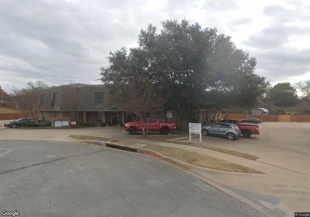
This home is located at 1236 Southridge Ct Unit 105, Hurst, TX 76053. 1236 Southridge Ct Unit 105 is a home located in Tarrant County with nearby schools including Donna Park Elementary, Bedford Junior High School, and L.D. Bell High School.
Ownership History
Date
Name
Owned For
Owner Type
Purchase Details
Closed on
Jun 29, 2022
Sold by
Lee John C
Bought by
Jchl Llc
Purchase Details
Closed on
Oct 28, 2021
Sold by
South Ridge 1236 Investments Llc
Bought by
Lee John C
Home Financials for this Owner
Home Financials are based on the most recent Mortgage that was taken out on this home.
Original Mortgage
$677,000
Interest Rate
2.8%
Mortgage Type
Purchase Money Mortgage
Purchase Details
Closed on
Jan 22, 2019
Sold by
Bluffview Ridgewood Ltd
Bought by
Southridge 1236 Investments Llc
Home Financials for this Owner
Home Financials are based on the most recent Mortgage that was taken out on this home.
Original Mortgage
$450,000
Interest Rate
4.6%
Mortgage Type
Purchase Money Mortgage
Purchase Details
Closed on
May 1, 1997
Sold by
Childs Pamela Suzanne and Childs Karleen Ervin
Bought by
Foster Debra Kay and Phillips Melinda Ann
Purchase Details
Closed on
Jun 8, 1994
Sold by
Hutchinson Irene Janet
Bought by
Leach Terry R and Ames James R
Create a Home Valuation Report for This Property
The Home Valuation Report is an in-depth analysis detailing your home's value as well as a comparison with similar homes in the area
Home Values in the Area
Average Home Value in this Area
Purchase History
| Date | Buyer | Sale Price | Title Company |
|---|---|---|---|
| Jchl Llc | -- | None Listed On Document | |
| Lee John C | -- | First American Title Ins Co | |
| Southridge 1236 Investments Llc | -- | None Available | |
| Foster Debra Kay | -- | -- | |
| Leach Terry R | -- | -- |
Source: Public Records
Mortgage History
| Date | Status | Borrower | Loan Amount |
|---|---|---|---|
| Previous Owner | Lee John C | $677,000 | |
| Previous Owner | Southridge 1236 Investments Llc | $450,000 |
Source: Public Records
Tax History Compared to Growth
Tax History
| Year | Tax Paid | Tax Assessment Tax Assessment Total Assessment is a certain percentage of the fair market value that is determined by local assessors to be the total taxable value of land and additions on the property. | Land | Improvement |
|---|---|---|---|---|
| 2025 | $17,141 | $807,202 | $176,978 | $630,224 |
| 2024 | $17,141 | $839,229 | $176,978 | $662,251 |
| 2023 | $15,651 | $781,234 | $176,978 | $604,256 |
| 2022 | $13,667 | $593,601 | $176,978 | $416,623 |
| 2021 | $11,383 | $472,000 | $176,978 | $295,022 |
| 2020 | $10,827 | $450,000 | $176,978 | $273,022 |
| 2019 | $11,014 | $450,000 | $176,978 | $273,022 |
| 2018 | $9,653 | $394,422 | $176,978 | $217,444 |
| 2017 | $13,655 | $539,600 | $176,978 | $362,622 |
| 2014 | $10,730 | $409,175 | $171,921 | $237,254 |
Source: Public Records
Map
Nearby Homes
- 1208 Birch St
- 1228 Brookside Dr
- 1212 Brookside Dr
- 1208 Karla Dr
- 1137 Karla Dr
- 632 Forest Ln
- 400 Joanna Dr
- 809 Wheelwood Dr
- 820 Bedford Ct W
- 1228 Valentine St
- 1204 Princess Ln
- 853 Royal Terrace
- 833 W Cheryl Ave
- 521 Brookview Dr
- 604 Brookview Dr
- 829 Joanna Dr
- 636 W Cedar St
- 1221 Simpson Dr
- 1337 Harrison Ln
- 1129 Irwin Dr
- 1236 Southridge Ct
- 1236 Southridge Ct Unit 101
- 1236 Southridge Ct Unit 200
- 1216 Birch St
- 1212 Birch St
- 1220 Birch St
- 1229 Brookside Dr
- 1221 Terrace Trail
- 1233 Brookside Dr
- 1237 Brookside Dr
- 1241 Brookside Dr
- 1225 Brookside Dr
- 1217 Terrace Trail
- 1209 Birch St
- 1221 Brookside Dr
- 1208 Terrace Trail
- 1204 Birch St
- 1213 Terrace Trail
- 1205 Birch St
- 1236 Brookside Dr
