Estimated Value: $171,000 - $224,000
3
Beds
2
Baths
1,196
Sq Ft
$164/Sq Ft
Est. Value
About This Home
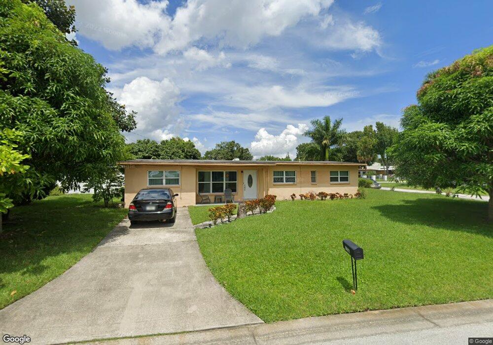
This home is located at 1236 Thor Ave, Cocoa, FL 32922 and is currently estimated at $196,092, approximately $163 per square foot. 1236 Thor Ave is a home located in Brevard County with nearby schools including Endeavour Elementary Magnet, Ronald McNair Magnet Middle School, and Rockledge Senior High School.
Ownership History
Date
Name
Owned For
Owner Type
Purchase Details
Closed on
Aug 7, 2018
Sold by
Wright Ernel Winston and Wright Julie Ann Mc Cormack
Bought by
Wright Ernel Winston
Current Estimated Value
Purchase Details
Closed on
Mar 17, 2014
Sold by
Wright Percival
Bought by
Wright Ernel Winston and Mccormack Wright Julie Ann
Purchase Details
Closed on
Jan 6, 2011
Sold by
Mathis Leshawn and Mathis Marilyn
Bought by
Wright Percival
Purchase Details
Closed on
Jan 27, 2010
Sold by
Simpkins Priscilla M
Bought by
Mathis Leshawn and Mathis Marilyn
Create a Home Valuation Report for This Property
The Home Valuation Report is an in-depth analysis detailing your home's value as well as a comparison with similar homes in the area
Home Values in the Area
Average Home Value in this Area
Purchase History
| Date | Buyer | Sale Price | Title Company |
|---|---|---|---|
| Wright Ernel Winston | -- | None Available | |
| Wright Ernel Winston | -- | None Available | |
| Wright Percival | $17,500 | Countywide Title & Escrow Co | |
| Mathis Leshawn | -- | Countywide Title & Escrow Co | |
| Mathis Leshawn | -- | Attorney |
Source: Public Records
Tax History
| Year | Tax Paid | Tax Assessment Tax Assessment Total Assessment is a certain percentage of the fair market value that is determined by local assessors to be the total taxable value of land and additions on the property. | Land | Improvement |
|---|---|---|---|---|
| 2025 | $815 | $46,700 | -- | -- |
| 2024 | $783 | $45,390 | -- | -- |
| 2023 | $783 | $44,070 | $0 | $0 |
| 2022 | $726 | $42,790 | $0 | $0 |
| 2021 | $700 | $41,550 | $0 | $0 |
| 2020 | $675 | $40,980 | $0 | $0 |
| 2019 | $648 | $40,060 | $0 | $0 |
| 2018 | $524 | $39,320 | $0 | $0 |
| 2017 | $511 | $38,520 | $0 | $0 |
| 2016 | $494 | $37,730 | $12,000 | $25,730 |
| 2015 | $491 | $37,470 | $12,000 | $25,470 |
| 2014 | $909 | $35,910 | $12,000 | $23,910 |
Source: Public Records
Map
Nearby Homes
- 128 Aurora St
- 145 Ruth Ave
- 00 S Georgia Ave
- 1317 Moss Ln
- 708 Ixora Ave
- 621 S Georgia Ave
- 1435 W King St Unit A38
- 633 S Varr Ave
- 480 Sorrento Dr
- 618 S Varr Ave
- 714 S Georgia Ave
- 590 Sorrento Dr
- 465 Sorrento Dr
- 235 Sorrento Dr
- 1515 Peachtree St Unit 4
- Xxxx S Fiske Blvd
- 1051 Grove Ave
- 0 State Route 520 Unit MFRV4947135
- 838 Georgia Ave
- 93 Prospect Ave
- 1236 S Thor
- 109 Explorer St
- 1240 Thor Ave
- 1237 Thor Ave
- 110 Aurora St
- 112 Explorer St
- 1241 Thor Ave
- 116 Explorer St
- 105 Polaris St
- 108 Aurora St
- 102 Polaris St
- 117 Explorer St
- 118 Aurora St
- 118 Explorer St
- 104 Polaris St
- 111 Polaris St
- 115 Polaris St
- 106 Polaris St
- 124 Explorer St
- 1261 W King St Unit 1283
Your Personal Tour Guide
Ask me questions while you tour the home.