Estimated Value: $68,106
--
Bed
--
Bath
1,500
Sq Ft
$45/Sq Ft
Est. Value
About This Home
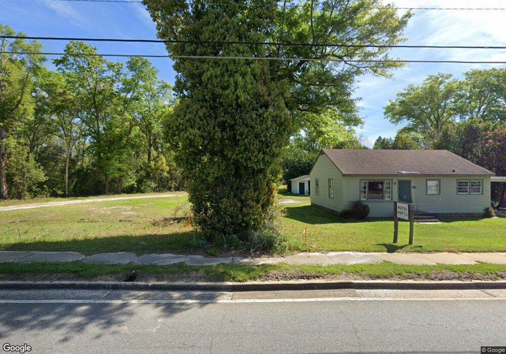
This home is located at 1236 Us Highway 84 W, Cairo, GA 39828 and is currently estimated at $68,106, approximately $45 per square foot. 1236 Us Highway 84 W is a home located in Grady County with nearby schools including Cairo High School.
Ownership History
Date
Name
Owned For
Owner Type
Purchase Details
Closed on
Feb 22, 2024
Sold by
Chuck Thomas Investments Llc
Bought by
Lopez Amilcar C
Current Estimated Value
Purchase Details
Closed on
Apr 12, 2019
Sold by
Ameris Bank
Bought by
Chuch Thomas Investments Llc
Purchase Details
Closed on
Jun 9, 2017
Bought by
Brannon John J
Purchase Details
Closed on
Sep 1, 2015
Sold by
Jones Jack E
Bought by
Ameris Bank
Purchase Details
Closed on
Apr 7, 2007
Sold by
Davis Johnnie D
Bought by
Jones Jack E
Purchase Details
Closed on
Jun 8, 2005
Sold by
Maxwell Winifred
Bought by
Jones Jack E and Davis Johnnie D
Purchase Details
Closed on
Mar 27, 1987
Bought by
Maxwell C R
Create a Home Valuation Report for This Property
The Home Valuation Report is an in-depth analysis detailing your home's value as well as a comparison with similar homes in the area
Home Values in the Area
Average Home Value in this Area
Purchase History
| Date | Buyer | Sale Price | Title Company |
|---|---|---|---|
| Lopez Amilcar C | $65,000 | -- | |
| Chuch Thomas Investments Llc | $35,000 | -- | |
| Brannon John J | $178,000 | -- | |
| Ameris Bank | $59,000 | -- | |
| Jones Jack E | $30,000 | -- | |
| Jones Jack E | $85,000 | -- | |
| Maxwell C R | $19,000 | -- |
Source: Public Records
Tax History Compared to Growth
Tax History
| Year | Tax Paid | Tax Assessment Tax Assessment Total Assessment is a certain percentage of the fair market value that is determined by local assessors to be the total taxable value of land and additions on the property. | Land | Improvement |
|---|---|---|---|---|
| 2024 | $1,226 | $31,080 | $31,080 | $0 |
| 2023 | $524 | $14,151 | $14,151 | $0 |
| 2022 | $545 | $14,151 | $14,151 | $0 |
| 2021 | $546 | $14,151 | $14,151 | $0 |
| 2020 | $938 | $24,231 | $14,151 | $10,080 |
| 2019 | $938 | $24,231 | $14,151 | $10,080 |
| 2018 | $1,057 | $33,793 | $23,713 | $10,080 |
| 2017 | $1,196 | $33,793 | $23,713 | $10,080 |
| 2016 | $1,223 | $33,793 | $23,713 | $10,080 |
| 2015 | $1,211 | $33,793 | $23,713 | $10,080 |
| 2014 | -- | $33,793 | $23,713 | $10,080 |
| 2013 | -- | $33,792 | $23,712 | $10,080 |
Source: Public Records
Map
Nearby Homes
- 1420 Parallel Dr NW
- 00 6th St NW
- 000 15th Ave Nw -- Tract 2
- 000 15th Ave Nw -- Tract 1
- 698 12th Ave NW
- 220 8th Ave NW
- 2975 U S 84
- 1490 Magnolia Dr
- 00 00 Hwy 111 South Tract 2
- 1006 Syrup Mill Creek
- 1002 Syrup Mill Creek
- 1006 Syrup Mill Creek Ln
- 125 6th Ave NW
- 1200 15th Ave NW
- 1296 McQuaig St NW
- 4761 Hadley Ferry Rd
- 1725 Tract 2 Hwy 84w
- 1725 Tract #1 Hwy 84w
- 00 NW 9th Ave
- 1500 15th Ave NW
- 1236 U S 84
- 1236 Hwy 84w
- 1232 U S 84
- 1232 Us Highway 84 W
- 45 14th Ave NW
- 1305 Us Highway 84 W
- 1233 Us Highway 84 W
- 1221 Bolden St NW
- 35 14th Ave NW
- 1219 Bolden St NW
- 1345 U S 84
- 1345 Us Highway 84 W
- 1223 Us Highway 84 W
- 315 13th Ave NW
- 320 13th Ave NW
- 1213 Us Highway 84 W
- 1217 Bolden St NW
- 320 13th Ave NW
- 316 13th Ave NW
- 25 14th Ave NW