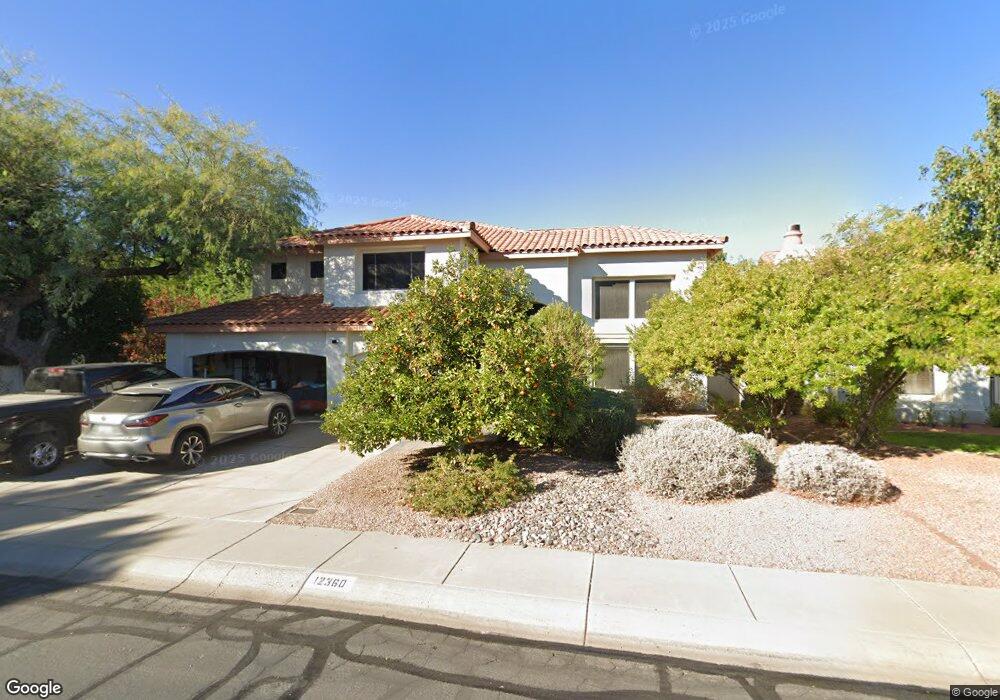
12360 N 54th Ave Glendale, AZ 85304
Estimated Value: $530,718 - $733,000
--
Bed
4
Baths
2,933
Sq Ft
$212/Sq Ft
Est. Value
About This Home
This home is located at 12360 N 54th Ave, Glendale, AZ 85304 and is currently estimated at $623,180, approximately $212 per square foot. 12360 N 54th Ave is a home located in Maricopa County with nearby schools including Marshall Ranch Elementary School, Ironwood High School, and Intelli-School Glendale.
Ownership History
Date
Name
Owned For
Owner Type
Purchase Details
Closed on
Apr 18, 1997
Sold by
Wallmuth James H and Wallmuth Mary E
Bought by
Simmons Robert L and Simmons Mary
Current Estimated Value
Home Financials for this Owner
Home Financials are based on the most recent Mortgage that was taken out on this home.
Original Mortgage
$194,750
Outstanding Balance
$25,732
Interest Rate
8.14%
Mortgage Type
New Conventional
Estimated Equity
$597,448
Create a Home Valuation Report for This Property
The Home Valuation Report is an in-depth analysis detailing your home's value as well as a comparison with similar homes in the area
Home Values in the Area
Average Home Value in this Area
Purchase History
| Date | Buyer | Sale Price | Title Company |
|---|---|---|---|
| Simmons Robert L | $205,000 | Transnation Title Ins Co |
Source: Public Records
Mortgage History
| Date | Status | Borrower | Loan Amount |
|---|---|---|---|
| Open | Simmons Robert L | $194,750 |
Source: Public Records
Tax History Compared to Growth
Tax History
| Year | Tax Paid | Tax Assessment Tax Assessment Total Assessment is a certain percentage of the fair market value that is determined by local assessors to be the total taxable value of land and additions on the property. | Land | Improvement |
|---|---|---|---|---|
| 2025 | $2,039 | $26,753 | -- | -- |
| 2024 | $2,081 | $25,479 | -- | -- |
| 2023 | $2,081 | $43,320 | $8,660 | $34,660 |
| 2022 | $2,062 | $32,020 | $6,400 | $25,620 |
| 2021 | $2,213 | $30,460 | $6,090 | $24,370 |
| 2020 | $2,246 | $30,670 | $6,130 | $24,540 |
| 2019 | $2,184 | $28,950 | $5,790 | $23,160 |
| 2018 | $2,133 | $27,500 | $5,500 | $22,000 |
| 2017 | $2,147 | $23,270 | $4,650 | $18,620 |
| 2016 | $2,134 | $22,330 | $4,460 | $17,870 |
| 2015 | $2,001 | $22,480 | $4,490 | $17,990 |
Source: Public Records
Map
Nearby Homes
- 12407 N 54th Ave
- 5341 W Bloomfield Rd
- 5318 W Shaw Butte Dr
- 5319 W Columbine Dr
- 5320 W Desert Hills Dr Unit 3
- 5221 W Columbine Dr
- 12031 N 53rd Ave
- 5534 W Riviera Dr
- 5432 W Sunnyside Dr
- 12327 N 57th Dr
- 5228 W Aster Dr
- 5174 W Laurel Ave
- 5148 W Dahlia Dr
- 11639 N 52nd Ave
- 5422 W Pershing Ave
- 11640 N 51st Ave Unit 204
- 11640 N 51st Ave Unit 137
- 11640 N 51st Ave Unit 221
- 11640 N 51st Ave Unit 211
- 11640 N 51st Ave Unit 250
- 12380 N 54th Ave
- 5420 W Wethersfield Dr
- 5428 W Wethersfield Dr
- 12335 N 54th Dr
- 12355 N 54th Dr
- 12402 N 54th Ave
- 5365 W Bloomfield Rd
- 5436 W Wethersfield Dr
- 5370 W Wethersfield Dr
- 5429 W Aster Dr
- 5423 W Aster Dr
- 12410 N 54th Ave
- 5435 W Aster Dr
- 5359 W Bloomfield Rd
- 5362 W Wethersfield Dr
- 5425 W Wethersfield Dr
- 5377 W Wethersfield Dr
- 12418 N 54th Ave
- 5431 W Wethersfield Dr
- 12350 N 54th Dr