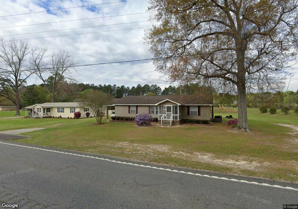
12361 Ga Highway 169 Claxton, GA 30417
Estimated Value: $154,073 - $514,000
3
Beds
2
Baths
1,596
Sq Ft
$176/Sq Ft
Est. Value
About This Home
This home is located at 12361 Ga Highway 169, Claxton, GA 30417 and is currently estimated at $280,518, approximately $175 per square foot. 12361 Ga Highway 169 is a home located in Evans County with nearby schools including Claxton Elementary School, Second Chance, and Claxton Middle School.
Ownership History
Date
Name
Owned For
Owner Type
Purchase Details
Closed on
Oct 11, 2012
Sold by
Jernigan Robert K
Bought by
Jernigan Lisa Sapp
Current Estimated Value
Purchase Details
Closed on
Jan 19, 2006
Sold by
Moore Roger K
Bought by
Jernigan Robert K and Jernigan Lisa S
Purchase Details
Closed on
Jun 4, 1999
Sold by
Sapp Lucille and Sapp Robbi
Bought by
Jernigan Robert and Jernigan Lisa
Purchase Details
Closed on
Mar 3, 1972
Sold by
Rogers Tom T
Bought by
Sapp Lucille and Sapp Robbie
Create a Home Valuation Report for This Property
The Home Valuation Report is an in-depth analysis detailing your home's value as well as a comparison with similar homes in the area
Home Values in the Area
Average Home Value in this Area
Purchase History
| Date | Buyer | Sale Price | Title Company |
|---|---|---|---|
| Jernigan Lisa Sapp | -- | -- | |
| Jernigan Robert K | $700 | -- | |
| Jernigan Robert | -- | -- | |
| Sapp Lucille | -- | -- |
Source: Public Records
Tax History Compared to Growth
Tax History
| Year | Tax Paid | Tax Assessment Tax Assessment Total Assessment is a certain percentage of the fair market value that is determined by local assessors to be the total taxable value of land and additions on the property. | Land | Improvement |
|---|---|---|---|---|
| 2024 | $1,235 | $43,952 | $1,760 | $42,192 |
| 2023 | $877 | $30,640 | $2,400 | $28,240 |
| 2022 | $787 | $30,640 | $2,400 | $28,240 |
| 2021 | $940 | $30,640 | $2,400 | $28,240 |
| 2020 | $944 | $30,640 | $2,400 | $28,240 |
| 2019 | $859 | $30,640 | $2,400 | $28,240 |
| 2018 | $988 | $29,200 | $2,400 | $26,800 |
| 2017 | $983 | $30,640 | $2,400 | $28,240 |
| 2016 | $921 | $27,480 | $1,640 | $25,840 |
| 2015 | -- | $28,440 | $1,320 | $27,120 |
| 2014 | -- | $28,440 | $1,320 | $27,120 |
| 2013 | -- | $26,640 | $1,320 | $25,320 |
Source: Public Records
Map
Nearby Homes
- 1302 Jim Sapp Rd
- 15683 Ga Highway 129 N
- 1304 Myrtle Rd
- 352 Riverside Dr
- 1200 Riverside Dr
- 628 Riverside Dr
- 147 Creek Ridge Rd
- 179 Creek Ridge Rd
- 101 Ridge Dr
- 0 Hillside Dr - 2 49 Acres Dr
- 1293 Pine Ridge Dr
- 1377 Hillside Dr
- 0 Dr
- 0 Dublin Rd
- 308 Old Metter Rd
- 0 Turnpike Rd Unit SA339603
- 0 Hendrix Bridge Rd
- 19 Collins St
- 17939 Ga Hwy 169 Hwy
- 92 Graham Ln
- 12325 Ga Highway 169
- 12231 Ga Highway 169
- 3078 Burkhalter Rd
- 3078 Burkhalter Rd Unit Smaller Parcel
- 12567 Ga Highway 169
- 12680 Georgia 169
- 12680 Ga Highway 169
- 3486 Burkhalter Rd
- 3298 Burkhalter Rd
- 0 Ga Hwy 169 Unit 130482
- 0 Ga Hwy 169 Unit 10281550
- 0 Ga Hwy 169 Unit 309918
- 0 Ga Hwy 169 Unit 20125249
- 0 Ga Hwy 169 Unit 288817
- 0 Ga Hwy 169 Unit 20070490
- 0 Ga Hwy 169 Unit 7135152
- 0 Ga Hwy 169 Unit 8142113
- 0 Ga Hwy 169 Unit 8281447
- 0 Ga Hwy 169 Unit 230668
- 0 Ga Hwy 169 Unit 7341527