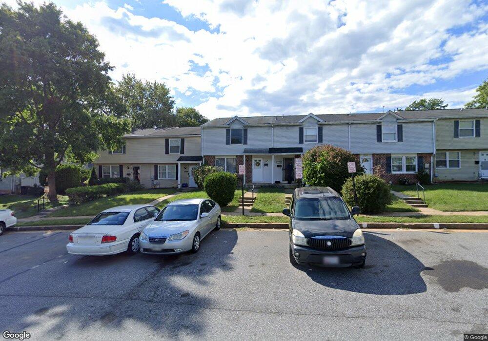
12364 Bonfire Dr Reisterstown, MD 21136
Estimated Value: $250,000 - $282,000
3
Beds
2
Baths
1,540
Sq Ft
$172/Sq Ft
Est. Value
About This Home
This home is located at 12364 Bonfire Dr, Reisterstown, MD 21136 and is currently estimated at $264,331, approximately $171 per square foot. 12364 Bonfire Dr is a home located in Baltimore County with nearby schools including Glyndon Elementary School, Franklin Middle, and Franklin High.
Ownership History
Date
Name
Owned For
Owner Type
Purchase Details
Closed on
Oct 22, 2003
Sold by
Tankin Robert
Bought by
Sands Rose Ann
Current Estimated Value
Purchase Details
Closed on
Sep 4, 2003
Sold by
Secretary Of Veterans Affairs
Bought by
Tankin Robert
Purchase Details
Closed on
Dec 2, 2002
Sold by
Johnson Randolph
Bought by
Secretary Of Veterans Affairs
Purchase Details
Closed on
Jan 7, 1997
Sold by
Said Mohammed B
Bought by
Johnson Randolph
Create a Home Valuation Report for This Property
The Home Valuation Report is an in-depth analysis detailing your home's value as well as a comparison with similar homes in the area
Home Values in the Area
Average Home Value in this Area
Purchase History
| Date | Buyer | Sale Price | Title Company |
|---|---|---|---|
| Sands Rose Ann | $127,000 | -- | |
| Tankin Robert | $87,700 | -- | |
| Secretary Of Veterans Affairs | $77,996 | -- | |
| Johnson Randolph | $81,900 | -- |
Source: Public Records
Tax History Compared to Growth
Tax History
| Year | Tax Paid | Tax Assessment Tax Assessment Total Assessment is a certain percentage of the fair market value that is determined by local assessors to be the total taxable value of land and additions on the property. | Land | Improvement |
|---|---|---|---|---|
| 2025 | $2,586 | $188,300 | -- | -- |
| 2024 | $2,586 | $174,100 | $45,700 | $128,400 |
| 2023 | $1,268 | $171,000 | $0 | $0 |
| 2022 | $2,599 | $167,900 | $0 | $0 |
| 2021 | $2,338 | $164,800 | $45,700 | $119,100 |
| 2020 | $2,338 | $159,733 | $0 | $0 |
| 2019 | $2,254 | $154,667 | $0 | $0 |
| 2018 | $2,245 | $149,600 | $45,700 | $103,900 |
| 2017 | $2,158 | $146,567 | $0 | $0 |
| 2016 | $2,053 | $143,533 | $0 | $0 |
| 2015 | $2,053 | $140,500 | $0 | $0 |
| 2014 | $2,053 | $140,500 | $0 | $0 |
Source: Public Records
Map
Nearby Homes
- 12314 Bonfire Dr
- 648 Glynock Place
- 10 Greensborough Rd
- 12 Greensborough Rd
- 12406 Old Grey Mare Ct
- 1 Brampton Ct
- 7 Putman Ct
- 10 Simpson Ct
- 611 Brickston Rd
- 10944 Baskerville Rd
- 15 Gloucester Ct
- 13 Bellinger Ct
- 49 Merino Ct
- 570 Kennington Rd
- 341 Central Ave
- 120 Lamport Rd
- 3 Meadow Mist Ct
- 225 Highmeadow Rd
- 4 Romney Ct
- 10 Wensley Dale Ct
- 12362 Bonfire Dr
- 12368 Bonfire Dr
- 12360 Bonfire Dr
- 12370 Bonfire Dr
- 12358 Bonfire Dr
- 12369 Boncrest Dr
- 12371 Boncrest Dr
- 12367 Boncrest Dr
- 12372 Bonfire Dr
- 12373 Boncrest Dr
- 12356 Bonfire Dr
- 12365 Boncrest Dr
- 12375 Boncrest Dr
- 12377 Boncrest Dr
- 12363 Boncrest Dr
- 12354 Bonfire Dr
- 12379 Boncrest Dr
- 12361 Boncrest Dr
- 12352 Bonfire Dr
- 12359 Boncrest Dr