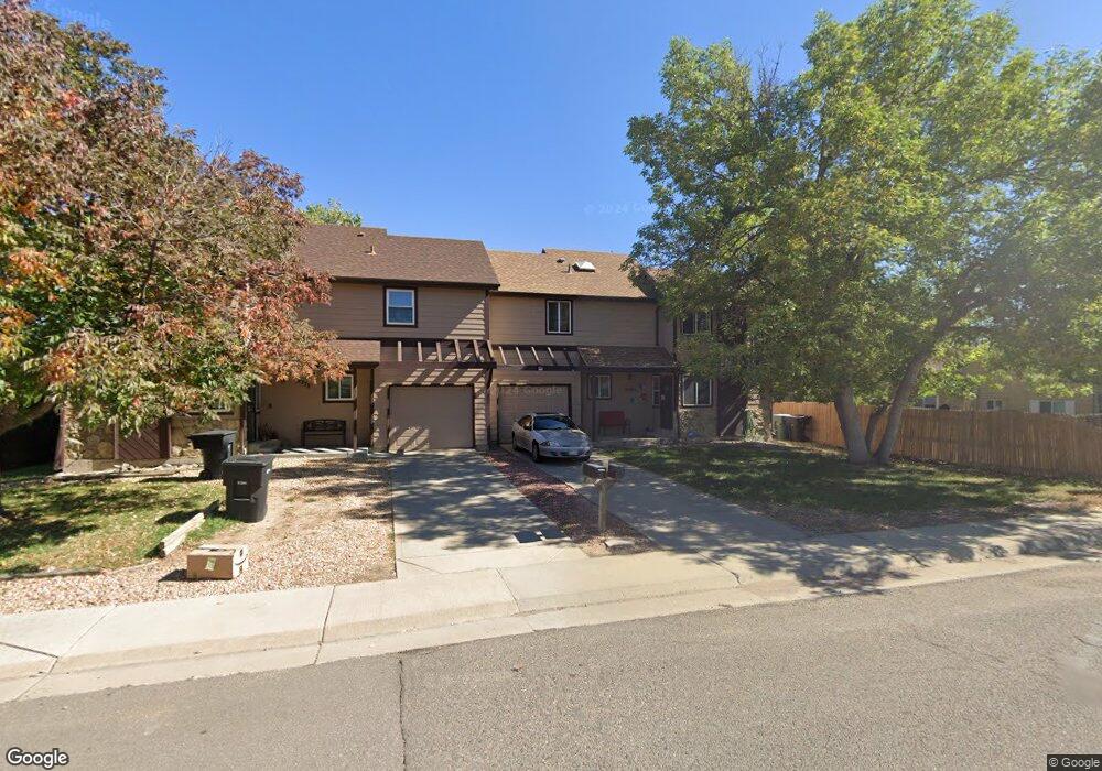
12368 Monroe Dr Thornton, CO 80241
Northaven NeighborhoodEstimated Value: $379,866 - $453,000
2
Beds
2
Baths
1,352
Sq Ft
$307/Sq Ft
Est. Value
About This Home
This home is located at 12368 Monroe Dr, Thornton, CO 80241 and is currently estimated at $414,467, approximately $306 per square foot. 12368 Monroe Dr is a home located in Adams County with nearby schools including Stellar Elementary School, Century Middle School, and Mountain Range High School.
Ownership History
Date
Name
Owned For
Owner Type
Purchase Details
Closed on
Sep 9, 2022
Sold by
Marie Johnston Andrea
Bought by
Marfil Rita Ann
Current Estimated Value
Purchase Details
Closed on
Jul 22, 2020
Sold by
Bryant Maria
Bought by
Marfil Rita and Johnston Andrea
Home Financials for this Owner
Home Financials are based on the most recent Mortgage that was taken out on this home.
Original Mortgage
$12,764
Interest Rate
3.2%
Mortgage Type
New Conventional
Purchase Details
Closed on
Jul 6, 1992
Create a Home Valuation Report for This Property
The Home Valuation Report is an in-depth analysis detailing your home's value as well as a comparison with similar homes in the area
Home Values in the Area
Average Home Value in this Area
Purchase History
| Date | Buyer | Sale Price | Title Company |
|---|---|---|---|
| Marfil Rita Ann | $37,000 | -- | |
| Marfil Rita | $325,000 | Land Title Guarantee | |
| -- | $57,000 | -- |
Source: Public Records
Mortgage History
| Date | Status | Borrower | Loan Amount |
|---|---|---|---|
| Previous Owner | Marfil Rita | $12,764 | |
| Previous Owner | Marfil Rita | $319,113 |
Source: Public Records
Tax History Compared to Growth
Tax History
| Year | Tax Paid | Tax Assessment Tax Assessment Total Assessment is a certain percentage of the fair market value that is determined by local assessors to be the total taxable value of land and additions on the property. | Land | Improvement |
|---|---|---|---|---|
| 2025 | $2,360 | $26,250 | $5,580 | $20,670 |
| 2024 | $2,360 | $24,130 | $5,130 | $19,000 |
| 2023 | $2,336 | $26,520 | $5,550 | $20,970 |
| 2022 | $1,972 | $17,900 | $5,700 | $12,200 |
| 2021 | $2,037 | $17,900 | $5,700 | $12,200 |
| 2020 | $1,811 | $16,230 | $5,860 | $10,370 |
| 2019 | $1,814 | $16,230 | $5,860 | $10,370 |
| 2018 | $1,815 | $15,770 | $6,260 | $9,510 |
| 2017 | $1,650 | $15,770 | $6,260 | $9,510 |
| 2016 | $1,379 | $12,830 | $3,580 | $9,250 |
| 2015 | $1,377 | $12,830 | $3,580 | $9,250 |
| 2014 | -- | $9,420 | $2,630 | $6,790 |
Source: Public Records
Map
Nearby Homes
- 12604 Madison Way
- 3700 E 122nd Ave
- 3225 E 124th Ave
- 12672 Madison Ct
- 3989 E 121st Ave
- 12218 Adams St
- 12711 Colorado Blvd Unit 1106
- 12711 Colorado Blvd Unit 314C
- 12737 Jackson St
- 12433 Bellaire Dr
- 3765 E 127th Way
- 3491 E 119th St
- 3450 E 128th Place
- 11981 Bellaire St Unit D
- 3670 E 128th Place
- 11982 Bellaire St Unit G
- 11901 Bellaire St Unit D
- 11845 Garfield St
- 4135 E 119th Place Unit B
- 12540 Dahlia Way
- 12378 Monroe Dr
- 3535 E 123rd Ave
- 3556 E 124th Ave
- 3565 E 123rd Ave
- 3566 E 124th Ave
- 3516 E 124th Ave
- 3595 E 123rd Ave
- 12487 Monroe Dr
- 12349 Monroe Dr
- 3586 E 124th Ave
- 3506 E 124th Ave
- 12319 Monroe Dr
- 3596 E 124th Ave
- 3625 E 123rd Ave
- 12288 Monroe Dr
- 12289 Monroe Dr
- 12287 Monroe Place
- 3636 E 124th Ave
- 3645 E 123rd Ave
- 3646 E 124th Ave