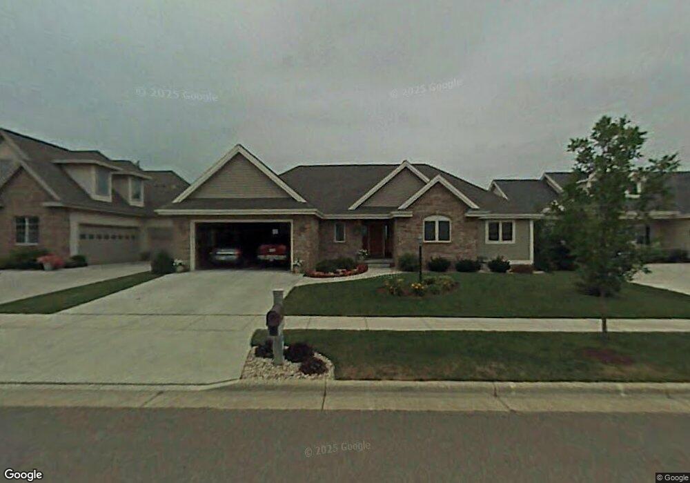
1237 Dartmouth Dr Waunakee, WI 53597
Estimated Value: $654,861 - $765,000
4
Beds
3
Baths
2,790
Sq Ft
$259/Sq Ft
Est. Value
About This Home
This home is located at 1237 Dartmouth Dr, Waunakee, WI 53597 and is currently estimated at $723,965, approximately $259 per square foot. 1237 Dartmouth Dr is a home located in Dane County with nearby schools including Arboretum Elementary School, Waunakee Intermediate School, and Waunakee Community Middle School.
Ownership History
Date
Name
Owned For
Owner Type
Purchase Details
Closed on
Jun 1, 2022
Sold by
Delgado Brook A
Bought by
Brindley Brook A
Current Estimated Value
Purchase Details
Closed on
Jan 30, 2014
Sold by
Delgado Patrick
Bought by
Delgado Brook A
Purchase Details
Closed on
Nov 19, 2008
Sold by
Wallace Brian R and Wallace Michelle M
Bought by
Delgado Patrick and Delgado Brook A
Home Financials for this Owner
Home Financials are based on the most recent Mortgage that was taken out on this home.
Original Mortgage
$38,100
Interest Rate
6.5%
Mortgage Type
Purchase Money Mortgage
Create a Home Valuation Report for This Property
The Home Valuation Report is an in-depth analysis detailing your home's value as well as a comparison with similar homes in the area
Home Values in the Area
Average Home Value in this Area
Purchase History
| Date | Buyer | Sale Price | Title Company |
|---|---|---|---|
| Brindley Brook A | -- | None Listed On Document | |
| Delgado Brook A | -- | None Available | |
| Delgado Patrick | $381,000 | None Available |
Source: Public Records
Mortgage History
| Date | Status | Borrower | Loan Amount |
|---|---|---|---|
| Previous Owner | Delgado Patrick | $38,100 | |
| Previous Owner | Delgado Patrick | $304,800 |
Source: Public Records
Tax History Compared to Growth
Tax History
| Year | Tax Paid | Tax Assessment Tax Assessment Total Assessment is a certain percentage of the fair market value that is determined by local assessors to be the total taxable value of land and additions on the property. | Land | Improvement |
|---|---|---|---|---|
| 2024 | $8,299 | $507,400 | $109,500 | $397,900 |
| 2023 | $8,020 | $507,400 | $109,500 | $397,900 |
| 2021 | $8,280 | $423,500 | $103,500 | $320,000 |
| 2020 | $8,019 | $423,500 | $103,500 | $320,000 |
| 2019 | $7,987 | $423,500 | $103,500 | $320,000 |
| 2018 | $7,801 | $365,500 | $100,500 | $265,000 |
| 2017 | $7,745 | $365,500 | $100,500 | $265,000 |
| 2016 | $7,638 | $365,500 | $100,500 | $265,000 |
| 2015 | $7,505 | $365,500 | $100,500 | $265,000 |
| 2014 | -- | $365,500 | $100,500 | $265,000 |
| 2013 | $7,658 | $365,500 | $100,500 | $265,000 |
Source: Public Records
Map
Nearby Homes
- 1306 Hanover Ct
- 1140 Reese Trail
- 1151 Reese Trail
- 1104 Reese Trail
- 1146 Irene Ct
- 1148 Irene Ct
- 1155 Irene Ct Unit 15
- 1153 Irene Ct Unit 14
- 1157 Irene Ct Unit 16
- 1151 Irene Ct Unit 13
- 1109 Stephenson Ln
- 1033 Quinn Dr
- 1110 Stephenson Ln
- 1122 Stephenson Ln
- 1028 Quinn Dr
- 5802 Woodland Dr
- 1016 Quinn Dr
- 5018 Apricot Blossom Ct
- 5006 Apricot Blossom Ct
- Lot 36 Cooper Hawk Dr
- 1235 Dartmouth Dr
- 1239 Dartmouth Dr
- 1241 Dartmouth Dr
- 1233 Dartmouth Dr
- 1231 Dartmouth Dr
- 1238 Dartmouth Dr
- 1236 Dartmouth Dr
- 1325 Gile Dr
- 1327 Gile Dr
- 1240 Dartmouth Dr
- 1234 Dartmouth Dr
- 1323 Gile Dr
- 1242 Dartmouth Dr
- 1321 Gile Dr
- 1232 Dartmouth Dr
- 1225 Dartmouth Dr
- 1319 Gile Dr
- 1407 Trotta Ct
- 1324 Gile Dr
- 1324 Gile Dr Unit 404