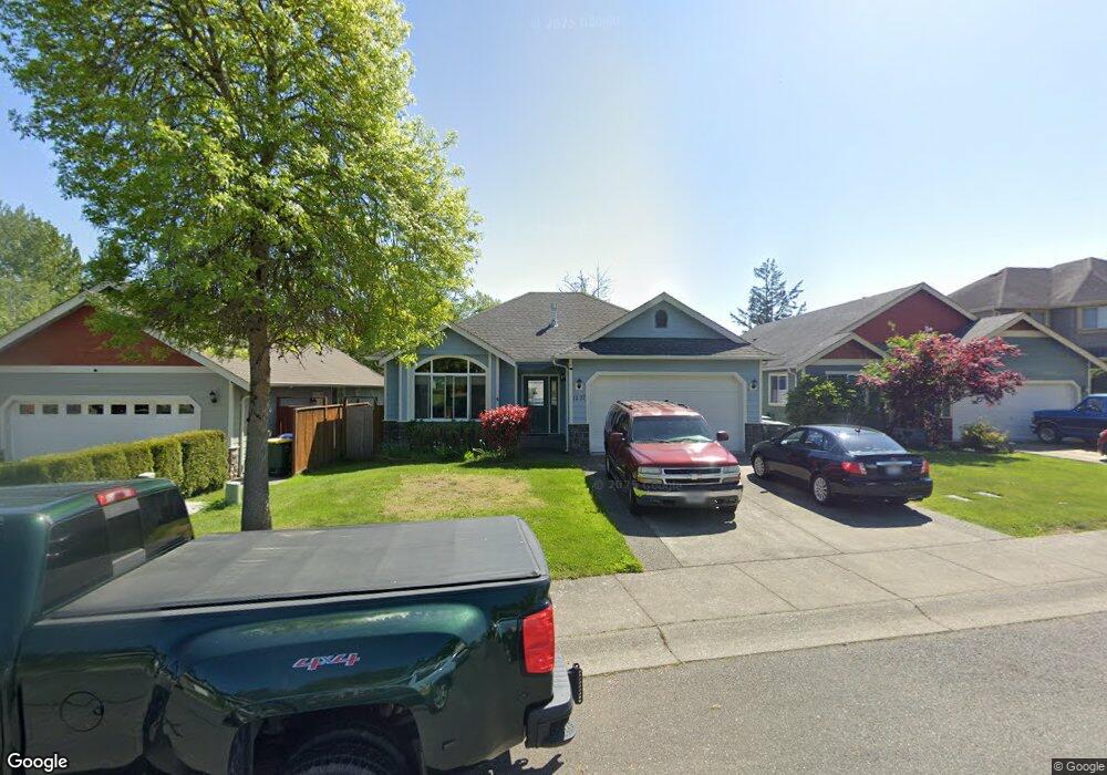
1237 Garland Ln Bellingham, WA 98226
Meridian NeighborhoodEstimated Value: $605,000 - $777,000
4
Beds
3
Baths
1,151
Sq Ft
$571/Sq Ft
Est. Value
About This Home
This home is located at 1237 Garland Ln, Bellingham, WA 98226 and is currently estimated at $656,728, approximately $570 per square foot. 1237 Garland Ln is a home located in Whatcom County with nearby schools including Cordata Elementary School, Shuksan Middle School, and Squalicum High School.
Ownership History
Date
Name
Owned For
Owner Type
Purchase Details
Closed on
Oct 5, 2005
Sold by
Mcdonald Charles Logan and Mcdonald Brenda
Bought by
Atkins David A and Atkins Monette
Current Estimated Value
Home Financials for this Owner
Home Financials are based on the most recent Mortgage that was taken out on this home.
Original Mortgage
$252,000
Outstanding Balance
$134,116
Interest Rate
5.67%
Mortgage Type
Fannie Mae Freddie Mac
Estimated Equity
$522,612
Purchase Details
Closed on
Apr 13, 2004
Sold by
Savchuk Sergey and Savchuk Svetlana
Bought by
Mcdonald Charles Logan and Mcdonald Brenda
Home Financials for this Owner
Home Financials are based on the most recent Mortgage that was taken out on this home.
Original Mortgage
$120,000
Interest Rate
4.37%
Mortgage Type
Purchase Money Mortgage
Purchase Details
Closed on
Oct 27, 2003
Sold by
Crown Point Holdings Inc
Bought by
Savchuk Sergey and Savchuk Svetlana
Create a Home Valuation Report for This Property
The Home Valuation Report is an in-depth analysis detailing your home's value as well as a comparison with similar homes in the area
Home Values in the Area
Average Home Value in this Area
Purchase History
| Date | Buyer | Sale Price | Title Company |
|---|---|---|---|
| Atkins David A | $336,280 | Chicago Title Insurance | |
| Mcdonald Charles Logan | $259,000 | Whatcom Land Title | |
| Savchuk Sergey | -- | Whatcom Land Title |
Source: Public Records
Mortgage History
| Date | Status | Borrower | Loan Amount |
|---|---|---|---|
| Open | Atkins David A | $252,000 | |
| Previous Owner | Mcdonald Charles Logan | $120,000 |
Source: Public Records
Tax History Compared to Growth
Tax History
| Year | Tax Paid | Tax Assessment Tax Assessment Total Assessment is a certain percentage of the fair market value that is determined by local assessors to be the total taxable value of land and additions on the property. | Land | Improvement |
|---|---|---|---|---|
| 2024 | $4,489 | $552,441 | $184,982 | $367,459 |
| 2023 | $4,489 | $576,733 | $193,116 | $383,617 |
| 2022 | $3,884 | $505,906 | $169,400 | $336,506 |
| 2021 | $3,960 | $418,104 | $140,000 | $278,104 |
| 2020 | $3,828 | $402,389 | $116,828 | $285,561 |
| 2019 | $3,424 | $375,935 | $109,238 | $266,697 |
| 2018 | $3,544 | $337,187 | $97,988 | $239,199 |
| 2017 | $3,081 | $298,345 | $86,700 | $211,645 |
| 2016 | $2,820 | $271,113 | $78,900 | $192,213 |
| 2015 | $3,168 | $258,322 | $75,000 | $183,322 |
| 2014 | -- | $280,768 | $72,240 | $208,528 |
| 2013 | -- | $268,550 | $70,000 | $198,550 |
Source: Public Records
Map
Nearby Homes
- 1217 Garland Ln
- 1210 Mahogany Ave
- 4252 Northwest Dr
- 1365 Mahogany Ave
- 4226 Traverse Dr
- 1360 Talus Way
- 4243 Cameo Ln
- 1370 Talus Way
- 1368 Talus Way
- 1366 Talus Way
- 4250 Braeburn Ln Unit 37
- 4232 Melrose Ln
- 4228 Melrose Ln
- 4230 Melrose Ln
- 4226 Melrose Ln
- 4225 Ambrosia Ln
- 4227 Ambrosia Ln
- 4229 Ambrosia Ln
- 0 Home Ln
- 4154 Pacific Hwy
- 1233 Garland Ln
- 1241 Garland Ln
- 1245 Garland Ln
- 1229 Garland Ln
- 1249 Garland Ln
- 1225 Garland Ln
- 1240 Garland Ln
- 1234 Garland Ln
- 1244 Garland Ln
- 1230 Garland Ln
- 4170 Dover St
- 1253 Garland Ln
- 1221 Garland Ln
- 1224 Garland Ln
- 1220 Garland Ln
- 4174 Dover St
- 4160 Dover St
- 1218 Garland Ln
- 1213 Garland Ln
- 1214 Garland Ln