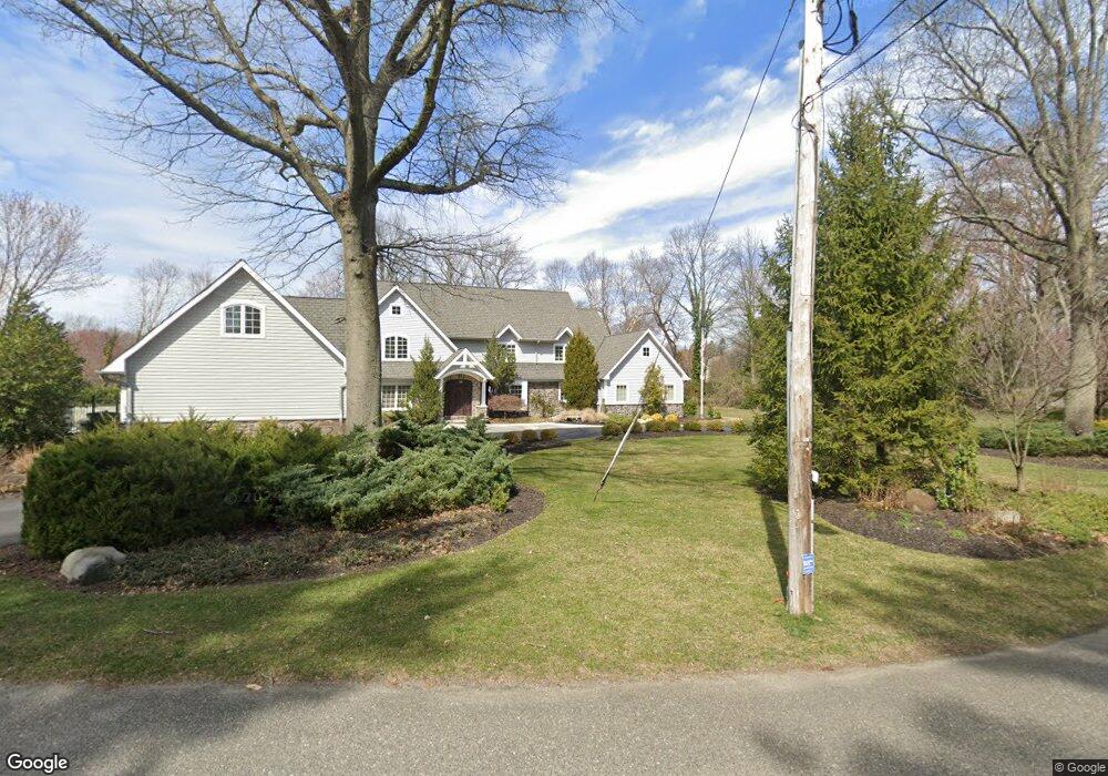
1237 Kay Dr S Cherry Hill, NJ 08034
Estimated Value: $860,000 - $1,225,000
--
Bed
--
Bath
5,602
Sq Ft
$187/Sq Ft
Est. Value
About This Home
This home is located at 1237 Kay Dr S, Cherry Hill, NJ 08034 and is currently estimated at $1,045,059, approximately $186 per square foot. 1237 Kay Dr S is a home located in Camden County with nearby schools including A. Russell Knight Elementary School, John A Carusi Middle School, and Cherry Hill High-West High School.
Ownership History
Date
Name
Owned For
Owner Type
Purchase Details
Closed on
Apr 26, 2004
Sold by
Davol Richard M
Bought by
Casey Donald J and Casey Rose Ann A
Current Estimated Value
Home Financials for this Owner
Home Financials are based on the most recent Mortgage that was taken out on this home.
Original Mortgage
$205,000
Outstanding Balance
$95,168
Interest Rate
5.36%
Estimated Equity
$949,891
Create a Home Valuation Report for This Property
The Home Valuation Report is an in-depth analysis detailing your home's value as well as a comparison with similar homes in the area
Home Values in the Area
Average Home Value in this Area
Purchase History
| Date | Buyer | Sale Price | Title Company |
|---|---|---|---|
| Casey Donald J | $456,000 | -- |
Source: Public Records
Mortgage History
| Date | Status | Borrower | Loan Amount |
|---|---|---|---|
| Open | Casey Donald J | $205,000 |
Source: Public Records
Tax History Compared to Growth
Tax History
| Year | Tax Paid | Tax Assessment Tax Assessment Total Assessment is a certain percentage of the fair market value that is determined by local assessors to be the total taxable value of land and additions on the property. | Land | Improvement |
|---|---|---|---|---|
| 2025 | $27,793 | $623,300 | $182,500 | $440,800 |
| 2024 | $26,191 | $623,300 | $182,500 | $440,800 |
| 2023 | $26,191 | $623,300 | $182,500 | $440,800 |
| 2022 | $25,468 | $623,300 | $182,500 | $440,800 |
| 2021 | $25,549 | $623,300 | $182,500 | $440,800 |
| 2020 | $25,237 | $623,300 | $182,500 | $440,800 |
| 2019 | $25,225 | $623,300 | $182,500 | $440,800 |
| 2018 | $25,156 | $623,300 | $182,500 | $440,800 |
| 2017 | $24,814 | $623,300 | $182,500 | $440,800 |
| 2016 | $24,483 | $623,300 | $182,500 | $440,800 |
| 2015 | $24,097 | $623,300 | $182,500 | $440,800 |
| 2014 | $23,829 | $623,300 | $182,500 | $440,800 |
Source: Public Records
Map
Nearby Homes
- 130 Pearl Croft Rd
- 1227 Cotswold Ln
- 109 Old Carriage Rd
- 124 Edison Rd
- 217 Redstone Ridge
- 115 Edison Rd
- 505 Fern Ave
- 100 Park Blvd Unit 20C
- 100 Park Blvd Unit 75B
- 100 Park Blvd Unit 44D
- 100 Park Blvd Unit 88 C
- 100 Park Blvd Unit 2D
- 4514 Champions Run Unit 4514
- 515 Kresson Rd
- 1324 Charleston Rd
- 307 Provincetown Cir
- 1217 Forge Rd
- 16 Churchill Rd
- 300 Portsmouth Rd
- 110 Barclay Ln
- 1247 Kay Dr E
- 1240 Kay Dr S
- 1246 Kay Dr E
- 1236 Kay Dr S
- 1232 Kay Dr S
- 1253 Kay Dr E
- 308 Cotswold Ln
- 1201 Kay Dr W
- 118 Deerfield Dr
- 120 Deerfield Dr
- 1230 Kay Dr S
- 122 Deerfield Dr
- 1252 Kay Dr E
- 114 Deerfield Dr
- 1257 Kay Dr E
- 124 Deerfield Dr
- 126 Deerfield Dr
- 110 Deerfield Dr
- 310 Cotswold Ln
- 1258 Kay Dr E