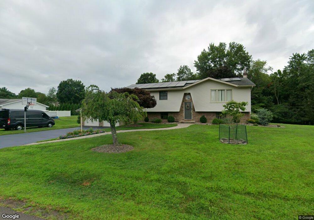
1237 Maple St Bloomsburg, PA 17815
Estimated Value: $320,583 - $363,000
--
Bed
--
Bath
1,888
Sq Ft
$183/Sq Ft
Est. Value
About This Home
This home is located at 1237 Maple St, Bloomsburg, PA 17815 and is currently estimated at $345,146, approximately $182 per square foot. 1237 Maple St is a home located in Columbia County with nearby schools including Central Columbia Elementary School, Central Columbia Middle School, and Central Columbia Senior High School.
Ownership History
Date
Name
Owned For
Owner Type
Purchase Details
Closed on
Dec 27, 2018
Sold by
Mintzer Craig C and Mintzer Diane M
Bought by
Bower Corey D and Bower Katherine M
Current Estimated Value
Home Financials for this Owner
Home Financials are based on the most recent Mortgage that was taken out on this home.
Original Mortgage
$188,800
Outstanding Balance
$166,989
Interest Rate
4.9%
Mortgage Type
New Conventional
Estimated Equity
$178,157
Create a Home Valuation Report for This Property
The Home Valuation Report is an in-depth analysis detailing your home's value as well as a comparison with similar homes in the area
Home Values in the Area
Average Home Value in this Area
Purchase History
| Date | Buyer | Sale Price | Title Company |
|---|---|---|---|
| Bower Corey D | $236,000 | None Available |
Source: Public Records
Mortgage History
| Date | Status | Borrower | Loan Amount |
|---|---|---|---|
| Open | Bower Corey D | $188,800 |
Source: Public Records
Tax History Compared to Growth
Tax History
| Year | Tax Paid | Tax Assessment Tax Assessment Total Assessment is a certain percentage of the fair market value that is determined by local assessors to be the total taxable value of land and additions on the property. | Land | Improvement |
|---|---|---|---|---|
| 2025 | $3,864 | $55,543 | $0 | $0 |
| 2024 | $3,769 | $55,543 | $11,734 | $43,809 |
| 2023 | $3,602 | $55,543 | $11,734 | $43,809 |
| 2022 | $3,536 | $55,543 | $11,734 | $43,809 |
| 2021 | $3,505 | $55,543 | $11,734 | $43,809 |
| 2020 | $3,385 | $55,543 | $11,734 | $43,809 |
| 2019 | $3,315 | $55,543 | $11,734 | $43,809 |
| 2018 | $3,304 | $55,543 | $11,734 | $43,809 |
| 2017 | $3,786 | $55,543 | $11,734 | $43,809 |
| 2016 | -- | $55,543 | $11,734 | $43,809 |
| 2015 | -- | $55,543 | $11,734 | $43,809 |
| 2014 | -- | $55,543 | $11,734 | $43,809 |
Source: Public Records
Map
Nearby Homes
- 1277 Cherry St
- 1246 Cherry St
- 1251 Chestnut St
- 1219 Maple St
- 1311 Sassafras St
- 1 Bittersweet Dr
- 505 Crestwood Dr
- 11 Amanda Dr
- 9 Crestmont Cir
- 925 Mcguire Rd
- 4 Kent Rd
- 712 Country Club Dr
- 829 Lightstreet Rd
- 601 Honeysuckle Ln
- 638 E 4th St
- 650652 Old Berwick Rd
- 0 Alliance Park Dr
- 2144 Old Berwick Rd
- 0 Alliance Park Lot 6 Dr
- 500 E 5th St
- 1239 Maple St
- 1235 Maple St
- 1312 Treeline Dr
- 1314 Treeline Dr
- 1232 Maple St
- 1234 Maple St
- 1316 Treeline Dr
- 1241 Maple St
- 1230 Maple St
- 1281 Cherry St
- 1308 Treeline Dr
- 1243 Chestnut St
- 1283 Cherry St
- 1320 Treeline Dr
- 1279 Cherry St
- 1405 Treeline Dr
- 1228 Maple St
- 1231 Maple St
- 1306 Treeline Dr
- 1403 Treeline Dr