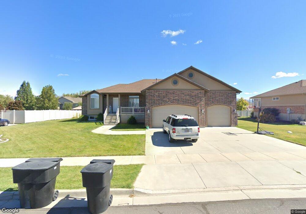
1237 S 4050 W Syracuse, UT 84075
Estimated Value: $556,000 - $606,000
3
Beds
2
Baths
3,300
Sq Ft
$176/Sq Ft
Est. Value
About This Home
This home is located at 1237 S 4050 W, Syracuse, UT 84075 and is currently estimated at $581,084, approximately $176 per square foot. 1237 S 4050 W is a home located in Davis County with nearby schools including Buffalo Point School, Syracuse Junior High School, and Syracuse High School.
Ownership History
Date
Name
Owned For
Owner Type
Purchase Details
Closed on
Aug 5, 2008
Sold by
Bond Colby and Bond Wayne
Bought by
Lee Hank L and Lee Janet
Current Estimated Value
Purchase Details
Closed on
Apr 23, 2007
Sold by
Lee Hank L and Lee Janet
Bought by
Bond Colby and Bond Wayne
Home Financials for this Owner
Home Financials are based on the most recent Mortgage that was taken out on this home.
Original Mortgage
$240,000
Interest Rate
6.14%
Mortgage Type
Seller Take Back
Purchase Details
Closed on
Mar 27, 2007
Sold by
Modern Homes Llc
Bought by
Lee Hank L and Lee Janet
Home Financials for this Owner
Home Financials are based on the most recent Mortgage that was taken out on this home.
Original Mortgage
$240,000
Interest Rate
6.14%
Mortgage Type
Seller Take Back
Purchase Details
Closed on
Aug 9, 2005
Sold by
U S Development Inc
Bought by
Modern Homes Llc
Create a Home Valuation Report for This Property
The Home Valuation Report is an in-depth analysis detailing your home's value as well as a comparison with similar homes in the area
Home Values in the Area
Average Home Value in this Area
Purchase History
| Date | Buyer | Sale Price | Title Company |
|---|---|---|---|
| Lee Hank L | $220,000 | Bonneville Superior Title Co | |
| Bond Colby | -- | Bonneville Superior Title Co | |
| Lee Hank L | $215,868 | Bonneville Superior Title Co | |
| Modern Homes Llc | -- | Bonneville Title Company |
Source: Public Records
Mortgage History
| Date | Status | Borrower | Loan Amount |
|---|---|---|---|
| Previous Owner | Bond Colby | $240,000 |
Source: Public Records
Tax History Compared to Growth
Tax History
| Year | Tax Paid | Tax Assessment Tax Assessment Total Assessment is a certain percentage of the fair market value that is determined by local assessors to be the total taxable value of land and additions on the property. | Land | Improvement |
|---|---|---|---|---|
| 2025 | $2,976 | $287,100 | $112,924 | $174,176 |
| 2024 | $2,854 | $277,199 | $93,236 | $183,963 |
| 2023 | $2,667 | $259,600 | $76,018 | $183,581 |
| 2022 | $2,891 | $510,000 | $129,033 | $380,967 |
| 2021 | $2,510 | $377,000 | $103,249 | $273,751 |
| 2020 | $2,242 | $326,000 | $85,163 | $240,837 |
| 2019 | $2,187 | $314,000 | $87,995 | $226,005 |
| 2018 | $2,007 | $286,000 | $84,993 | $201,007 |
| 2016 | $1,839 | $137,445 | $34,670 | $102,775 |
| 2015 | $1,737 | $123,640 | $34,670 | $88,970 |
| 2014 | $1,762 | $127,762 | $34,670 | $93,092 |
| 2013 | -- | $121,540 | $30,991 | $90,549 |
Source: Public Records
Map
Nearby Homes
- 3951 Baltimore Cir
- 1084 S 4090 W
- 3867 Rungsted Cir
- 1039 S 4250 W
- 1238 S 4290 W
- 4191 W 1425 S
- 3882 Turnberry Dr
- 1157 S 4425 W
- 3736 W 1225 S
- 1155 S 4475 W
- 1139 S 4475 W
- 835 S Criddle Rd
- Bradford Plan at Harvest Fields
- Avery Plan at Harvest Fields
- Sullivan Plan at Harvest Fields
- Presley Plan at Harvest Fields
- Ashmore Plan at Harvest Fields
- Bridgeport Plan at Harvest Fields
- Malan Plan at Harvest Fields
- Havenwood Plan at Harvest Fields
- 1217 S 4050 W
- 1257 S 4050 W
- 1236 S 4000 W
- 1216 S 4000 W
- 1252 S 4050 W
- 1256 S 4000 W
- 4062 W 1235 S
- 1218 S 4050 W
- 1277 S 4050 W
- 1276 S 4000 W
- 1272 S 4050 W
- 4032 W 1200 S Unit LOT 26
- 4081 W 1235 S Unit 607
- 1231 S 4000 W
- 4018 W 1200 S Unit 1
- 1249 S 4000 W
- 1294 S 4000 W
- 1213 S 4000 W
- 1267 S 4000 W
- 4068 W 1200 S Unit 28