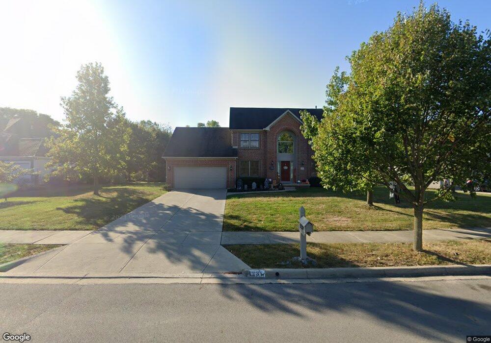
1237 Sea Shell Dr Westerville, OH 43082
Genoa NeighborhoodEstimated Value: $311,000 - $527,000
4
Beds
3
Baths
2,308
Sq Ft
$173/Sq Ft
Est. Value
About This Home
This home is located at 1237 Sea Shell Dr, Westerville, OH 43082 and is currently estimated at $400,154, approximately $173 per square foot. 1237 Sea Shell Dr is a home located in Delaware County with nearby schools including Robert Frost Elementary School, Heritage Middle School, and Westerville-North High School.
Ownership History
Date
Name
Owned For
Owner Type
Purchase Details
Closed on
Feb 11, 2025
Sold by
Domicent Llc
Bought by
Kaviyakone Lindsey and Kaviyakone Joel
Current Estimated Value
Home Financials for this Owner
Home Financials are based on the most recent Mortgage that was taken out on this home.
Original Mortgage
$240,000
Outstanding Balance
$238,579
Interest Rate
6.93%
Mortgage Type
New Conventional
Estimated Equity
$161,575
Purchase Details
Closed on
Dec 28, 2021
Bought by
Domicent Llc
Purchase Details
Closed on
Apr 29, 2015
Sold by
Steele Crest Ltd
Bought by
Domicent Ii Llc
Purchase Details
Closed on
Feb 1, 2000
Sold by
Sunbury Highlands Ltd
Bought by
Silver Creek Homes Ltd
Create a Home Valuation Report for This Property
The Home Valuation Report is an in-depth analysis detailing your home's value as well as a comparison with similar homes in the area
Home Values in the Area
Average Home Value in this Area
Purchase History
| Date | Buyer | Sale Price | Title Company |
|---|---|---|---|
| Kaviyakone Lindsey | $300,000 | Talon Title | |
| Kaviyakone Lindsey | $300,000 | Talon Title | |
| Domicent Llc | -- | -- | |
| Domicent Ii Llc | $190,000 | Talon Title | |
| Silver Creek Homes Ltd | $46,500 | -- |
Source: Public Records
Mortgage History
| Date | Status | Borrower | Loan Amount |
|---|---|---|---|
| Open | Kaviyakone Lindsey | $240,000 | |
| Closed | Kaviyakone Lindsey | $240,000 |
Source: Public Records
Tax History Compared to Growth
Tax History
| Year | Tax Paid | Tax Assessment Tax Assessment Total Assessment is a certain percentage of the fair market value that is determined by local assessors to be the total taxable value of land and additions on the property. | Land | Improvement |
|---|---|---|---|---|
| 2024 | $7,669 | $147,040 | $36,050 | $110,990 |
| 2023 | $7,584 | $147,040 | $36,050 | $110,990 |
| 2022 | $7,249 | $108,750 | $22,750 | $86,000 |
| 2021 | $7,313 | $108,750 | $22,750 | $86,000 |
| 2020 | $7,361 | $108,750 | $22,750 | $86,000 |
| 2019 | $6,790 | $95,620 | $22,750 | $72,870 |
| 2018 | $6,681 | $95,620 | $22,750 | $72,870 |
| 2017 | $6,636 | $90,970 | $19,950 | $71,020 |
| 2016 | $6,936 | $90,970 | $19,950 | $71,020 |
| 2015 | $6,642 | $90,970 | $19,950 | $71,020 |
| 2014 | -- | $90,970 | $19,950 | $71,020 |
| 2013 | $6,510 | $88,240 | $19,950 | $68,290 |
Source: Public Records
Map
Nearby Homes
- 1155 Ashford Ct
- 7568 Park Bend Ct
- 9119 Robinhood Cir
- 6618 Wild Rose Ln
- 974 Lakeland Dr
- 6611 Lake of the Woods Point
- 6460 Bromfield Dr
- 6685 Tussic Street Rd
- 8369 Manitou Dr
- 9200 Knoll Dr
- 73 Keethler Dr S
- 912 Lakeway Ct E
- 656 Olde Mill Dr
- 7663 Rolling Ridge Way
- 718 Sugar Ct
- 754 Kingsmead Rd Unit 18754
- 4485 Smothers Rd
- 90 Spring Creek Dr
- 5840 Heron Ct
- 6999 Red Bank Rd
- 1227 Sea Shell Dr
- 1228 Buoy Ct
- 1259 Sea Shell Dr
- 1244 Sea Shell Dr
- 1225 Sea Shell Dr
- 1232 Sea Shell Dr
- 1252 Sea Shell Dr
- 1231 Buoy Ct
- 1266 Sea Shell Dr
- 1228 Sea Shell Dr
- 1226 Sea Shell Dr
- 664 Sea Shell Ct
- 661 Sea Shell Ct
- 1227 Buoy Ct
- 1221 Buoy Ct
- 7200 Sunbury Rd
- 1220 Sea Shell Dr
- 665 Sea Shell Ct
- 672 Sea Shell Ct
- 636 Freshwater Ct