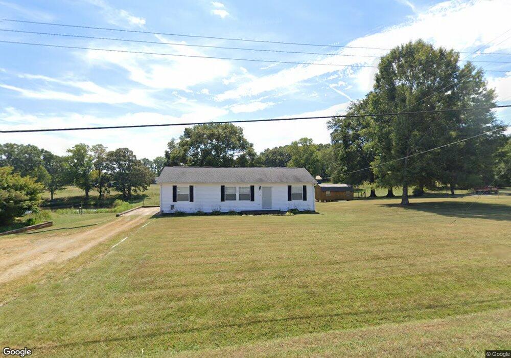
1237 W Highway 27 Lincolnton, NC 28092
Estimated Value: $179,185 - $270,000
3
Beds
2
Baths
1,152
Sq Ft
$185/Sq Ft
Est. Value
About This Home
This home is located at 1237 W Highway 27, Lincolnton, NC 28092 and is currently estimated at $212,546, approximately $184 per square foot. 1237 W Highway 27 is a home located in Lincoln County with nearby schools including Norris S. Childers Elementary School, West Lincoln Middle, and West Lincoln High School.
Ownership History
Date
Name
Owned For
Owner Type
Purchase Details
Closed on
Apr 15, 2016
Sold by
Peeler Ronnie Richard and Peeler Patsy D
Bought by
Hendrick James Michael
Current Estimated Value
Home Financials for this Owner
Home Financials are based on the most recent Mortgage that was taken out on this home.
Original Mortgage
$80,000
Outstanding Balance
$35,019
Interest Rate
3.68%
Mortgage Type
Purchase Money Mortgage
Estimated Equity
$177,527
Purchase Details
Closed on
Apr 2, 2008
Sold by
Peeler Lewis D
Bought by
Peeler Ronnie Richard
Purchase Details
Closed on
Oct 9, 1995
Bought by
Peeler Lewis D and Peeler Joann C
Create a Home Valuation Report for This Property
The Home Valuation Report is an in-depth analysis detailing your home's value as well as a comparison with similar homes in the area
Purchase History
We collect this data history from publicly available records. To have your information removed, we recommend requesting removal directly through your county’s website.
| Date | Buyer | Sale Price | Title Company |
|---|---|---|---|
| Hendrick James Michael | $80,000 | None Available | |
| Peeler Ronnie Richard | -- | None Available | |
| Peeler Lewis D | $45,000 | -- |
Source: Public Records
Mortgage History
We collect this data history from publicly available records. To have your information removed, we recommend requesting removal directly through your county’s website.
| Date | Status | Borrower | Loan Amount |
|---|---|---|---|
| Open | Hendrick James Michael | $80,000 |
Source: Public Records
Tax History
| Year | Tax Paid | Tax Assessment Tax Assessment Total Assessment is a certain percentage of the fair market value that is determined by local assessors to be the total taxable value of land and additions on the property. | Land | Improvement |
|---|---|---|---|---|
| 2025 | $1,196 | $166,455 | $31,454 | $135,001 |
| 2024 | $1,176 | $166,455 | $31,454 | $135,001 |
| 2023 | $1,176 | $166,455 | $31,454 | $135,001 |
| 2022 | $858 | $98,527 | $23,000 | $75,527 |
| 2021 | $858 | $98,527 | $23,000 | $75,527 |
| 2020 | $724 | $98,527 | $23,000 | $75,527 |
| 2019 | $724 | $75,527 | $0 | $75,527 |
| 2018 | $709 | $82,891 | $21,000 | $61,891 |
| 2017 | $608 | $82,891 | $21,000 | $61,891 |
| 2016 | $608 | $82,891 | $21,000 | $61,891 |
| 2015 | $680 | $82,891 | $21,000 | $61,891 |
| 2014 | $718 | $90,410 | $22,000 | $68,410 |
Source: Public Records
Map
Nearby Homes
- 1178 N Carolina 182
- 11 Dorset Ln
- 000 Better Brook Ln
- 00 George Brown Rd Unit 7
- 00 George Brown Rd Unit 4
- 00 George Brown Rd Unit 6
- 00 George Brown Rd Unit 5
- 00 George Brown Rd Unit 8
- 00 George Brown Rd Unit 10
- 00 George Brown Rd Unit 3
- 00 George Brown Rd Unit 23
- 00 George Brown Rd Unit 9
- #167 Rolling Rd
- 1994 Modern Estates Rd
- 2006 Modern Estates Rd
- #168 Rolling Rd
- 218 Hauss Rd
- 600 Blossom Hill Rd
- 606 Childs St
- 801 N Grove St
- 1229 W Highway 27
- 1267 W Highway 27
- 1254 W Highway 27
- 123 Rock Hill Ln
- 1216 W Highway 27
- 131 Rock Hill Ln
- 1205 W Highway 27
- 1282 Hwy 27 Hwy
- 1206 W Highway 27
- 1308 Highway 182
- 1346 Highway 182
- 1346 N Carolina 182
- 219 Rock Hill Ln
- 1278 Highway 182
- 203 Rock Hill Ln
- 1181 W Highway 27
- 1378 Highway 182
- 161 Rock Hill Ln
- 00 Bob Burgin Rd
- 1312 W Highway 27
Your Personal Tour Guide
Ask me questions while you tour the home.