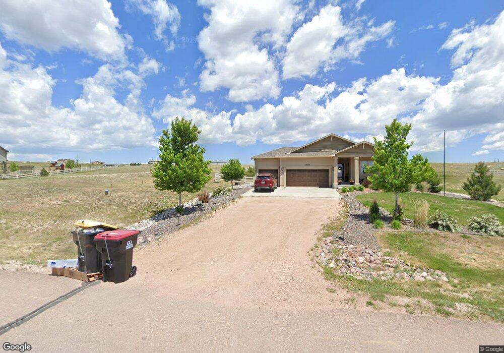
12370 Smoke Bluffs Rd Peyton, CO 80831
Estimated Value: $662,543 - $839,000
4
Beds
4
Baths
1,699
Sq Ft
$442/Sq Ft
Est. Value
About This Home
This home is located at 12370 Smoke Bluffs Rd, Peyton, CO 80831 and is currently estimated at $750,136, approximately $441 per square foot. 12370 Smoke Bluffs Rd is a home with nearby schools including Meridian Ranch International School, Falcon Middle School, and Falcon High School.
Ownership History
Date
Name
Owned For
Owner Type
Purchase Details
Closed on
Nov 28, 2017
Sold by
Bard Jarrad Scott and Bard Amber Marie
Bought by
Ott Charles Dustin and Ott Katy G
Current Estimated Value
Home Financials for this Owner
Home Financials are based on the most recent Mortgage that was taken out on this home.
Original Mortgage
$450,275
Outstanding Balance
$378,503
Interest Rate
3.88%
Mortgage Type
VA
Estimated Equity
$371,633
Purchase Details
Closed on
Oct 31, 2014
Sold by
Vantage Homes Corp
Bought by
Bard Jarrad Scott and Bard Amber Marie
Purchase Details
Closed on
Jun 11, 2014
Sold by
Antlers Ridge Holdings Llc
Bought by
Vantage Homes Corp
Create a Home Valuation Report for This Property
The Home Valuation Report is an in-depth analysis detailing your home's value as well as a comparison with similar homes in the area
Home Values in the Area
Average Home Value in this Area
Purchase History
| Date | Buyer | Sale Price | Title Company |
|---|---|---|---|
| Ott Charles Dustin | $459,000 | Heritage Title Co | |
| Bard Jarrad Scott | $366,214 | Land Title Guarantee Company | |
| Vantage Homes Corp | -- | Land Title Guarantee Company | |
| Vantage Homes Corp | $66,000 | Land Title Guarantee Company |
Source: Public Records
Mortgage History
| Date | Status | Borrower | Loan Amount |
|---|---|---|---|
| Open | Ott Charles Dustin | $450,275 |
Source: Public Records
Tax History Compared to Growth
Tax History
| Year | Tax Paid | Tax Assessment Tax Assessment Total Assessment is a certain percentage of the fair market value that is determined by local assessors to be the total taxable value of land and additions on the property. | Land | Improvement |
|---|---|---|---|---|
| 2025 | $2,909 | $46,970 | -- | -- |
| 2024 | $2,317 | $44,590 | $8,340 | $36,250 |
| 2023 | $2,317 | $44,590 | $8,340 | $36,250 |
| 2022 | $1,712 | $31,610 | $6,410 | $25,200 |
| 2021 | $1,781 | $32,520 | $6,600 | $25,920 |
| 2020 | $1,789 | $32,520 | $5,900 | $26,620 |
| 2019 | $1,773 | $32,520 | $5,900 | $26,620 |
| 2018 | $1,490 | $28,160 | $5,510 | $22,650 |
| 2017 | $1,833 | $28,160 | $5,510 | $22,650 |
| 2016 | $1,919 | $29,090 | $5,670 | $23,420 |
| 2015 | $1,921 | $29,090 | $5,670 | $23,420 |
| 2014 | $987 | $14,670 | $14,670 | $0 |
Source: Public Records
Map
Nearby Homes
- 12190 Smoke Bluffs Rd
- 11504 Blackcomb Trail
- 12071 Smokes Bluffs Rd
- 11133 Lobo Peak Dr
- 12010 S Conestoga Trail
- 12020 S Conestoga Trail
- 11960 Conestoga Trail S
- The Peak Plan at Latigo
- The Brooklyn Plan at Latigo
- The Grand Royal Plan at Latigo
- 12150 Fox Brush Dr
- 11134 Lobo Peak Dr
- 11935 Conestoga Trail S
- 12045 S Conestoga Trail
- 12695 Black Hills Dr
- 12340 Oregon Wagon Trail
- 11824 Black Hills Dr
- 12275 Oregon Wagon Trail
- 11825 Black Hills Dr
- 11333 Sage Mesa Way
- 12310 Smoke Bluffs Rd
- 12430 Smoke Bluffs Rd
- 12250 Smoke Bluffs Rd
- 11625 Blackcomb Trail
- 11624 Blackcomb Trail
- 12251 Smoke Bluffs Rd
- 11565 Blackcomb Trail
- 12065 N Meridian Rd
- 11564 Blackcomb Trail
- 12045 N Meridian Rd
- 11627 Denali Trail
- 11505 Blackcomb Trail
- 12130 Smoke Bluffs Rd
- 11567 Denali Trail
- 11686 Denali Trail
- 12085 N Meridian Rd
- 11807 White Antlers Trail
- 11626 Denali Trail
- 12071 Smoke Bluffs Rd
- 12070 Smoke Bluffs Rd