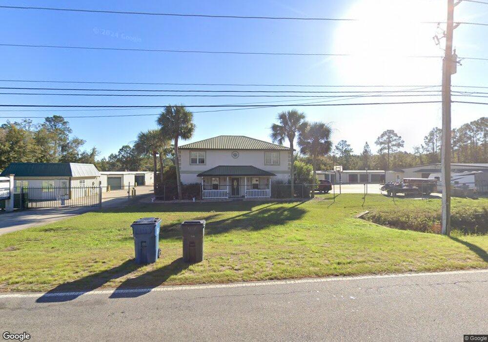
1238 Cate Rd Brunswick, GA 31525
Estimated Value: $245,000 - $4,608,599
3
Beds
3
Baths
1,266
Sq Ft
$1,995/Sq Ft
Est. Value
About This Home
This home is located at 1238 Cate Rd, Brunswick, GA 31525 and is currently estimated at $2,525,150, approximately $1,994 per square foot. 1238 Cate Rd is a home with nearby schools including Golden Isles Elementary School, Jane Macon Middle School, and Brunswick High School.
Ownership History
Date
Name
Owned For
Owner Type
Purchase Details
Closed on
Oct 28, 2015
Sold by
The Storage Shed Inc
Bought by
Invesstments 1426
Current Estimated Value
Home Financials for this Owner
Home Financials are based on the most recent Mortgage that was taken out on this home.
Original Mortgage
$1,435,000
Outstanding Balance
$1,021,864
Interest Rate
3.89%
Mortgage Type
Commercial
Estimated Equity
$1,503,286
Create a Home Valuation Report for This Property
The Home Valuation Report is an in-depth analysis detailing your home's value as well as a comparison with similar homes in the area
Home Values in the Area
Average Home Value in this Area
Purchase History
| Date | Buyer | Sale Price | Title Company |
|---|---|---|---|
| Invesstments 1426 | $2,050,000 | -- |
Source: Public Records
Mortgage History
| Date | Status | Borrower | Loan Amount |
|---|---|---|---|
| Open | Invesstments 1426 | $1,435,000 |
Source: Public Records
Tax History Compared to Growth
Tax History
| Year | Tax Paid | Tax Assessment Tax Assessment Total Assessment is a certain percentage of the fair market value that is determined by local assessors to be the total taxable value of land and additions on the property. | Land | Improvement |
|---|---|---|---|---|
| 2025 | $13,407 | $534,600 | $39,920 | $494,680 |
| 2024 | $12,715 | $507,000 | $39,920 | $467,080 |
| 2023 | $12,584 | $507,000 | $39,920 | $467,080 |
| 2022 | $12,840 | $507,000 | $39,920 | $467,080 |
| 2021 | $13,192 | $505,280 | $39,920 | $465,360 |
| 2020 | $13,318 | $505,280 | $39,920 | $465,360 |
| 2019 | $13,318 | $505,280 | $39,920 | $465,360 |
| 2018 | $13,318 | $505,280 | $39,920 | $465,360 |
| 2017 | $13,318 | $505,280 | $39,920 | $465,360 |
| 2016 | $12,252 | $505,280 | $39,920 | $465,360 |
| 2015 | $12,028 | $493,880 | $28,520 | $465,360 |
| 2014 | $12,028 | $493,880 | $28,520 | $465,360 |
Source: Public Records
Map
Nearby Homes
- 201 Spruce Rd
- 252 S Teakwood Ct
- 145 Merritt Cir
- 151 Merritt Cir
- 147 Merritt Cir
- 149 Merritt Cir
- 150 Merritt Cir
- 148 Merritt Cir
- 146 Merritt Cir
- 105 Adams Ct
- 132 Easy St
- 1820 Perry Lane Rd
- 161 Huntington Cir
- 491 Gateway Center Blvd Unit 17000
- 264 Millennium Blvd
- 93 Brook Dr
- 1052 Lakes Blvd
- 1042 Lakes Blvd
- 1038 Lakes Blvd
- 1026 Lakes Blvd
- 1231 Cate Rd
- 1265 Cate Rd
- 104 Elm Rd
- 152 Winstead Dr
- 158 Winstead Dr
- 1215 Cate Rd
- 156 Winstead Dr
- 150 Winstead Dr
- 103 Northwood Dr
- 144 Winstead Dr
- 160 Winstead Dr
- 146 Winstead Dr
- 200 Spruce Rd
- 140 Winstead Dr
- 120 Spruce Rd
- 1201 Cate Rd
- 164 Winstead Dr
- 167 Winstead Dr
- 105 Northwood Dr
- 138 Winstead Dr