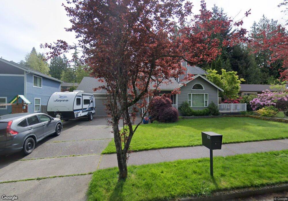
1238 E Clearbrook Dr Bellingham, WA 98229
Whatcom Falls NeighborhoodEstimated Value: $767,966 - $816,000
3
Beds
3
Baths
1,992
Sq Ft
$397/Sq Ft
Est. Value
About This Home
This home is located at 1238 E Clearbrook Dr, Bellingham, WA 98229 and is currently estimated at $791,492, approximately $397 per square foot. 1238 E Clearbrook Dr is a home located in Whatcom County with nearby schools including Wade King Elementary School, Kulshan Middle School, and Sehome High School.
Ownership History
Date
Name
Owned For
Owner Type
Purchase Details
Closed on
Apr 20, 1999
Sold by
Emmerson Richard K and Clayton Emmerson Sandra
Bought by
Dustrude Eric J and Dustrude Jan C
Current Estimated Value
Home Financials for this Owner
Home Financials are based on the most recent Mortgage that was taken out on this home.
Original Mortgage
$160,000
Outstanding Balance
$40,717
Interest Rate
7.1%
Estimated Equity
$750,775
Create a Home Valuation Report for This Property
The Home Valuation Report is an in-depth analysis detailing your home's value as well as a comparison with similar homes in the area
Home Values in the Area
Average Home Value in this Area
Purchase History
| Date | Buyer | Sale Price | Title Company |
|---|---|---|---|
| Dustrude Eric J | $180,000 | Whatcom Land Title Company I |
Source: Public Records
Mortgage History
| Date | Status | Borrower | Loan Amount |
|---|---|---|---|
| Open | Dustrude Eric J | $160,000 |
Source: Public Records
Tax History Compared to Growth
Tax History
| Year | Tax Paid | Tax Assessment Tax Assessment Total Assessment is a certain percentage of the fair market value that is determined by local assessors to be the total taxable value of land and additions on the property. | Land | Improvement |
|---|---|---|---|---|
| 2024 | $5,513 | $690,860 | $270,419 | $420,441 |
| 2023 | $5,513 | $708,450 | $277,304 | $431,146 |
| 2022 | $4,357 | $600,393 | $235,008 | $365,385 |
| 2021 | $4,274 | $469,057 | $183,600 | $285,457 |
| 2020 | $4,141 | $434,312 | $170,000 | $264,312 |
| 2019 | $3,901 | $406,689 | $148,000 | $258,689 |
| 2018 | $3,931 | $384,090 | $139,860 | $244,230 |
| 2017 | $3,423 | $330,920 | $120,200 | $210,720 |
| 2016 | $3,054 | $301,175 | $109,300 | $191,875 |
| 2015 | $3,061 | $279,728 | $103,100 | $176,628 |
| 2014 | -- | $271,317 | $100,000 | $171,317 |
| 2013 | -- | $263,806 | $97,350 | $166,456 |
Source: Public Records
Map
Nearby Homes
- 0 US Highway 27 Hwy N Unit MFRP4936152
- 0 US Highway 27 Hwy N Unit MFRP4935974
- 0 US Highway 27 Hwy N Unit MFRO6335808
- 0 US Highway 27 Hwy N Unit MFRL4957889
- 0 US Highway 27 Hwy N Unit MFRL4952111
- 1211 Kenoyer Dr
- 2501 Fireweed Ln
- 1146 Whidbey St
- 1101 Whidbey St
- 0 Princeton Ct
- 1120 Birch Falls Dr
- 0 Bonanza Way Unit NWM2327531
- 1501 Lakeway Dr
- 950 Yew St
- 1227 Puget St
- 1328 Parkstone Ln
- 0 Lopez St
- 842 Woodbine Way
- 1110 Divine Ln
- 2104 Birch Cir Unit 5C
- 1234 E Clearbrook Dr
- 1237 Modoc Dr
- 1229 Modoc Dr
- 1225 Modoc Dr
- 1233 Modoc Dr
- 1230 E Clearbrook Dr
- 1221 Modoc Dr
- 1224 E Clearbrook Dr
- 0 US Highway 27 Hwy N Unit P4714676
- 0 US Highway 27 Hwy N Unit MFRO6303485
- 0 US Highway 27 Hwy N Unit MFRO6259236
- Us Highway 27 Hwy N
- Us Highway 27 Hwy N
- 0 US Highway 27 Hwy N Unit P4908339
- 1304 Clearbrook Dr
- 1219 Modoc Dr
- 1248 Modoc Dr
- 2627 Blackberry Ln
- 11111 Modoc Dr
- 1221 W Clearbrook Dr