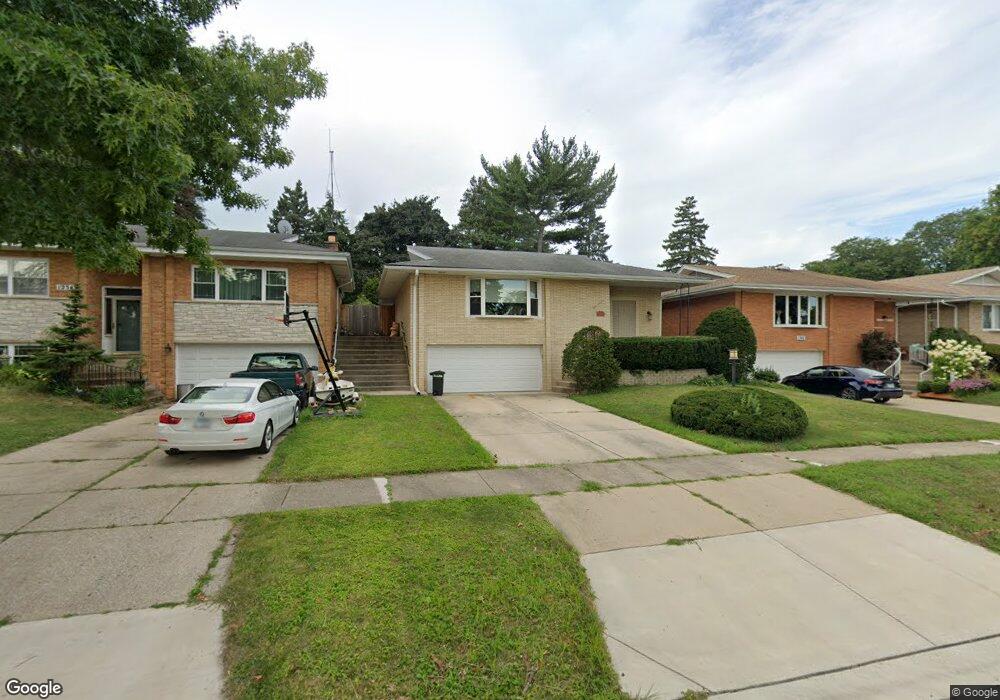
1238 Woodside Rd La Grange Park, IL 60526
Estimated Value: $444,000 - $504,000
3
Beds
2
Baths
1,284
Sq Ft
$366/Sq Ft
Est. Value
About This Home
This home is located at 1238 Woodside Rd, La Grange Park, IL 60526 and is currently estimated at $469,786, approximately $365 per square foot. 1238 Woodside Rd is a home located in Cook County with nearby schools including Forest Road Elementary School, Park Junior High School, and Lyons Township High School.
Ownership History
Date
Name
Owned For
Owner Type
Purchase Details
Closed on
Jul 2, 2001
Sold by
Pachura Henry Z and Pachura Barbara Mary
Bought by
Cooke Robert M and Cooke Darla J
Current Estimated Value
Home Financials for this Owner
Home Financials are based on the most recent Mortgage that was taken out on this home.
Original Mortgage
$230,000
Outstanding Balance
$89,151
Interest Rate
7.22%
Estimated Equity
$380,635
Create a Home Valuation Report for This Property
The Home Valuation Report is an in-depth analysis detailing your home's value as well as a comparison with similar homes in the area
Home Values in the Area
Average Home Value in this Area
Purchase History
| Date | Buyer | Sale Price | Title Company |
|---|---|---|---|
| Cooke Robert M | $288,000 | -- |
Source: Public Records
Mortgage History
| Date | Status | Borrower | Loan Amount |
|---|---|---|---|
| Open | Cooke Robert M | $230,000 | |
| Closed | Cooke Robert M | $28,800 |
Source: Public Records
Tax History Compared to Growth
Tax History
| Year | Tax Paid | Tax Assessment Tax Assessment Total Assessment is a certain percentage of the fair market value that is determined by local assessors to be the total taxable value of land and additions on the property. | Land | Improvement |
|---|---|---|---|---|
| 2024 | $9,113 | $39,000 | $6,971 | $32,029 |
| 2023 | $7,504 | $39,000 | $6,971 | $32,029 |
| 2022 | $7,504 | $28,085 | $6,126 | $21,959 |
| 2021 | $7,240 | $28,084 | $6,126 | $21,958 |
| 2020 | $7,135 | $28,084 | $6,126 | $21,958 |
| 2019 | $7,516 | $29,822 | $5,492 | $24,330 |
| 2018 | $7,387 | $29,822 | $5,492 | $24,330 |
| 2017 | $7,210 | $29,822 | $5,492 | $24,330 |
| 2016 | $6,890 | $25,302 | $5,070 | $20,232 |
| 2015 | $6,160 | $25,302 | $5,070 | $20,232 |
| 2014 | $6,080 | $25,302 | $5,070 | $20,232 |
| 2013 | $6,921 | $29,076 | $5,070 | $24,006 |
Source: Public Records
Map
Nearby Homes
- 1132 Community Dr
- 314 E 31st St
- 4 Garden Dr Unit 4
- 1427 Homestead Rd Unit H
- 205 Huntington Ct
- 213 Pine Tree Ln
- 818 N La Grange Rd
- 10511 Preston St
- 2623 Sunnyside Ave
- 1436 Kemman Ave
- 725 N Catherine Ave
- 1518 Cleveland Ave
- 9532 Lexington Ave
- 10610 Essex St
- 636 N Stone Ave
- 1427 Cleveland Ave
- 2858 Kensington Ave
- 9532 Jackson Ave
- 1245 Morgan Ave
- 638 N Edgewood Ave
- 1234 Woodside Rd
- 1242 Woodside Rd
- 1230 Woodside Rd
- 1246 Woodside Rd
- 18 29th St
- 1226 Woodside Rd
- 1229 N La Grange Rd Unit 2-R
- 1229 N La Grange Rd
- 1229 N La Grange Rd Unit 1-REAR
- 1237 N La Grange Rd
- 1222 Woodside Rd
- 1233 N La Grange Rd Unit 2FRONT
- 1233 N La Grange Rd
- 1233 N La Grange Rd Unit 2F
- 1233 Woodside Rd
- 1237 Woodside Rd
- 1229 Woodside Rd
- 1241 N La Grange Rd
- 1225 N La Grange Rd Unit 1F
- 1225 N La Grange Rd