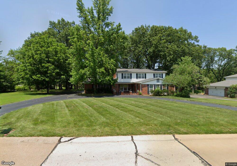
12385 Ironstone Rd Saint Louis, MO 63131
Estimated Value: $781,823 - $947,000
4
Beds
3
Baths
2,821
Sq Ft
$320/Sq Ft
Est. Value
About This Home
This home is located at 12385 Ironstone Rd, Saint Louis, MO 63131 and is currently estimated at $901,956, approximately $319 per square foot. 12385 Ironstone Rd is a home located in St. Louis County with nearby schools including Westchester Elementary School, North Kirkwood Middle School, and Kirkwood Senior High School.
Ownership History
Date
Name
Owned For
Owner Type
Purchase Details
Closed on
Apr 12, 2002
Sold by
Korum David M and Korum Lynne R
Bought by
Korum David M
Current Estimated Value
Home Financials for this Owner
Home Financials are based on the most recent Mortgage that was taken out on this home.
Original Mortgage
$150,000
Interest Rate
7.09%
Create a Home Valuation Report for This Property
The Home Valuation Report is an in-depth analysis detailing your home's value as well as a comparison with similar homes in the area
Home Values in the Area
Average Home Value in this Area
Purchase History
| Date | Buyer | Sale Price | Title Company |
|---|---|---|---|
| Korum David M | -- | -- |
Source: Public Records
Mortgage History
| Date | Status | Borrower | Loan Amount |
|---|---|---|---|
| Closed | Korum David M | $150,000 |
Source: Public Records
Tax History Compared to Growth
Tax History
| Year | Tax Paid | Tax Assessment Tax Assessment Total Assessment is a certain percentage of the fair market value that is determined by local assessors to be the total taxable value of land and additions on the property. | Land | Improvement |
|---|---|---|---|---|
| 2025 | $6,801 | $136,140 | $72,470 | $63,670 |
| 2024 | $6,801 | $117,610 | $58,880 | $58,730 |
| 2023 | $6,695 | $117,610 | $58,880 | $58,730 |
| 2022 | $6,466 | $105,870 | $58,880 | $46,990 |
| 2021 | $6,397 | $105,870 | $58,880 | $46,990 |
| 2020 | $6,190 | $98,480 | $35,420 | $63,060 |
| 2019 | $6,198 | $98,480 | $35,420 | $63,060 |
| 2018 | $6,435 | $91,770 | $26,300 | $65,470 |
| 2017 | $6,452 | $91,770 | $26,300 | $65,470 |
| 2016 | $6,160 | $88,730 | $26,300 | $62,430 |
| 2015 | $6,168 | $88,730 | $26,300 | $62,430 |
| 2014 | $6,377 | $89,680 | $27,040 | $62,640 |
Source: Public Records
Map
Nearby Homes
- The Hawthorne Plan at Ballas Ridge
- The Roclare II Plan at Ballas Ridge
- The Westchester IV Plan at Ballas Ridge
- The Nottingham II Plan at Ballas Ridge
- The Hawthorne II Plan at Ballas Ridge
- TBB
- TBB Ballas Ridge Roclare II
- 12439 Springdale Ln Unit TBB
- TBB Ballas Ridge Hawthorne II
- TBB Ballas Ridge Westchester IV
- TBB
- 2056 N Ballas Rd
- 2062 N Ballas Rd
- 8 Briarbrook Trail
- 0 Unknown Unit 22071090
- 2409 N Ballas Rd
- 1728 Folkstone Dr
- 5 W Point Ln
- 1741 Pine Hill Dr
- 1090 Kinstern Dr
- 1936 N Ballas Rd
- 12384 Ironstone Rd
- 12370 Ironstone Rd
- 1901 N Ballas Rd
- 12359 Ironstone Rd
- 2004 N Ballas Rd
- 1849 N Ballas Rd
- 12334 Trearcy Ln
- 12349 Borcherding Ln
- 12420 Rekart Ln
- 12358 Ironstone Rd
- 12345 Borcherding Ln
- 12417 Rekart Ln
- 12347 Ironstone Rd
- 1843 N Ballas Rd
- 12339 Borcherding Ln
- 2014 N Ballas Rd
- 12432 Rekart Ln
- 12346 Ironstone Rd
- 12425 Rekart Ln