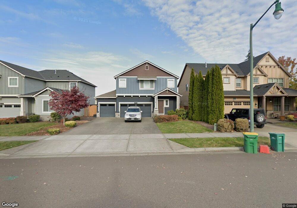
1239 Goff Rd Forest Grove, OR 97116
Estimated Value: $631,492 - $646,000
5
Beds
3
Baths
2,425
Sq Ft
$264/Sq Ft
Est. Value
About This Home
This home is located at 1239 Goff Rd, Forest Grove, OR 97116 and is currently estimated at $639,373, approximately $263 per square foot. 1239 Goff Rd is a home located in Washington County with nearby schools including Harvey Clarke Elementary School, Tom McCall Upper Elementary School, and Neil Armstrong Middle School.
Ownership History
Date
Name
Owned For
Owner Type
Purchase Details
Closed on
Jul 19, 2013
Sold by
Dr Horton Inc Portland
Bought by
Sabin Jasper K and Sabin Kimberly K
Current Estimated Value
Home Financials for this Owner
Home Financials are based on the most recent Mortgage that was taken out on this home.
Original Mortgage
$317,139
Outstanding Balance
$228,619
Interest Rate
3.87%
Mortgage Type
FHA
Estimated Equity
$410,754
Purchase Details
Closed on
Dec 28, 2012
Sold by
Pacific Crossing Lots Llc
Bought by
D R Horton Inc Portland
Create a Home Valuation Report for This Property
The Home Valuation Report is an in-depth analysis detailing your home's value as well as a comparison with similar homes in the area
Home Values in the Area
Average Home Value in this Area
Purchase History
| Date | Buyer | Sale Price | Title Company |
|---|---|---|---|
| Sabin Jasper K | $322,990 | Fatco | |
| D R Horton Inc Portland | $2,030,000 | Chicago Title Company Oregon |
Source: Public Records
Mortgage History
| Date | Status | Borrower | Loan Amount |
|---|---|---|---|
| Open | Sabin Jasper K | $317,139 |
Source: Public Records
Tax History Compared to Growth
Tax History
| Year | Tax Paid | Tax Assessment Tax Assessment Total Assessment is a certain percentage of the fair market value that is determined by local assessors to be the total taxable value of land and additions on the property. | Land | Improvement |
|---|---|---|---|---|
| 2026 | $6,955 | $390,570 | -- | -- |
| 2025 | $6,955 | $379,200 | -- | -- |
| 2024 | $6,710 | $368,160 | -- | -- |
| 2023 | $6,710 | $357,440 | $0 | $0 |
| 2022 | $5,867 | $357,440 | $0 | $0 |
| 2021 | $5,791 | $336,930 | $0 | $0 |
| 2020 | $5,760 | $327,120 | $0 | $0 |
| 2019 | $5,631 | $317,600 | $0 | $0 |
| 2018 | $5,459 | $308,350 | $0 | $0 |
| 2017 | $5,290 | $299,370 | $0 | $0 |
| 2016 | $5,141 | $290,660 | $0 | $0 |
| 2015 | $4,943 | $282,200 | $0 | $0 |
| 2014 | $4,920 | $273,990 | $0 | $0 |
Source: Public Records
Map
Nearby Homes
- 1222 Brookside Ave
- 1315 Begonia Ave
- 1078 Vista Oaks Dr
- 2517 Sweetwood Ct
- 1104 Magnolia Way
- 2440 Heather Way
- 1609 Camino Dr
- 1611 Camino Dr
- 1425 Willamina Ave
- 2108 D St
- 2341 Turnbull Ct
- 1316 19th Place
- 2327 Turnbull Ct
- 1718 23rd Ave
- 1294 19th Ave
- 1224 Alyssum Ave
- 1419 19th Ave
- 0 C St Unit Lot 1
- 0 C St Unit 24232816
- 1931 D St